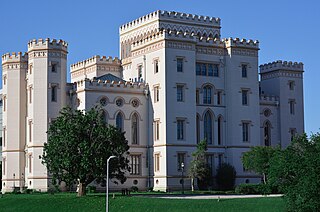
Baton Rouge is the capital city of the U.S. state of Louisiana. Located on the eastern bank of the Mississippi River, it is the parish seat of East Baton Rouge Parish, Louisiana's most populous parish. Since 2020, it has been the second-largest city in Louisiana after New Orleans; Baton Rouge is the 18th-most-populous state capital. According to the 2020 United States census, the city-proper had a population of 227,470; its consolidated population was 456,781 in 2020. The city is the center of the Greater Baton Rouge area—Louisiana's second-largest metropolitan area—with a population of 870,569 as of 2020, up from 802,484 in 2010. Baton Rouge is the fourth most populous city proper in the Deep South region of the southeastern United States.
West Baton Rouge Parish is one of the sixty-four parishes in the U.S. state of Louisiana. Established in 1807, its parish seat is Port Allen. With a 2020 census population of 27,199 residents, West Baton Rouge Parish is part of the Baton Rouge metropolitan statistical area.
St. John the Baptist Parish is a parish located in the U.S. state of Louisiana. At the 2020 census, the population was 42,477. The parish seat is Edgard, an unincorporated area, and the largest city is LaPlace, which is also unincorporated.

Baker is a city in the U.S. state of Louisiana, in East Baton Rouge Parish. It is part of the Baton Rouge metropolitan statistical area, and had a population of 12,455 at the 2020 census, down from 13,895 at the 2010 U.S. census.
Denham Springs is a city in Livingston Parish, Louisiana, United States. The 2010 U.S. census placed the population at 10,215, up from 8,757 at the 2000 U. S. census. At the 2020 United States census, 9,286 people lived in the city. The city is the largest area of commercial and residential development in Livingston Parish. Denham Springs and Walker are the only parish municipalities classified as cities. The area has been known as Amite Springs, Hill's Springs, and Denham Springs.

Addis is a town in West Baton Rouge Parish, Louisiana, United States. The population was 3,593 at the 2010 census. It is part of the Baton Rouge Metropolitan Statistical Area.

Port Allen is a city in, and the parish seat of, West Baton Rouge Parish, Louisiana, United States. Located on the west bank of the Mississippi River, it is bordered by Interstate 10 and US Highway 190. The population was 5,180 at the 2010 census, down from 5,278 in 2000. It is part of the Baton Rouge Metropolitan Statistical Area.

St. Francisville is a town in and the parish seat of, West Feliciana Parish, Louisiana, United States. The population was 1,765 at the 2010 U.S. census, and 1,589 at the 2020 population estimates program. It is part of the Baton Rouge metropolitan statistical area.

Natchez is the only city in and the county seat of Adams County, Mississippi, United States. It has a total population of 14,520. Located on the Mississippi River across from Vidalia in Concordia Parish, Louisiana, Natchez was a prominent city in the antebellum years, a center of cotton planters and Mississippi River trade.
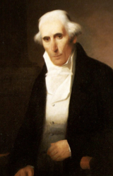
Julien de Lallande (Lalande) Poydras was a French American merchant, planter, financier, poet, educator and political leader who served as Delegate from the Territory of Orleans to the U.S. House of Representatives from 1809 to 1811. He was a catalyst in the promotion of Louisiana statehood and helped draft the state's first constitution. He served as the first President of the Louisiana State Senate from 1812 to 1813.

Henry Watkins Allen was a member of the Confederate States Army and the Texian Army as a soldier, also serving as a military leader, politician, writer, slave owner, and sugar cane planter.

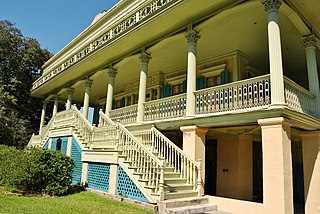
Lakeland, is a village in southeastern Pointe Coupee Parish, Louisiana United States. The area is home to several plantation houses such as Alma and Poydras Plantations.
Bayou Manchac is an 18-mile-long (29 km) bayou in southeast Louisiana, USA. First called the Iberville River by its French discoverers, the bayou was once a very important waterway linking the Mississippi River to the Amite River. East Baton Rouge Parish lies on its northern side, while its southern side is divided between Ascension Parish and Iberville Parish. The large unincorporated community of Prairieville and the city of St. Gabriel both lie on its southern side.
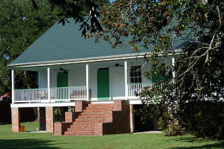
John Hill of Homestead Plantation was a wealthy industrialist, sugar planter, philanthropist, and benefactor of Louisiana State University.
Almadane is an unincorporated community in Vernon Parish, Louisiana, United States. The community is located 3 miles to the south of Evans and 13 miles west of Rosepine on the western edge of Clear Creek Wildlife Management Area on the scenic Myths and Legends Byway.
Warden is an unincorporated community in Richland Parish, Louisiana, United States. The community is located 5 miles N of Delhi, Louisiana.
Corbin is an unincorporated community in Livingston Parish, Louisiana, United States. The community is located 6 miles east of Denham Springs and 6 miles west of Livingston.
Starns also known as Starns Mill is an unincorporated community in Livingston Parish, Louisiana, United States. The community is located 6 miles northwest of Albany and 4 miles north of Holden.
Weiss is an unincorporated community in Livingston Parish, Louisiana, United States. The community is located less than 3 miles southwest of Baywood and 6 miles northeast of Watson near the Amite River.
Istrouma is an unincorporated community in East Baton Rouge Parish, Louisiana, United States. The community is located less than 2 miles northwest of Baton Rouge and 7 miles south of Baker.


