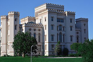
Baton Rouge is the capital city of the U.S. state of Louisiana. Located on the eastern bank of the Mississippi River, it is the parish seat of East Baton Rouge Parish, Louisiana's most populous parish. Since 2020, it has been the second-largest city in Louisiana after New Orleans; Baton Rouge is the 18th-most-populous state capital. According to the 2020 United States census, the city-proper had a population of 227,470; its consolidated population was 456,781 in 2020. The city is the center of the Greater Baton Rouge area—Louisiana's second-largest metropolitan area—with a population of 870,569 as of 2020, up from 802,484 in 2010. Baton Rouge is the fourth most populous city proper in the Deep South region of the southeastern United States.

St. Landry Parish is a parish located in the U.S. state of Louisiana. As of the 2020 Census, the population was 82,540. The parish seat is Opelousas. The parish was established in 1807.

East Baton Rouge Parish is the most populous parish in the U.S. state of Louisiana. Its population was 456,781 at the 2020 census. The parish seat is Baton Rouge, Louisiana's state capital. East Baton Rouge Parish is located within the Greater Baton Rouge area.

Brownfields is an unincorporated area and census-designated place (CDP) in East Baton Rouge Parish, Louisiana, United States. The population was 5,401 at the 2010 census. It is part of the Baton Rouge Metropolitan Statistical Area.

Gardere is an unincorporated area and census-designated place (CDP) in East Baton Rouge Parish, Louisiana, United States. The area is also known as Riverland. The population was 10,580 at the 2010 census, up from 8,992 in 2000. It is part of the Baton Rouge Metropolitan Statistical Area.

Merrydale is an unincorporated area and census-designated place (CDP) in East Baton Rouge Parish, Louisiana, United States. The population was 9,772 at the 2010 census, down from 10,427 in 2000. It is part of the Baton Rouge Metropolitan Statistical Area.

Monticello is a census-designated place (CDP) in East Baton Rouge Parish, Louisiana, United States. The population was 5,172 at the 2010 census, up from 4,763 in 2000. It is part of the Baton Rouge Metropolitan Statistical Area.

Old Jefferson is a census-designated place (CDP) in East Baton Rouge Parish, Louisiana, United States. The population was 6,980 at the 2010 census, up from 5,631 in 2000. It is part of the Baton Rouge Metropolitan Statistical Area.

Denham Springs is a city in Livingston Parish, Louisiana, United States. The 2010 U.S. census placed the population at 10,215, up from 8,757 at the 2000 U. S. census. At the 2020 United States census, 9,286 people lived in the city. The city is the largest area of commercial and residential development in Livingston Parish. Denham Springs and Walker are the only parish municipalities classified as cities. The area has been known as Amite Springs, Hill's Springs, and Denham Springs.

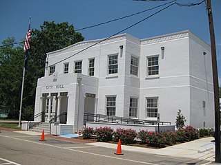
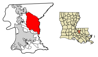
Central is a city in the U.S. state of Louisiana, second largest city in East Baton Rouge Parish, and part of the Baton Rouge metropolitan statistical area. The state's newest incorporated city in April 2005, Central had a 2020 census population of 29,565.

The East Baton Rouge Parish School System, also known as East Baton Rouge Schools or the East Baton Rouge Parish School Board, is a public school district headquartered in Baton Rouge, Louisiana, United States. The district serves most of East Baton Rouge Parish; it contains 54 elementary schools, 16 middle schools, and 18 high schools.
Central Community School System, (CCSS), is a school district headquartered in Central, Louisiana, United States, in the Baton Rouge metropolitan area. This district serves more than 4,500 students in the City of Central. There are five schools within the Central Community School System: Bellingrath Hills Elementary (PK - K), Tanglewood Elementary School (Grades 1 - 2), Central Intermediate School (Grades 3 - 5), Central Middle School (Grades 6 - 8), and Central High School (Grades 9-12).

Louisiana Highway 37 is a 42.7-mile-long (68.7 km) north-south state highway in Louisiana, United States, extending from Wooddale Boulevard in Baton Rouge to Louisiana Highway 10 in Greensburg. In East Baton Rouge Parish, the highway is named Greenwell Springs Road.

Louisiana Highway 64 (LA 64) is a state highway located in southeastern Louisiana. It runs 20.45 miles (32.91 km) in a general east–west direction from LA 964 in Zachary to the junction of LA 16 and LA 1026 north of Denham Springs.
Pride is an unincorporated community in East Baton Rouge Parish, Louisiana, United States. Its ZIP code is 70770.

In August 2016, prolonged rainfall from an unpredictable storm resulted in catastrophic flooding in the state of Louisiana, United States; thousands of houses and businesses were submerged. Louisiana's governor, John Bel Edwards, called the disaster a "historic, unprecedented flooding event" and declared a state of emergency. Many rivers and waterways, particularly the Amite and Comite rivers, reached record levels, and rainfall exceeded 20 inches (510 mm) in multiple parishes.

Central High School is a public high school in Central, Louisiana, United States, in the Baton Rouge metropolitan area. It is the only high school in the Central Community School System.
East Baton Rouge Parish Library (EBRPL) is the public library system of East Baton Rouge Parish, Louisiana. It serves Baton Rouge and other cities in the parish.


