Gary is a city in Lake County, Indiana, United States, 25 miles (40 km) from downtown Chicago, Illinois. Gary is adjacent to the Indiana Dunes National Park and borders southern Lake Michigan. Gary was named after lawyer Elbert Henry Gary, who was the founding chairman of the United States Steel Corporation. The city is known for its large steel mills, and as the birthplace of the Jackson 5 music group.
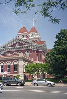
Lake County is a county located in the U.S. state of Indiana. In 2010, its population was 496,005, making it Indiana's second-most populous county. The county seat is Crown Point.

The Calumet River is a system of heavily industrialized rivers and canals in the region between the neighborhood of South Chicago in Chicago, Illinois, and the city of Gary, Indiana. Historically, the Little Calumet River and the Grand Calumet River were one, the former flowing west from Indiana into Illinois, then turning back east to its mouth at Lake Michigan at Marquette Park in Gary.

Fell's Point is a historic waterfront neighborhood in southeastern Baltimore, Maryland. It was established around 1763 and is located along the north shore of the Baltimore Harbor and the Northwest Branch of the Patapsco River. The area has many antique, music and other stores, restaurants, coffee bars, a municipal markethouse with individual stalls, and over 120 pubs. Located 1.5 miles east of Baltimore's downtown central business district and the Jones Falls stream, Fells Point has a maritime past and the air of a seafaring town. It also has the greatest concentration of drinking establishments and restaurants in the city.

Logan Square is an official community area, historical neighborhood, and public square located on the northwest side of the City of Chicago. The Logan Square community area is one of the 77 city-designated community areas established for planning purposes. The Logan Square neighborhood, located within the Logan Square community area, is centered on the public square that serves as its namesake, located at the three-way intersection of Milwaukee Avenue, Logan Boulevard and Kedzie Boulevard.

West Town, located in Chicago, in the U.S. state of Illinois, northwest of the Loop, on Chicago's West Side is one of 77 officially designated Chicago community areas. Much of this area was historically part of the city's Polish Downtown, and its name may refer to Western Avenue, which was the city's western boundary at the time of West Town's settlement, but more likely was a convenient abstraction by the creators of Chicago's community areas. Then, as now, West Town was a collection of several distinct neighborhoods. It was the most populous of the community areas from their creation until it was surpassed by Near West Side in the 1960s. The boundaries of the community area are the Chicago River to the east, the Union Pacific railroad tracks to the south, the former railroad tracks on Bloomingdale Avenue to the North, and an irregular western border to the west that includes the city park called Humboldt Park. Humboldt Park is also the name of the community area to West Town's west, Logan Square is to the north, Near North Side to the east, and Near West Side to the south. Currently, as well as historically, the collection of neighborhoods in West Town along with the neighborhoods of Bucktown and the eastern portion of Logan Square have been referred to by media as the Near Northwest Side. However, since the gentrification of West Town, media often refers to the area as solely the Northwest Side for the purposes of real estate gentrification tactics.

South Deering, located on Chicago's far South Side, is the largest of the 77 official community areas of that city. It is part of the 10th Ward, once under the control of former Richard J. Daley ally Alderman Edward Vrdolyak. Primarily an industrial neighborhood, a small group of homes exists in the northeast corner and Lake Calumet takes up a large portion of the area. 80% of the community is zoned as industrial, natural wetlands, or parks. The remaining 20% is zoned for residential and small-scale commercial uses. The neighborhood is named for Charles Deering, an executive in the Deering Harvester Company that would later form a major part of International Harvester. International Harvester owned Wisconsin Steel, which was originally established in 1875 and was located along Torrence Avenue south of 106th Street to 109th Street.

Hegewisch is one of the 77 community areas of Chicago, Illinois, located on the city's far south side. It is bordered by the neighborhoods of Riverdale and South Deering to the west, the East Side to the north, the village of Burnham to the south and the city of Hammond, Indiana to the east. The community area is named for Adolph Hegewisch, the president of U.S. Rolling Stock Company who hoped to establish "an ideal workingman's community" when he laid out the town along a rail line in 1883, six years before Chicago annexed the town.

The Port of Indiana-Burns Harbor is an industrial area, founded in 1965 and located on the Lake Michigan shore of Indiana at the intersection of U.S. Highway 12 and Indiana 249. The primary work done in the area is the manufacturing of steel, and the port area is dominated by steel mills. The port is divided between the municipalities of Burns Harbor and Portage.
Calumet is the portion of East Chicago, Indiana located east of the Indiana Harbor and Ship Canal and south of Chicago Avenue. The neighborhood is bisected by the Indiana Harbor Belt Railroad. The area west of the tracks is referred to as Calumet proper, or as "West Calumet". The area east of the tracks is known as "East Calumet."
Sunnyside is a neighborhood in easternmost East Chicago, Indiana, in the Indiana Harbor section near Cline Avenue. It is unique among East Chicago neighborhoods for its suburban character, including a curvilinear street grid. The population is 55% African American and 42% Hispanic. The neighborhood has one of the highest rates of owner-occupied homes in the city.
North Harbor is a neighborhood in northeastern East Chicago, Indiana. It constitutes the portion of the Indiana Harbor section north of 138th Street. The neighborhood is home to one of the highest concentrations of affordable housing in the United States.
The Brickyard was a neighborhood in the Indiana Harbor section of East Chicago, Indiana, near the intersection of Kennedy Avenue and Gannister Court. It stood for much of the 20th century, housing approximately 30 primarily African American families, until the City of East Chicago demolished it in the mid-1990s due to contamination from the adjacent Pollution Control Industries (PCI) hazardous waste mixing facility.

Northside or North Side is a neighborhood in western East Chicago, Indiana. Together with Southside and Roxana, it makes up "East Chicago proper," as distinct from Indiana Harbor. The population is 72% Hispanic and 21% African American. The neighborhood has one of the highest rates of owner-occupied homes in the city. Notable landmarks in Northside include the East Chicago City Hall and Central High School.
Southside or South Side is a neighborhood in western East Chicago, Indiana. Together with Northside and Roxana, it makes up "East Chicago proper," as distinct from Indiana Harbor. The population is 64% Hispanic and 25% African American. The neighborhood is home to 20% of East Chicago's population. The neighborhood is dominated by residential uses, with relatively few institutional buildings.
Washington Park or Park Addition is a neighborhood in the Indiana Harbor section of East Chicago, Indiana, near the city park with which it shares its name. It is bounded on the north by U.S. Route 12, and on the south by 144th Street. As of the 2010 United States Census, Washington Park had 1459 residents, of whom 38.1% were African American and 60.3% were Hispanic.
Prairie Park is a neighborhood in the Indiana Harbor section of East Chicago, Indiana. It is bounded on the north by U.S. 12, and on the south by Indiana 312. To the west, it looks across Elm Street at the Washington Park neighborhood, and to the east it is bounded by the Cline Avenue expressway and industrial northern Gary beyond.