
Lake Michigan is one of the five Great Lakes of North America. It is the second-largest of the Great Lakes by volume and the third-largest by surface area, after Lake Superior and Lake Huron. To the east, its basin is conjoined with that of Lake Huron through the 3+1⁄2-mile (5.6-kilometer) wide, 295-foot deep Straits of Mackinac, giving it the same surface elevation as its easterly counterpart; the two are geologically a single lake.

East Chicago is a city in Lake County, Indiana, United States. The population was 26,370 at the 2020 census. Centered around heavy industry, the city is home to the Indiana Harbor and Ship Canal, an artificial freshwater harbor characterized by industrial and manufacturing activity.

The Calumet River is a system of heavily industrialized rivers and canals in the region between the south side of Chicago, Illinois, and the city of Gary, Indiana. Historically, the Little Calumet River and the Grand Calumet River were one, the former flowing west from Indiana into Illinois, then turning back east to its mouth at Lake Michigan at Marquette Park in Gary. Now the system is part of the Chicago Area Waterway System and through the use of locks flows away from Lake Michigan to the Cal-Sag Channel.

The Indiana Harbor and Ship Canal is an artificial waterway on the southwest shore of Lake Michigan, in East Chicago, Indiana, which connects the Grand Calumet River to Lake Michigan. It consists of two branch canals, the 1.25 miles (2.01 km) Lake George Branch and the 2 miles (3.2 km) long Grand Calumet River Branch which join to form the main Indiana Harbor Canal.
The Greater Richmond, Virginia area has many neighborhoods and districts.
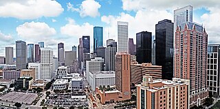
The geographic areas of Houston are generally classified as either being inside or outside Interstate 610, colloquially called "the Loop". The Loop generally encircles the central business district and the "island cities" of West University Place, Southside Place, and a portion of Bellaire.

There are more than 500 neighborhoods within the area of Jacksonville, Florida, the largest city in the contiguous United States by area. These include Downtown Jacksonville and surrounding neighborhoods. Additionally, greater Jacksonville is traditionally divided into several major sections with amorphous boundaries: Northside, Westside, Southside, and Arlington, as well as the Jacksonville Beaches.

Navy Yard is a neighborhood of Washington, D.C., located in Southeast D.C. Navy Yard, situated along the Anacostia Riverfront south of Capitol Hill, takes its name from Washington Navy Yard, the administrative seat of the U.S. Navy. Historically an industrial area, today Navy Yard is a popular entertainment district, home to Nationals Park, a notable nightlife scene, and numerous waterfront esplanades.

Ambridge Mann, sometimes called Ambridge-Horace Mann or Horace Mann-Ambridge, is a neighborhood in northwestern Gary, Indiana. It is bounded by the Grand Calumet River on the north, by Grant Street on the east, by Chase Street on the west, and by the Norfolk Southern railroad on the south. Adjacent areas include an industrial district to the north, Downtown West to the east, Tolleston to the south, and Brunswick to the west. As of 2000, Ambridge Mann had a population of 6,236, which was 96.3% African-American. Located just south of Interstate 90, the neighborhood can be seen while passing Buchanan Street.

The Grand Calumet River is a 13.0-mile-long (20.9 km) river that flows primarily into Lake Michigan. Originating in Miller Beach in Gary, it flows through the cities of Gary, East Chicago and Hammond, as well as Calumet City and Burnham on the Illinois side. The majority of the river's flow drains into Lake Michigan via the Indiana Harbor and Ship Canal, sending about 1,500 cubic feet (42 m3) per second of water into the lake. A smaller part of the flow, at the river's western end, enters the Calumet River, and through the Illinois ultimately drains into the Mississippi River.

Robertsdale is a neighborhood in northernmost Hammond, Indiana, north of 129th Street and south of Lake Michigan. It is bounded to the south by Pulaski Park, to the west by the Chicago neighborhood of East Side, to the north by Lake Michigan, and to the east by the cities of Whiting and East Chicago. The neighborhood's boundaries correspond to Hammond's Planning District I. The neighborhood is traversed by the Indiana Toll Road, which has an exit into the neighborhood at the Indianapolis Boulevard immediately east of the state line. Amtrak passenger trains pass through Hammond/Whiting station in the neighborhood.
New Addition, also called West Harbor, is a small triangular neighborhood in the Indiana Harbor section of East Chicago, Indiana, west of Kennedy Avenue, east of the Indiana Harbor and Ship Canal, and north of United States Route 12. As of 2013, it was home to approximately 263 people.
Indiana Harbor or The Harbor is the portion of East Chicago, Indiana, located east of the Indiana Harbor and Ship Canal, as opposed to "East Chicago proper" which is located west of the canal. It contains several distinct neighborhoods, including New Addition, Sunnyside, and North Harbor. The Calumet neighborhood is west of the Canal but sometimes considered distinct from "Indiana Harbor proper".
Calumet is the portion of East Chicago, Indiana located east of the Indiana Harbor and Ship Canal and south of Chicago Avenue. The neighborhood is bisected by the Indiana Harbor Belt Railroad. The area west of the tracks is referred to as Calumet proper, or as "West Calumet". The area east of the tracks is known as "East Calumet."
North Harbor is a neighborhood in northeastern East Chicago, Indiana. It constitutes the portion of the Indiana Harbor section north of 138th Street. The neighborhood is home to one of the highest concentrations of affordable housing in the United States.
The Brickyard was a neighborhood in the Indiana Harbor section of East Chicago, Indiana, near the intersection of Kennedy Avenue and Gannister Court. It stood for much of the 20th century, housing approximately 30 primarily African American families, until the City of East Chicago demolished it in the mid-1990s due to contamination from the adjacent Pollution Control Industries (PCI) hazardous waste mixing facility.

Southside or South Side is a neighborhood in western East Chicago, Indiana. Together with Northside and Roxana, it makes up "East Chicago proper," as distinct from Indiana Harbor. The population is 64% Hispanic and 25% African American. The neighborhood is home to 20% of East Chicago's population. The neighborhood is dominated by residential properties, with relatively few institutional buildings.
Washington Park or Park Addition is a neighborhood in the Indiana Harbor section of East Chicago, Indiana, near the city park with which it shares its name. It is bounded on the north by U.S. Route 12, and on the south by 144th Street.
Prairie Park is a neighborhood in the Indiana Harbor section of East Chicago, Indiana. It is bounded on the north by U.S. 12, and on the south by Indiana 312. To the west, it looks across Elm Street at the Washington Park neighborhood, and to the east it is bounded by the Cline Avenue expressway and industrial northern Gary beyond.

William Hunter Penman was the first known permanent resident of East Chicago, Indiana, and later its first mayor.
