
Charlton is an area of southeast London, England, within the Royal Borough of Greenwich. It is east of Greenwich and west of Woolwich. It is 7.2 miles (11.6 km) east-southeast of Charing Cross. 'Charlton next Woolwich' was an ancient parish in the county of Kent, which became part of the metropolitan area of London in 1855. It is home to Charlton Athletic and to Charlton House.

Sutton Bonington is a village and civil parish lying along the valley of the River Soar in the Borough of Rushcliffe, south west Nottinghamshire, England. The University of Nottingham has a 420 hectares (4.2 km2) site just to the north of the village: Sutton Bonington Campus.

Hatfield is a town and civil parish in the Metropolitan Borough of Doncaster in South Yorkshire, England. It had a population of 17,236 at the 2011 Census. The town is located to the west of the M18 motorway and has a railway station on the line between Goole/Scunthorpe and Doncaster. Recorded history in the parish extends as far back as 730, when Bede wrote about the Northumbrian King, Edwin, being killed in battle in the area.

Maltby is a former mining town and civil parish of 16,688 inhabitants (2011) in the Metropolitan Borough of Rotherham, South Yorkshire, England. It was historically in the West Riding of Yorkshire. It is located about 6 miles (10 km) east of Rotherham town centre and 10 miles (16 km) north-east of Sheffield city centre. It forms a continuous urban area with Hellaby, separated from the rest of Rotherham by the M18 motorway.

Theale is a large village and civil parish in West Berkshire, England, 5 miles (8 km) southwest of Reading and 10 miles (16 km) east of Thatcham.

Coalpit Heath is a small village in the parish of Westerleigh, South Gloucestershire, England, south of Yate and east of Frampton Cotterell in South Gloucestershire.
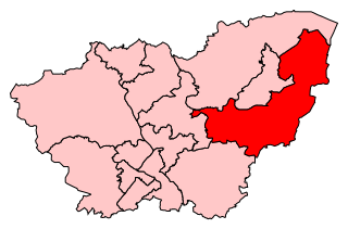
Don Valley is a constituency in South Yorkshire represented in the House of Commons of the UK Parliament since 2019 by Nick Fletcher of the Conservative Party.

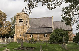
Birstall is a large village and civil parish within the Charnwood borough of Leicestershire, England. It is three miles north of Leicester city centre and is part of the wider Leicester Urban Area.
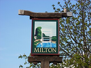
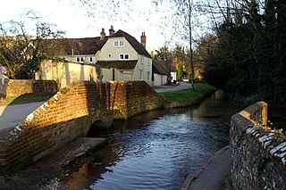
Milton is a village just north of Cambridge, England, with a population of 4,679 at the 2011 census.
Burghfield is a village and large civil parish in West Berkshire, England, with a boundary with Reading. Burghfield can trace its history back to before the Domesday book, and was once home to three manors: Burghfield Regis, Burghfield Abbas and Sheffield. Since the 1980s the population of Burghfield has nearly doubled with the construction of many new housing estates, dependent for its employment on, for instance, Reading, Newbury and Basingstoke and the M4 corridor which bisects the edge of the area.

Sprotbrough and Cusworth is a civil parish in the Metropolitan Borough of Doncaster in South Yorkshire, England. It lies 3 miles (4.8 km) to the north west of Doncaster town centre and is split by the A1(M) motorway. It lies 1.5 miles (2.4 km) from Scawsby, and had a population of 12,166 in 2001 and 12,134 at the 2011 Census.
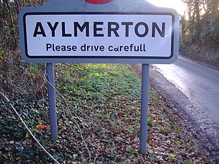
Aylmerton is a village in the county of Norfolk, England. It is in the area of North Norfolk and lies 2.2 miles (3.5 km) south of the North Sea, 3.2 miles (5.1 km) south-west of Cromer and 7.5 miles (12.1 km) east of Holt. The parish is bordered by the parishes of Beeston Regis and Runton to the north, West Beckham to the west, Felbrigg to the east and Gresham and Sustead to the south. The village is ¾ miles south of the A148 King’s Lynn to Cromer road. The nearest railway stations are Cromer at 2.9 miles (4.7 km) and Roughton Road at 4.1 miles (6.6 km). The civil parish has an area of 6.86 square kilometres and in the 2001 census the population was 435 in 178 households, increasing to 458 at the 2011 Census. For the purposes of local government, the parish is in North Norfolk, whose headquarters are in Cromer.

East Malling and Larkfield is a civil parish in the borough of Tonbridge and Malling in Kent, England. It is about 2.4 miles (3.9 km) southeast of West Malling, 5.5 miles (8.9 km) northwest of Maidstone, and 11.4 miles (18.3 km) south-southwest of Rochester. In 1962, the parish was formed from two smaller ancient ecclesiastical parishes, East Malling and Larkfield. Covering 4.16 square miles (10.77 km2), the parish is in the heart of the hop fields and fruit-growing region, and has an expanding residential area. The distinct hamlet of East Malling Heath is in the parish.
North Hykeham is a town in the North Kesteven district, in the county of Lincolnshire, England. It forms part of the Lincoln Urban Area. The population of the town at the 2011 census was 13,884.

Edlington is a town and civil parish in the Metropolitan Borough of Doncaster, South Yorkshire, England, lying to the south west of Doncaster and Warmsworth. It has a population of 8,276. The original parish town of Edlington is now known as Old Edlington; adjacent, and to the north, is New Edlington. It is often referred to by locals as 'Edlo'. Since 1974 Edlington has been part of the Metropolitan Borough of Doncaster in the metropolitan county of South Yorkshire. It had, since 1894, formed part of Doncaster Rural District in the West Riding of Yorkshire.
Warnford is a village and civil parish in the City of Winchester district of Hampshire, England. The parish covers 1283 hectares. The population in 2019 was estimated at 220.

Warmsworth is a suburban village to the west of Doncaster in South Yorkshire, England. Its population of 3,752 in 2001 and 3,887 at time of the 2011 Census was estimated at 3,908 in 2019. The village lies along the A1(M) Doncaster Bypass and the A630. The River Don runs adjacent to it, as does the train line from Doncaster to Sheffield. The parish is bounded by Doncaster and the civil parishes of Sprotbrough, Edlington, Conisbrough, Cadeby and Balby. It lies 4 miles (6.5 km) from the centre of Doncaster. It falls in the catchment area of Warmsworth Primary School and Sir Thomas Wharton Academy.

Henfield is a hamlet in South Gloucestershire, England between Coalpit Heath and Westerleigh, adjoining the hamlet of Ram Hill immediately to the north.
Sir Thomas Wharton Academy is a coeducational academy school and sixth form located in Edlington, Doncaster, England. It accepts pupils from the surrounding areas including Balby, Braithwell, Conisbrough, Edlington, Loversall, Micklebring, Tickhill, Wadworth, Warmsworth and Woodfield Plantation.


