Fort Bridger was originally a 19th-century fur trading outpost established in 1842, on Blacks Fork of the Green River, in what is now Uinta County, Wyoming, United States. It became a vital resupply point for wagon trains on the Oregon Trail, California Trail, and Mormon Trail. The Army established a military post here in 1858 during the Utah War, until it was finally closed in 1890. A small town, Fort Bridger, Wyoming, remains near the fort and takes its name from it.

New Echota was the capital of the Cherokee Nation in the Southeast United States from 1825 until their forced removal in the late 1830s. New Echota is located in present-day Gordon County, in northwest Georgia, 3.68 miles north of Calhoun. It is south of Resaca, next to present day New Town, known to the Cherokee as Ꭴꮝꮤꮎꮅ, Ustanali. The site has been preserved as a state park and a historic site. It was designated in 1973 as a National Historic Landmark District.

Fort Fetterman was constructed in 1867 by the United States Army on the Great Plains frontier in Dakota Territory, approximately 11 miles northwest of present-day Douglas, Wyoming. Located high on the bluffs south of the North Platte River, it served as a major base for the start of several United States military expeditions against warring Native American tribes. The fort is listed on the National Register of Historic Places.

The Cunningham Cabin is a double-pen log cabin in Grand Teton National Park in the US state of Wyoming. It was built as a homestead in Jackson Hole and represents an adaptation of an Appalachian building form to the West. The cabin was built just south of Spread Creek by John Pierce Cunningham, who arrived in Jackson Hole in 1885 and subsisted as a trapper until he established the Bar Flying U Ranch in 1888. The Cunninghams left the valley for Idaho in 1928, when land was being acquired for the future Grand Teton National Park.

The Log Cabin Motel, also known as Camp O' The Pines in Pinedale, Wyoming, United States, was built in 1929 as a cabin camp to serve growing numbers of automobile-borne tourists bound for Yellowstone National Park. The camp was owned by Walter Scott, who operated the Pinedale Cash Store. Contrary to the name, Scott allowed customers to buy on credit, and some worked off their credit by building cabins at Camp O' The Pines. Unlike many auto camps, the camp was open year-round, with cabins often rented by the month by local people.

The Manges Cabin in Grand Teton National Park, also known as the Old Elbo Ranch Homestead Cabin, Mangus Cabin and the Taggart Creek Barn, was built in 1911 by James Manges. Manges was the second settler on the west side of the Snake River after Bill Menor, setting up a homestead near Taggart Creek. James Manges arrived in Jackson Hole in 1910, where he cut wood for Charles or William Wort. Manges' cabin is stated to have been the first two-story structure in the northern part of the valley. A root cellar was excavated beneath. The log and frame structure features wide eaves to keep the winter snow away from the walls. It was heated in winter by a single stove, with one room on each level.

The Van Vleck House was built in Jackson, Wyoming in 1910–1011. The log house and barn are the only remaining residential structures in the vicinity of the Town Square.

The Parting of the Ways is an historic site in Sweetwater County, Wyoming, United States, where the Oregon and California Trails fork from the original route to Fort Bridger to an alternative route, the Sublette-Greenwood Cutoff, across the Little Colorado Desert. Many wagon trains parted company, some preferring the shorter cutoff route, which involved fifty waterless miles, to the longer but better-watered main route.

The Anderson Lodge or Anderson Studio was built in 1890 in the Absaroka Mountains west of Meeteetse, Wyoming, in what was then the Yellowstone Park Timber Land Reserve, soon renamed the Yellowstone Forest Reserve. The two-story rustic log structure became the home of rancher and artist Abraham Archibald Anderson from 1901 to 1905. Anderson played a significant role in the development of the forest reserve as Special Superintendent of Forest Reserves, and the Anderson Lodge was used as an administrative building for the forest.
The T E Ranch Headquarters, near Cody, Wyoming, is a log ranch house that belonged to buffalo hunter and entertainer Buffalo Bill Cody (1846–1917). The house may have originally been built by homesteader Bob Burns prior to 1895, when Cody acquired the ranch. Cody expanded the ranch to about eight thousand acres (32 km2), using the T E brand for his thousand head of cattle.

This is a list of the National Register of Historic Places listings in Johnson County, Wyoming. It is intended to be a complete list of the properties and districts on the National Register of Historic Places in Johnson County, Wyoming, United States. The locations of National Register properties and districts for which the latitude and longitude coordinates are included below, may be seen in an online map.

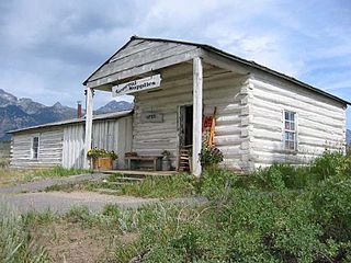
Welty's General Store is a store in Dubois, Wyoming.

The Worland Ranch is a historic district that includes the farmstead established in 1900 by C.F. "Dad" Worland near his namesake town of Worland, Wyoming, United States. The site was in fact the original townsite, with the Worland post office located on the grounds. The present town developed just to the east on the broad flatlands east of the Bighorn River. The original townsite is commemorated by an inscribed stone marker.

The historical buildings and structures of Grand Teton National Park include a variety of buildings and built remains that pre-date the establishment of Grand Teton National Park, together with facilities built by the National Park Service to serve park visitors. Many of these places and structures have been placed on the National Register of Historic Places. The pre-Park Service structures include homestead cabins from the earliest settlement of Jackson Hole, working ranches that once covered the valley floor, and dude ranches or guest ranches that catered to the tourist trade that grew up in the 1920s and 1930s, before the park was expanded to encompass nearly all of Jackson Hole. Many of these were incorporated into the park to serve as Park Service personnel housing, or were razed to restore the landscape to a natural appearance. Others continued to function as inholdings under a life estate in which their former owners could continue to use and occupy the property until their death. Other buildings, built in the mountains after the initial establishment of the park in 1929, or in the valley after the park was expanded in 1950, were built by the Park Service to serve park visitors, frequently employing the National Park Service Rustic style of design.

Independence is a ghost town in the U.S. state of Colorado. It is located just off State Highway 82 in the eastern corner of Pitkin County, below the Continental Divide. It was the first settlement established in the Roaring Fork Valley, after gold was struck in the vicinity on Independence Day, July 4, 1879, hence its name. In 1973 it was recognized as a historic district and listed on the National Register of Historic Places as Independence and Independence Mill Site, one of two ghost towns in the county so recognized. It has also been known historically by other names—Chipeta, Mammoth City, Mount Hope, Farwell, Sparkill and Hunter's Pass.

Cantonment Reno also known as Fort McKinney 1 was a US Army post or cantonment located on the Powder River near the old Bozeman Trail crossing. A previous fort near the site had been abandoned and burned after the Fort Laramie Treaty of 1868. Cantonment Reno was re-established in late 1876, just upstream of the site of old Fort Reno. Cantonment Reno started as a temporary base of operations for General George Crooks' 1876 Big Horn Expedition,. Crook's Expedition was part of the intensive campaign against the Sioux and Cheyenne in late 1876, following Custer's defeat at the Battle of the Little Bighorn.

The Powder River Crossing, officially known as Powder River Station-Powder River Crossing , is an abandoned settlement located on the east bank of the Powder River in southeast Johnson County about twenty-four miles east of Kaycee, Wyoming. It developed after a wooden toll bridge was built across the Powder River in 1877, at a site that was originally used as a ford. With crossing secured, a settlement developed here in the late 19th century, incorporating a stage stop on the Bozeman Trail. The site is notable for having well-preserved wagon ruts from the pioneer era.

The N.K. Boswell Ranch is one of the oldest ranches on the edge of the Laramie Plains along the Big Laramie River in Albany County, Wyoming, USA. The ranch was established in the early 1870s, possibly by a man named C.T. Waldron. The ranch is significant for its association with Nathaniel K. Boswell, who was Albany County Sheriff at a time when the county extended from Colorado to Montana.

Granger Station State Historic Site, also known as Granger Stage Station, South Bend Station and Ham's Fork Station, is a state park in Granger, Wyoming, United States, that is listed on the National Register of Historic Places (NRHP).

St. Michael's Mission is an Episcopal church mission established about 1887 in Fremont County, Wyoming to minister to the Arapaho and Shoshone of the Wind River Indian Reservation. It was founded by Reverend John Roberts with the permission of Shoshone Chief Washakie. The community of Ethete grew around the mission, given its name by Washakie's assent in the Shoshone language, ethete. In 1900 a small log church was built about 3 miles (4.8 km) from the present location. In 1910 the mission received an endowment from Mrs. Baird Cooper and the new site was developed over the next seven years. In 1920 the original church was moved to the mission, enlarged, and named "The Church of Our Father's House.


