Marbleton, Wyoming

Last updated

Marbleton, Wyoming
MarbledaleWY CityHall.jpg
City hall
Sublette County Wyoming Incorporated and Unincorporated areas Marbleton Highlighted 5650415.svg
Location of Marbleton in Sublette County, Wyoming.
Usa edcp location map.svg
Red pog.svg
Marbleton, Wyoming
Location in the United States
Coordinates: 42°33′26″N110°6′22″W / 42.55722°N 110.10611°W / 42.55722; -110.10611
Country United States
State Wyoming
County Sublette
Area
[1]
  Total0.91 sq mi (2.35 km2)
  Land0.91 sq mi (2.35 km2)
  Water0.00 sq mi (0.00 km2)
Elevation
6,867 ft (2,093 m)
Population
 (2010) [2]
  Total1,094
  Estimate 
(2019) [3]
1,111
  Density1,224.92/sq mi (472.84/km2)
Time zone UTC-7 (Mountain (MST))
  Summer (DST) UTC-6 (MDT)
ZIP code
83113
Area code 307
FIPS code 56-50415 [4]
GNIS feature ID1591209 [5]

Marbleton is a town in Sublette County, Wyoming, United States. The population was 1,094 at the 2010 census.

Contents

Geography

Marbleton is located at 42°33′26″N110°6′22″W / 42.55722°N 110.10611°W / 42.55722; -110.10611 (42.557108, -110.106196). [6]

According to the United States Census Bureau, the town has a total area of 0.86 square miles (2.23 km2), all land. [7]

Climate

Marbleton has a subarctic climate (Koppen: Dfc), with generally warm, sometimes hot summers, and brutally cold and long winters. Diurnal temperature range is very high all year round, but even more so during summertime, with August having an average daily temperature range of 42 degrees Fahrenheit (23.3 Celsius). The nearest official weather station is in nearby Big Piney.

Demographics

Historical population
CensusPop.Note
1920 89
1930 26−70.8%
1940 4365.4%
1950 20−53.5%
1960 189845.0%
1970 22318.0%
1980 537140.8%
1990 63418.1%
2000 72013.6%
2010 1,09451.9%
2019 (est.)1,111 [3] 1.6%
U.S. Decennial Census [8]

2010 census

As of the census [2] of 2010, there were 1,094 people, 415 households, and 273 families residing in the town. The population density was 1,272.1 inhabitants per square mile (491.2/km2). There were 494 housing units at an average density of 574.4 per square mile (221.8/km2). The racial makeup of the town was 87.4% White, 0.2% African American, 0.8% Native American, 0.2% Asian, 9.0% from other races, and 2.4% from two or more races. Hispanic or Latino of any race were 13.3% of the population.

There were 415 households, of which 38.3% had children under the age of 18 living with them, 49.2% were married couples living together, 7.5% had a female householder with no husband present, 9.2% had a male householder with no wife present, and 34.2% were non-families. 26.3% of all households were made up of individuals, and 6.7% had someone living alone who was 65 years of age or older. The average household size was 2.55 and the average family size was 3.05.

The median age in the town was 33 years. 27% of residents were under the age of 18; 9.9% were between the ages of 18 and 24; 30.6% were from 25 to 44; 24.6% were from 45 to 64; and 7.8% were 65 years of age or older. The gender makeup of the town was 56.9% male and 43.1% female.

2000 census

As of the census [4] of 2000, there were 720 people, 268 households, and 201 families residing in the town. The population density was 1,060.8 people per square mile (408.8/km2). There were 310 housing units at an average density of 456.7 per square mile (176.0/km2). The racial makeup of the town was 96.25% White, 0.42% African American, 0.69% Native American, 0.42% Asian, 0.14% Pacific Islander, 0.56% from other races, and 1.53% from two or more races. Hispanic or Latino of any race were 1.67% of the population.

There were 268 households, out of which 42.5% had children under the age of 18 living with them, 64.2% were married couples living together, 6.0% had a female householder with no husband present, and 25.0% were non-families. 20.1% of all households were made up of individuals, and 2.2% had someone living alone who was 65 years of age or older. The average household size was 2.69 and the average family size was 3.09.

In the town, the population was spread out, with 31.1% under the age of 18, 8.1% from 18 to 24, 33.1% from 25 to 44, 22.6% from 45 to 64, and 5.1% who were 65 years of age or older. The median age was 34 years. For every 100 females, there were 106.3 males. For every 100 females age 18 and over, there were 105.8 males.

The median income for a household in the town was $41,406, and the median income for a family was $46,250. Males had a median income of $38,250 versus $17,500 for females. The per capita income for the town was $18,446. About 3.2% of families and 4.2% of the population were below the poverty line, including 5.8% of those under age 18 and none of those age 65 or over.

Education

Public education in the town of Marbleton is provided by Sublette County School District #9.

Related Research Articles

<span class="mw-page-title-main">Sublette County, Wyoming</span> County in Wyoming, United States

Sublette County is a county in the U.S. state of Wyoming. As of the 2020 United States Census, the population was 8,728. The county seat is Pinedale. It is a sparsely populated rural county in western Wyoming, along the Green River.

<span class="mw-page-title-main">Chatom, Alabama</span> City in and county seat of Washington County, Alabama

Chatom is a town in Washington County, Alabama, United States. It incorporated in 1949. Chatom is the county seat of Washington County, holding the distinction since 1907. The town's population was 1,288 At the 2010 census, up from 1,193 in 2000.

<span class="mw-page-title-main">Oakfield, Maine</span> Town in the state of Maine, United States

Oakfield is a town in Aroostook County, Maine, United States. The population was 661 at the 2020 census. The village of Oakfield, listed as a census-designated place, is in the northwestern corner of the town.

<span class="mw-page-title-main">Alna, Maine</span> Town in the state of Maine, United States

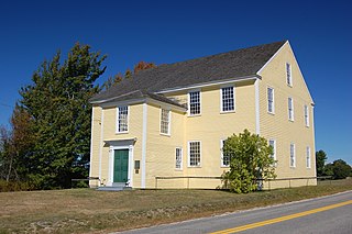
Alna is a town in Lincoln County, Maine, United States. The population was 710 at the 2020 census. Alna is home to the Wiscasset, Waterville and Farmington Railway Museum and is noted for its historic architecture, including the early mill village of Head Tide.

Bradley is a town in Penobscot County, Maine, United States. It is part of the Bangor Metropolitan Statistical Area. The population was 1,532 at the 2020 census. The village of Bradley is in the northwestern corner of the town.

Woodville is a town in Penobscot County, Maine, United States. The population was 201 at the 2020 census.

Detroit is a town in Somerset County, Maine, United States. The population was 885 at the 2020 census.

Northfield is a town in Washington County, Maine, United States. The population was 178 at the 2020 census.

<span class="mw-page-title-main">Milo, Missouri</span> Village in Missouri, United States

Milo is a village in Vernon County, Missouri, United States. The population was 90 at the 2010 census.

<span class="mw-page-title-main">Regent, North Dakota</span> City in North Dakota, United States

Regent is a city in Hettinger County, North Dakota, United States. The population was 170 at the 2020 census.

<span class="mw-page-title-main">Kenefick, Texas</span> Town in Texas, United States

Kenefick is a town in Liberty County, Texas, United States. The population was 563 at the 2010 census.

<span class="mw-page-title-main">West Logan, West Virginia</span> Town in West Virginia, United States

West Logan is a town along the Guyandotte River in Logan County, West Virginia, United States. The population was 400 at the 2020 census. For unknown reasons, some sources report West Logan to lay west of the county seat at Logan, attributing to this fact the name.

<span class="mw-page-title-main">Grant Town, West Virginia</span> Town in West Virginia, United States

Grant Town is a town in Marion County, West Virginia, in the eastern United States. The population was 690 at the 2020 census.

<span class="mw-page-title-main">New Haven, West Virginia</span> Town in West Virginia, United States

New Haven is a town in Mason County, West Virginia, United States, along the Ohio River. The population was 1,485 at the 2020 census. It is part of the Point Pleasant, WV–OH Micropolitan Statistical Area.

<span class="mw-page-title-main">Bancroft, West Virginia</span> Town in West Virginia, United States

Bancroft is a town in Putnam County, West Virginia, United States, along the Kanawha River. The population was 389 at the 2020 census. It is part of the Huntington–Ashland metropolitan area.

<span class="mw-page-title-main">Harman, West Virginia</span> Town in West Virginia, United States

Harman is a town in Randolph County, West Virginia, United States. The population was 96 at the 2020 census.

<span class="mw-page-title-main">Hanna, Wyoming</span> Town in Wyoming, United States

Hanna is a town in Carbon County, Wyoming, United States. The population was 683 at the 2020 census. The town was started as a coal supply location for the Union Pacific Railroad. Much of the old town is built on top of the former workings of the Hanna No. 4 mine. On December 18, 1979, the Town of Hanna annexed the adjacent Town of Elmo. The population peaked at 2,288 in 1980 and has declined as local coal mines have ceased operation.

<span class="mw-page-title-main">Big Piney, Wyoming</span> Town in Wyoming, United States

Big Piney is a town in Sublette County, Wyoming, United States. The population was 552 at the 2010 census.

<span class="mw-page-title-main">Calpet, Wyoming</span> Unincorporated community in Wyoming, United States

Calpet is an unincorporated community in Sublette County, Wyoming, United States. The population was 7 at the 2000 census, when it was a census-designated place (CDP).

<span class="mw-page-title-main">Belchertown (CDP), Massachusetts</span> Census-designated place in Massachusetts, United States

Belchertown is a census-designated place (CDP) comprising the central village in the town of Belchertown in Hampshire County, Massachusetts, United States. The population was 2,899 at the 2010 census, out of a total town population of 14,649. It is part of the Springfield, Massachusetts Metropolitan Statistical Area.

References

  1. "2019 U.S. Gazetteer Files". United States Census Bureau. Retrieved August 7, 2020.
  2. 1 2 "U.S. Census website". United States Census Bureau . Retrieved December 14, 2012.
  3. 1 2 "Population and Housing Unit Estimates". United States Census Bureau. May 24, 2020. Retrieved May 27, 2020.
  4. 1 2 "U.S. Census website". United States Census Bureau . Retrieved January 31, 2008.
  5. "US Board on Geographic Names". United States Geological Survey. October 25, 2007. Retrieved January 31, 2008.
  6. "US Gazetteer files: 2010, 2000, and 1990". United States Census Bureau. February 12, 2011. Retrieved April 23, 2011.
  7. "US Gazetteer files 2010". United States Census Bureau. Archived from the original on January 25, 2012. Retrieved December 14, 2012.
  8. "Census of Population and Housing". Census.gov. Retrieved June 4, 2015.