New Hope, Florida | |
|---|---|
 New Hope on SR79 in 2017 | |
 New Hope, Florida | |
| Coordinates: 30°34′40.78″N85°48′33.51″W / 30.5779944°N 85.8093083°W | |
| Country | United States |
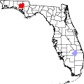
| State | Florida |
| County | Washington |
| Elevation | 194 ft (59 m) |
| Time zone | UTC-5 (Central (CST)) |
| • Summer (DST) | UTC-4 (EDT) |
| ZIP code | 32428 |
| Area code | 850 |
| GNIS feature ID | 295485 [1] |
New Hope is an unincorporated community in Washington County, Florida, United States. It is located on State Road 79.