Newport, Washington County, Ohio

Last updated
Newport, Ohio
CDP
OHMap-doton-Newport.png
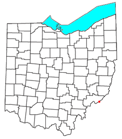
Location of Newport, Washington County, Ohio
Coordinates: 39°23′48″N81°13′29″W / 39.39667°N 81.22472°W / 39.39667; -81.22472
Country United States
State Ohio
County Washington
Township Newport
Elevation
[1]
742 ft (226 m)
Population
 (2020) [2]
  Total895
Time zone UTC-5 (Eastern (EST))
  Summer (DST) UTC-4 (EDT)
ZIP code
45768
Area code 740
GNIS feature ID2628944 [1]

Newport is a census-designated place in eastern Newport Township, Washington County, Ohio, United States. [1] It has a post office with the ZIP code 45768. [3] Newport lies along the Ohio River several miles above the county seat of Marietta. Today its main street is designated as State Route 7. [4] The population of the CPD was 895 at the 2020 census.

Contents

Newport is the location of the Carpenter Bridge, which carries State Route 807 over the Ohio River.

Demographics

As of the census of 2010, [5] there were 1003 people, 399 households, and 296 families residing in the town. The racial makeup of the town was 98.8% White, 0.6% Asian, 0.1% Native American, and 0.5% from two or more races. Hispanic or Latino of any race were 0.4% of the population.

There were 399 households, of which 23.3% had children under the age of 18 living with them, 61.9% were married couples living together, 8.5% had a female householder with no husband present, 3.8% had a male householder with no wife present, and 25.8% were non-families. 22.3% of all households were made up of individuals, and 11.5% had someone living alone who was 65 years of age or older. The average household size was 2.51 and the average family size was 2.92.

The median age in the town was 42 years. The gender makeup of the town was 48.6% male and 51.4% female.

History

The first European-American settlement at Newport was made as early as 1798, as settlers from Massachusetts were the first to make their home. [6] However, the site was not platted until 1839. [7] A post office called Newport has been in operation since 1815. [8]

A short distance southwest of Newport on what is now SR7 is the Judge Joseph Barker House. Built in 1832, it is listed on the National Register of Historic Places. [9]

Related Research Articles

<span class="mw-page-title-main">Washington County, Ohio</span> County in Ohio, United States

Washington County is a county located in the southeastern part of the U.S. state of Ohio. As of the 2020 census, the population was 59,711. Its county seat is Marietta. The county, the oldest in the state, is named for George Washington. Washington County comprises the Marietta, OH Micropolitan Statistical Area, which is also included in the Parkersburg-Marietta-Vienna, WV-OH Combined Statistical Area.

<span class="mw-page-title-main">Cherry Grove, Ohio</span> Census-designated place in Ohio, United States

Cherry Grove is a census-designated place (CDP) in Anderson Township, Hamilton County, Ohio, United States. The population was 4,419 at the 2020 census.

<span class="mw-page-title-main">Fruit Hill, Ohio</span> Census-designated place in Ohio, United States

Fruit Hill is a census-designated place (CDP) in Hamilton County, Ohio, United States. The population was 3,748 at the 2020 census.

<span class="mw-page-title-main">Grandview, Hamilton County, Ohio</span> Census-designated place in Ohio, United States

Grandview is a census-designated place (CDP) in Hamilton County, Ohio, United States. The population was 1,312 at the 2020 census.

<span class="mw-page-title-main">Burlington, Ohio</span> Census-designated place in Ohio, United States

Burlington is an unincorporated community and census-designated place in Lawrence County, Ohio, United States, along the Ohio River. The population was 2,416 at the 2020 census. Connected to neighboring Huntington, West Virginia and connected via the West Huntington Bridge over the Ohio River, it is part of the Huntington–Ashland metropolitan area. Burlington was once the leading community of Lawrence County, being the first county seat and the location of the county's first post office.

<span class="mw-page-title-main">Loveland Park, Ohio</span> Census-designated place in Ohio, United States

Loveland Park is a census-designated place (CDP) located in Symmes Township, Hamilton County and Deerfield Township, Warren County, in the southwestern part of the U.S. state of Ohio. The CDP is named after the city of Loveland. The population was 1,737 at the 2020 census.

<span class="mw-page-title-main">Miamitown, Ohio</span> Census-designated place in Ohio, United States

Miamitown is a census-designated place (CDP) in western Whitewater Township, Hamilton County, Ohio, United States. The population was 1,256 at the 2020 census. It has a post office with the ZIP code 45041.

<span class="mw-page-title-main">Camp Dennison, Ohio</span> Census-designated place in Ohio, United States

Camp Dennison is a census-designated place (CDP) just outside Indian Hill in southern Symmes Township, Hamilton County, Ohio, United States. It has a post office with the ZIP code 45111. The population was 384 at the 2020 census.

<span class="mw-page-title-main">Highpoint, Ohio</span> Census-designated place & Unincorporated community in Ohio, United States

Highpoint is an unincorporated community and census-designated place (CDP) in Sycamore Township, Hamilton County, Ohio, United States, located about 20 miles north of Cincinnati, Ohio. As of the 2020 census, its population was 1,558. Highpoint was founded in the 19th century.

<span class="mw-page-title-main">Mack, Ohio</span> Census-designated place in Ohio, United States

Mack is a census-designated place (CDP) in Green and Miami townships, Hamilton County, Ohio, United States. The population was 11,088 at the 2020 census. At prior censuses, the community was listed as two separate CDPs, Mack North and Mack South.

Plainville is a census-designated place (CDP) in Columbia Township, Hamilton County, Ohio, United States. The population was 120 at the 2020 census.

<span class="mw-page-title-main">Brecon, Ohio</span> Census-designated place in Ohio, United States

Brecon is a census-designated place (CDP) in Sycamore Township, Hamilton County, Ohio, United States. The population was 408 at the 2020 census.

<span class="mw-page-title-main">Coldstream, Ohio</span> Census-designated place in Ohio, United States

Coldstream is a census-designated place (CDP) in southern Anderson Township, Hamilton County, Ohio, United States. The population was 1,322 at the 2020 census.

<span class="mw-page-title-main">Delshire, Ohio</span> Census-designated place in Ohio, United States

Delshire is a census-designated place (CDP) in Delhi Township, Hamilton County, Ohio, United States. The population was 3,158 at the 2020 census.

<span class="mw-page-title-main">Elizabethtown, Ohio</span> Census-designated place in Ohio, United States

Elizabethtown is a census-designated place (CDP) in Whitewater Township, Hamilton County, Ohio, United States. The population was 323 at the 2020 census.

<span class="mw-page-title-main">Salem Heights, Hamilton County, Ohio</span> Census-designated place in Ohio, United States

Salem Heights is a census-designated place (CDP) in Anderson Township, Hamilton County, Ohio, United States, adjacent to the city of Cincinnati. The population of Salem Heights was 3,862 at the 2020 census.

<span class="mw-page-title-main">Sixteen Mile Stand, Ohio</span> Census-designated place in Ohio, United States

Sixteen Mile Stand is a census-designated place (CDP) in Symmes Township, Hamilton County, Ohio, United States, 19 miles (31 km) northeast of downtown Cincinnati. The population of Sixteen Mile Stand was 3,091 at the 2020 census.

<span class="mw-page-title-main">Taylor Creek, Ohio</span> Census-designated place in Ohio, United States

Taylor Creek is a census-designated place (CDP) in Colerain Township, Hamilton County, Ohio, United States. The population was 4,056 at the 2020 census.

Madison Place is a census-designated place (CDP) in Hamilton County, Ohio, United States, adjacent to the city of Cincinnati. It was first listed as a CDP prior to the 2020 census. The population was 572 at the 2020 census.

Ridgewood is a census-designated place (CDP) in Hamilton County, Ohio, United States, adjacent to the city of Cincinnati. It was first listed as a CDP prior to the 2020 census. The population was 506 at the 2020 census.

References

  1. 1 2 3 U.S. Geological Survey Geographic Names Information System: Newport, Washington County, Ohio
  2. "Newport CPD (Washington County), Ohio - Census Bureau Profile". United States Census Bureau. Retrieved 9 September 2023.
  3. USPS – Cities by ZIP Code
  4. DeLorme. Ohio Atlas & Gazetteer. 7th ed. Yarmouth: DeLorme, 2004, p. 73. ISBN   0-89933-281-1.
  5. "U.S. Census website". United States Census Bureau . Retrieved 2016-11-18.
  6. "Township Histories in Washington County, Ohio". genealogytrails.com. Retrieved 2021-06-24.
  7. History of Washington County, Ohio: With Illustrations and Biographical Sketches. H.Z. Williams. 1881. p. 578.
  8. "Washington County". Jim Forte Postal History. Retrieved 29 December 2015.
  9. "National Register Information System". National Register of Historic Places . National Park Service. March 13, 2009.