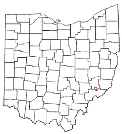
Lower Salem, Ohio | |
---|---|
Coordinates: 39°33′48″N81°23′39″W / 39.56333°N 81.39417°W | |
Country | United States |
State | Ohio |
County | Washington |
Government | |
• Mayor | Jared Lowe [1] |
Area | |
• Total | 0.06 sq mi (0.16 km2) |
• Land | 0.06 sq mi (0.15 km2) |
• Water | 0.00 sq mi (0.01 km2) |
Elevation | 696 ft (212 m) |
Population (2020) | |
• Total | 75 |
• Density | 1,271.19/sq mi (493.25/km2) |
Time zone | UTC-5 (Eastern (EST)) |
• Summer (DST) | UTC-4 (EDT) |
ZIP code | 45745 |
Area code | 740 |
FIPS code | 39-45220 [4] |
GNIS feature ID | 2399196 [3] |
Lower Salem is a village in Washington County, Ohio, United States. The population was 75 at the 2020 census.
Lower Salem had its start when a corduroy road (called the Old Plank Road) was built through it to Marietta. [5] It has a post office. [6] The town site was not laid out until 1850, and was settled predominantly by German immigrants. [7] Lower Salem was once home to a hotel, a doctor's office, an armory, Wagner's General Store, and a gas station and auto parts shop. While all of these buildings remain standing, all have gone out of business. [ citation needed ]
According to the United States Census Bureau, the village has a total area of 0.06 square miles (0.16 km2), all land. [8]
Census | Pop. | Note | %± |
---|---|---|---|
1870 | 187 | — | |
1880 | 198 | 5.9% | |
1900 | 190 | — | |
1910 | 187 | −1.6% | |
1920 | 138 | −26.2% | |
1930 | 135 | −2.2% | |
1940 | 135 | 0.0% | |
1950 | 126 | −6.7% | |
1960 | 143 | 13.5% | |
1970 | 106 | −25.9% | |
1980 | 110 | 3.8% | |
1990 | 103 | −6.4% | |
2000 | 109 | 5.8% | |
2010 | 86 | −21.1% | |
2020 | 75 | −12.8% | |
U.S. Decennial Census [9] |
As of the census [10] of 2010, there were 86 people, 31 households, and 21 families residing in the village. The population density was 1,433.3 inhabitants per square mile (553.4/km2). There were 39 housing units at an average density of 650.0 per square mile (251.0/km2). The racial makeup of the village was 93.0% White and 7.0% African American. Hispanic or Latino of any race were 1.2% of the population.
There were 31 households, of which 35.5% had children under the age of 18 living with them, 41.9% were married couples living together, 16.1% had a female householder with no husband present, 9.7% had a male householder with no wife present, and 32.3% were non-families. 19.4% of all households were made up of individuals, and 3.2% had someone living alone who was 65 years of age or older. The average household size was 2.77 and the average family size was 3.19.
The median age in the village was 41 years. 23.3% of residents were under the age of 18; 5.8% were between the ages of 18 and 24; 28% were from 25 to 44; 29.1% were from 45 to 64; and 14% were 65 years of age or older. The gender makeup of the village was 44.2% male and 55.8% female.
As of the census [4] of 2000, there were 109 people, 36 households, and 27 families residing in the village. The population density was 1,373.2 inhabitants per square mile (530.2/km2). There were 38 housing units at an average density of 478.7 per square mile (184.8/km2). The racial makeup of the village was 93.58% White, 0.92% African American, and 5.50% from two or more races.
There were 36 households, out of which 47.2% had children under the age of 18 living with them, 44.4% were married couples living together, 22.2% had a female householder with no husband present, and 25.0% were non-families. 19.4% of all households were made up of individuals, and 8.3% had someone living alone who was 65 years of age or older. The average household size was 3.03 and the average family size was 3.52.
In the village, the population was spread out, with 33.0% under the age of 18, 10.1% from 18 to 24, 31.2% from 25 to 44, 18.3% from 45 to 64, and 7.3% who were 65 years of age or older. The median age was 30 years. For every 100 females there were 73.0 males. For every 100 females age 18 and over, there were 73.8 males.
The median income for a household in the village was $36,875, and the median income for a family was $36,875. Males had a median income of $26,875 versus $16,875 for females. The per capita income for the village was $10,209. There were 7.4% of families and 5.0% of the population living below the poverty line, including 3.7% of under eighteens and 10.5% of those over 64.
Salem-Liberty Elementary School sits north of State Route 821 opposite the East Fork of Duck Creek west of the town's corporation limit and serves as the elementary school for more than 100 students of the Fort Frye Local School District. [ citation needed ]
Muir is a village in Lyons Township, Ionia County in the U.S. state of Michigan. The population was 604 at the 2010 census.
Clifford is a village in Lapeer County of the U.S. state of Michigan. The population was 324 at the 2010 census. The village is within Burlington Township.
Walthall is a village in Webster County, Mississippi. The population was 144 at the 2010 census. It is the county seat of Webster County, designated in 1876.
Emerald Beach is a village in White River Township, Barry County, Missouri, United States. The community is located on a bend in the White River now Table Rock Lake. Cassville is approximately 13 miles to the northwest and Rogers, Arkansas is 32 mile to the southwest.
Miller is a village in Buffalo County, Nebraska, United States. It is part of the Kearney, Nebraska Micropolitan Statistical Area. As of the 2010 census, the village population was 136.
Murdock is a village in Cass County, Nebraska, United States. The population was 270 according to the 2020 census.
Waterloo is a village in Douglas County, Nebraska, United States. The population was 935 at the 2020 census.
Shickley is a village in Fillmore County, Nebraska, United States. The population was 343 at the 2020 census.
Salem is a village in Richardson County, Nebraska, United States. The population was 84 at the 2020 census.
Ithaca is a village in Saunders County, Nebraska, United States. The population was 160 at the 2020 census.
Byron is a village in Thayer County, Nebraska, United States, and its south edge is the Nebraska-Kansas state border. The population was 85 at the 2020 census.
Stratton is a village in northern Jefferson County, Ohio, United States, along the Ohio River. The population was 267 at the 2020 census. It is part of the Weirton–Steubenville metropolitan area.
Sarahsville is a village in Noble County, Ohio, United States. The population was 147 at the 2020 census.
South Salem is a village in Ross County, Ohio, United States. The population was 219 at the 2020 census.
Wilkesville is a village in Vinton County, Ohio, United States. The population was 116 at the 2020 census.
Beverly is a village in Washington County, Ohio, United States. The population was 1,233 at the 2020 census. It is part of the Marietta micropolitan area.
Congress is a village in Wayne County, Ohio, United States. The population was 132 at the 2020 census.
Fairwater is a village in Fond du Lac County, Wisconsin, United States. The population was 371 at the 2010 census. The town of Metomen surrounds the village.
Wilson is a village in Belmont and Monroe counties in the U.S. state of Ohio. The population was 129 at the 2020 census. It is part of the Wheeling metropolitan area.
Milltown is a village in Polk County, Wisconsin, United States. The population was 917 at the 2010 census. The village is located within the Town of Milltown.