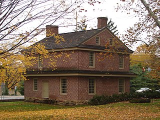
Newtown Township, also referred to by the name of its post office of Newtown Square, is a township in Delaware County, Pennsylvania, United States. Prior to 1789, it was part of Chester County, along with the rest of Delaware County. As of the 2020 census, the population was 15,002.

Upper Darby Township, often shortened to Upper Darby, is a home rule township in Delaware County, Pennsylvania, United States. As of the 2020 census, the township had a total population of 85,681, making it the state's sixth-most populated municipality after Philadelphia, Pittsburgh, Allentown, Reading, and Erie. Upper Darby borders Philadelphia, the nation's sixth-most populous city, and constitutes part of the Delaware Valley, also known as the Philadelphia metropolitan area, the nation's seventh-largest metropolitan area.

Fernwood–Yeadon station is a SEPTA Regional Rail station in Yeadon, Pennsylvania. It serves the Media/Wawa Line and is located at Church Lane and Penn Boulevard. The station saw 113 boardings and 132 alightings on an average weekday. The station originally had a wooden pedestrian bridge and a grade crossing.

SEPTA Route 13, also known as the Chester Avenue Line, is a trolley line operated by the Southeastern Pennsylvania Transportation Authority (SEPTA) that connects 13th Street Station in downtown Philadelphia, Pennsylvania, with Yeadon and Darby, Pennsylvania. It is one of five lines that are part of the Subway-Surface Trolley system. Route 13 will be rebranded as the T3 as part of the transition to SEPTA Metro.
The Baltimore Pike was an auto trail connecting Baltimore, Maryland, with Philadelphia, Pennsylvania.

Pennsylvania Route 3 is a 24.3-mile (39.1 km) state highway located in the southeastern portion of Pennsylvania. The route runs from U.S. Route 322 Business in West Chester east to PA 611 in Philadelphia.
Route 104 is a bus route operated by SEPTA between Upper Darby's 69th Street Transportation Center and the North Campus of West Chester University in West Chester, Pennsylvania. Route 104 initially was a streetcar line which operated parallel to the West Chester Pike and was operated by the Philadelphia Suburban Transportation Company. The former line spurred the development of streetcar suburbs in Upper Darby, Haverford Township, and communities in Chester County.

The Harrisburg Subdivision is a railroad line owned by CSX Transportation in Pennsylvania. The line is located in Philadelphia, and connects Greenwich Yard and the Philadelphia Subdivision with the Trenton Subdivision along a former Pennsylvania Railroad line. Much of the Harrisburg Subdivision is the High Line' or West Philadelphia Elevated along 31st Street over the 30th Street Station area.

The Trenton Subdivision is a railroad line owned by CSX Transportation in the U.S. states of Pennsylvania and New Jersey. The line runs from CP NICE in Philadelphia, Pennsylvania, northeast to Port Reading Junction in Manville, New Jersey. The line was formerly part of the Reading Company system.

U.S. Route 1 (US 1) is a major north–south U.S. Route, extending from Key West, Florida, in the south to Fort Kent, Maine, at the Canada–United States border in the north. In the U.S. state of Pennsylvania, US 1 runs for 81 miles (130 km) from the Maryland state line near Nottingham northeast to the New Jersey state line at the Delaware River in Morrisville, through the southeastern portion of the state. The route runs southwest to northeast and serves as a major arterial road through the city of Philadelphia and for many of the suburbs in the Delaware Valley metropolitan area. South of Philadelphia, the road mostly follows the alignment of the Baltimore Pike. Within Philadelphia, it mostly follows Roosevelt Boulevard. North of Philadelphia, US 1 parallels the route of the Lincoln Highway. Several portions of US 1 in Pennsylvania are freeways, including from near the Maryland state line to Kennett Square, the bypass of Media, the concurrency with Interstate 76 and the Roosevelt Expressway in Philadelphia, and between Bensalem Township and the New Jersey state line.

U.S. Route 13 (US 13) is a United States Numbered Highway running from Fayetteville, North Carolina, north to Morrisville, Pennsylvania. The route runs for 49.359 miles (79.436 km) through the Delaware Valley metropolitan area in the U.S. state of Pennsylvania. The route enters the state from Delaware in Marcus Hook, Delaware County. It continues northeast through Delaware County, passing through the city of Chester before heading through suburban areas along Chester Pike to Darby. US 13 enters the city of Philadelphia on Baltimore Avenue and runs through West Philadelphia to University City, where it turns north along several city streets before heading east across the Schuylkill River along Girard Avenue. The route turns north and heads to North Philadelphia, where it runs northeast along Hunting Park Avenue. US 13 becomes concurrent with US 1 on Roosevelt Boulevard, continuing into Northeast Philadelphia. US 13 splits southeast on a one-way pair of streets before heading northeast out of the city on Frankford Avenue. The route continues into Bucks County as Bristol Pike, heading northeast to Bristol, where it becomes a divided highway. US 13 becomes a freeway in Tullytown and continues north to its terminus at US 1 in Falls Township, near Morrisville. US 13 roughly parallels Interstate 95 (I-95) through its course in Pennsylvania.

Congress Avenue station is a SEPTA Media–Sharon Hill Line stop in Upper Darby Township, Pennsylvania. It is located at Garrett Road and Congress Avenue, and serves both Routes 101 and 102. Only local service is provided on both lines. The station is located on the north side of the terminus of the Congress Avenue intersection. It contains two platforms, but only one pre-fabricated shelter on the south side of the tracks.

Beverly Boulevard station is a SEPTA Media–Sharon Hill Line station in Upper Darby Township, Pennsylvania. It is officially located at Garrett Road and Bywood Avenue, but also includes Beverly Boulevard. The station serves both Routes 101 and 102. Only local service is provided on both lines. The station contains two platforms with plexiglass bus-type shelters on both sides of the tracks.

Route 103 is a bus route operated by the Southeastern Pennsylvania Transportation Authority (SEPTA) on the outskirts of Philadelphia, Pennsylvania, United States. Route 103 runs between Ardmore and the 69th Street Transportation Center in Upper Darby.

The Media/Wawa Line is a SEPTA Regional Rail service that runs from Center City Philadelphia west to Wawa in Delaware County. It uses the West Chester Branch, which connects with the SEPTA Main Line at 30th Street Station. Under the Pennsylvania Railroad, service continued to West Chester, Pennsylvania. On September 19, 1986, however, service was truncated to Elwyn.

The Philadelphia and Baltimore Central Railroad (P&BC) was a railroad that operated in Pennsylvania and Maryland in the 19th and early 20th centuries. It operated a 110-mile (180 km) main line between West Philadelphia and Octoraro Junction, Maryland, plus several branch lines.

Llanerch is an unincorporated community in Haverford Township in Delaware County, Pennsylvania, United States. Llanerch is located at the intersection of U.S. Route 1, Pennsylvania Route 3, and Darby Road. The name Llanerch means "Open Space" in Welsh.

Grassland is an abandoned train station located at the intersection of Hillcrest and Eagle Roads in Haverford Township, Pennsylvania. The station was a stop on the Pennsylvania Railroad 's (PRR) Newtown Square Branch.

Oakmont is an unincorporated community in Haverford Township in Delaware County, Pennsylvania, United States. The Oakmont neighborhood is generally bounded by Campbell Avenue, Winton Avenue, East Marthart Avenue and Darby Road. It borders the unincorporated communities of Merion Golf Manor, Merwood, Paddock Farms, Woodmere Park, Brookline, Lynnewood, and Manoa.

