
The Chicago River is a system of rivers and canals with a combined length of 156 miles (251 km) that runs through the city of Chicago, including its center. Though not especially long, the river is notable because it is one of the reasons for Chicago's geographic importance: the related Chicago Portage is a link between the Great Lakes and the Mississippi River Basin, and ultimately the Gulf of Mexico.

Pasco County is a county located on the west central coast of the U.S. state of Florida. According to the 2010 census, the population was 464,697. Its county seat is Dade City, and its largest city is New Port Richey. The county is named after Samuel Pasco.

The Feather River is the principal tributary of the Sacramento River, in the Sacramento Valley of Northern California. The river's main stem is about 73 miles (117 km) long. Its length to its most distant headwater tributary is just over 210 miles (340 km). The main stem Feather River begins in Lake Oroville, where its four long tributary forks join together—the South Fork, Middle Fork, North Fork, and West Branch Feather Rivers. These and other tributaries drain part of the northern Sierra Nevada, and the extreme southern Cascades, as well as a small portion of the Sacramento Valley. The total drainage basin is about 6,200 square miles (16,000 km2), with approximately 3,604 square miles (9,330 km2) above Lake Oroville.
The North Branch of the Contoocook River is a 16.8-mile-long (27.0 km) river in southwestern New Hampshire in the United States. It is a tributary of the Contoocook River, part of the Merrimack River watershed.

The North Branch of the Millers River is a river in southwestern New Hampshire and northern Massachusetts in the United States. It is a tributary of the Millers River, which flows west to the Connecticut River, which in turn flows south to Long Island Sound, an arm of the Atlantic Ocean.

Sawteeth is a mountain located in Essex County, New York. The mountain is part of the Great Range of the Adirondack Mountains. The mountain's name comes from the serrated appearance of its summit ridge. Sawteeth is on a spur ridge of the Great Range, which branches off to the southeast from Gothics.

Long Branch is a neighbourhood and former municipality in the south-west of Toronto, Ontario, Canada. It is located in the south-western corner of the former Township of Etobicoke on the shore of Lake Ontario. The Village of Long Branch was a partially independent municipality from 1930 to 1967. Long Branch is located within a land grant from the government to Colonel Samuel Smith in the late 18th century. After Smith's death, a small portion of it was developed as a summer resort in the late 1800s.
The Branch River, a watercourse of the Mid-Coast Council system, is located in the Mid North Coast and Upper Hunter regions of New South Wales, Australia.
The Baker Branch Saint John River is a 48.0-mile-long (77.2 km) river. This river is a tributary of the Saint John River, flowing in the Maine North Woods, in Maine, in the Northeastern United States.

The Northwest Branch Saint John River is a 15.5-mile-long (24.9 km) river primarily in Aroostook County, Maine, USA. Its origin is Frontier Lake (Quebec-Maine) in Quebec, Canada. After crossing the Canada–United States border, the Northwest Branch runs south close to the border until it picks up its tributary, the Daaquam River, which also flows out of Canada. The Northwest Branch then runs generally eastward to its confluence with the Southwest Branch to form the Saint John River.
The South Branch Penobscot River is a river in Somerset County, Maine. Its source, Penobscot lake, the north end of which at is about 1,000 feet (300 m) from the Canada–United States border in Sandy Bay. This section of the border runs along the height of land separating the watersheds of the Penobscot River and the Monument River, which feeds into the Saint Lawrence River.
The Southwest Branch Saint John River is a 62.0-mile-long (99.8 km) river in Maine and Quebec. The branch originates in "Little Saint John Lake" on the international boundary between Saint-Zacharie, Quebec and Seboomook Lake Township 5, Range 20, WELS. The branch forms the Canada–United States border as it flows northeasterly to a confluence with the Little Southwest Branch Saint John River in Seboomook Lake Township 9, Range 18, WELS. The Southwest Branch flows briefly into Quebec and then through Maine to its confluence with the Baker Branch Saint John River in Seboomook Lake Township 9, Range 17, WELS. The Southwest Branch finally joins with the Northwest Branch to form the Saint John River.
The West Branch Mattawamkeag River is a 52.6-mile-long (84.7 km) tributary of the Mattawamkeag River in Maine. From its source in Maine Township 6, Range 6, WELS, the river runs 10 miles (16 km) northeast by Pleasant Lake and through Mud Lake and Rockabema Lake, then 42 miles (68 km) south and southeast through Upper Mattawamkeag Lake and Mattawamkeag Lake to its confluence with the East Branch Mattawamkeag River in Haynesville, about 10 miles (16 km) west of the Canada–United States border.

The West Branch Penobscot River is a 117-mile-long (188 km) tributary of the Penobscot River through the North Maine Woods in Maine. The river is also known as Abocadneticook, Kahgognamock, and Kettegwewick.
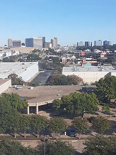
North Dallas is an area of numerous communities and neighborhoods in Dallas, Texas. The phrase "North Dallas" is also sometimes used to include any suburb or exurb north of Dallas proper within the metropolitan area. The majority of North Dallas is located in Dallas County, while a small portion is located in Collin and Denton Counties. North Dallas generally includes areas of Dallas north of Northwest Highway, along with Lake Highlands and areas of Dallas north of IH-635 known as Far North Dallas. The area has strong social and economic ties to the Dallas enclave of Park Cities, and two inner suburbs of Dallas, Richardson and Addison. It is the wealthiest part of Dallas, but has its adjacent, less resourced areas as well.

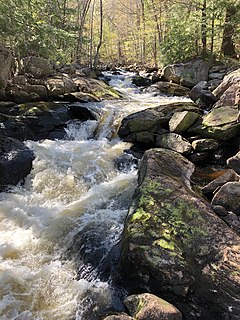
West Branch Sacandaga River converges with the Sacandaga River in Blackbridge, New York.

