
Montgomery County is a rural county located in the southern Piedmont of the U.S. state of North Carolina. As of the 2010 census, the population was 27,798. Its county seat is Troy.
U.S. Route 74 (US 74) is an east–west United States highway that runs for 515 miles (829 km) from Chattanooga, Tennessee to Wrightsville Beach, North Carolina. Primarily in North Carolina, it serves as an important highway from the mountains to the sea, connecting the cities of Asheville, Charlotte and Wilmington.
U.S. Route 701 is an auxiliary route of US 1 in the U.S. states of South Carolina and North Carolina. The U.S. Highway runs 171.45 miles (275.92 km) from US 17 and US 17 Alternate in Georgetown, South Carolina north to US 301, North Carolina Highway 96, and Interstate 95 (I-95) near Four Oaks, North Carolina. US 701 serves the Pee Dee region of South Carolina and the southern and central portions of Eastern North Carolina. The highway connects Georgetown and Conway in South Carolina with the North Carolina cities of Whiteville, Elizabethtown, Clinton, and a short distance north of its terminus, Smithfield. US 701 has four business routes in North Carolina, including those through Tabor City, Whiteville, Clarkton, and Clinton.
U.S. Route 158 (US 158) is an east–west United States highway that runs for 350 miles (560 km) from Mocksville to Whalebone Junction in Nags Head, entirely in the state of North Carolina. It is also a critical route that connects the cities of Winston-Salem, Summerfield, and Reidsville with one another.
North Carolina Highway 24 (NC 24) is the longest primary state highway in the U.S. state of North Carolina. Traveling east–west between the Charlotte metropolitan area and the Crystal Coast, connecting the cities of Charlotte, Fayetteville, Jacksonville and Morehead City.

North Carolina Highway 51 (NC 51) is a primary state highway in the U.S. state of North Carolina entirely in Mecklenburg County. It connects the towns of Pineville, Matthews and Mint Hill.

North Carolina Highway 211 (NC 211) is a 162.5-mile-long (261.5 km) primary state highway in the U.S. state of North Carolina. It traverses mostly through the Sandhills and Coastal Plain regions of the state; connecting the cities of Candor, Aberdeen, Raeford, Lumberton, Bladenboro, and Southport.
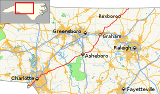
North Carolina Highway 49 (NC 49) is a primary state highway in the U.S. state of North Carolina. It traverses much of the Piedmont region of North Carolina.

North Carolina Highway 27 (NC 27) is a primary state highway in the U.S. state of North Carolina. The route traverses 198 miles (319 km) through southern and central North Carolina, about 100 miles (160 km) of it as a concurrency with NC 24.
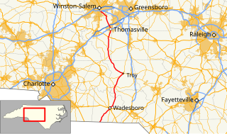
North Carolina Highway 109 (NC 109) is a north–south state highway in North Carolina. It primarily connects small towns in the central Piedmont region of the state. The 117-mile (188 km) route is a two-lane road for most of its length, but the segment between Winston-Salem and Thomasville is being upgraded to a divided 4-lane highway, as it is a major route between the two cities. The central segment of NC 109 passes through the Uwharrie Mountains and the Uwharrie National Forest.

North Carolina Highway 73 (NC 73) is a primary state highway in the U.S. state of North Carolina that travels through south-central North Carolina in the United States. Most of the route is a two-lane highway that passes through both rural scenic areas; however, it also serves several small and moderate-sized cities in the state, including Concord and Albemarle. The western terminus of NC 73 is at an intersection with NC 27 east of Lincolnton and its eastern terminus is at a junction with US 15/US 501 in Eastwood.
U.S. Route 220 is a north–south U.S. highway which travels from Rockingham, North Carolina to South Waverly, Pennsylvania. In the U.S. state of North Carolina, US 220 travels 123.4 miles (198.6 km) from an intersection with US 1 in Rockingham to the Virginia state line near Price, North Carolina. The highway is an important north-south route in Central North Carolina, connecting Rockingham, Asheboro, Greensboro, and Summerfield. US 220 runs concurrently with Interstate 73 from north of Rockingham to Greensboro, and from Summerfield to Stokesdale; while US 220 runs concurrently with I-74 from Rockingham to Randleman.
U.S. Route 52 (US 52) is a north–south United States highway that runs for 150 miles (240 km) from the South Carolina state line, near McFarlan, to the Virginia state line, near Mount Airy. It serves as a strategic highway through the central North Carolina Piedmont. Because of its alignment in the state, US 52 does not follow the standard convention of an even U.S. route number going east–west.

North Carolina Highway 43 (NC 43) is a primary state highway in the U.S. state of North Carolina. It connects many towns in the Coastal Plain region.
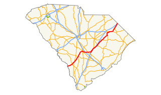
U.S. Route 301 (US 301) is a 189.704-mile (305.299 km) U.S. Highway that travels north–south from the Savannah River southwest of Allendale to Hamer approaching the South of the Border roadside attraction complex.
Several special routes of U.S. Route 220 exist. In order from south to north they are as follows.
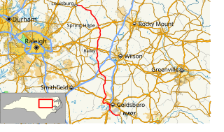
North Carolina Highway 581 (NC 581) is a primary state highway in the U.S. state of North Carolina. The highway travels from Goldsboro to Louisburg, connecting various rural communities in between.
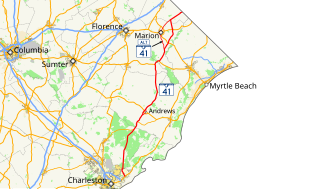
South Carolina Highway 41 (SC 41) is a 121.5-mile (195.5 km) state highway, connecting the Charleston region with eastern portions of the Pee Dee region in South Carolina. It serves as an alternative route to U.S. Route 52.

North Carolina Highway 134 (NC 134) is a primary state highway in the U.S. state of North Carolina. The 19.3-mile (31.1 km) highway provides a more direct route between Troy and Asheboro, via I-73/I-74/US 220 or US 220 Bus.

North Carolina Highway 704 (NC 704) is a primary state highway in the U.S. state of North Carolina. The highway connects Madison with northern Stokes County and the Wentworth-Reidsville area.


