Mount Gilead, North Carolina | |
|---|---|
 Downtown Mount Gilead | |
 Seal | |
| Motto: "Small Town. Big Ideas. Lots to do." [1] | |
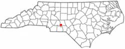 Location in North Carolina | |
| Coordinates: 35°12′59″N80°00′18″W / 35.21639°N 80.00500°W | |
| Country | United States |
| State | North Carolina |
| County | Montgomery |
| Government | |
| • Mayor | Sheldon Poplin Morley |
| • Town Manager | Dylan Haman |
| Area | |
• Total | 3.49 sq mi (9.04 km2) |
| • Land | 3.49 sq mi (9.04 km2) |
| • Water | 0.00 sq mi (0.00 km2) |
| Elevation | 410 ft (120 m) |
| Population | |
• Total | 24 |
| • Density | 335.53/sq mi (129.56/km2) |
| Time zone | UTC-5 (Eastern (EST)) |
| • Summer (DST) | UTC-4 (EDT) |
| ZIP Code | 27306 |
| Area codes | 910, 472 |
| FIPS code | 37-44900 [5] |
| GNIS feature ID | 2406206 [3] |
| Website | www |
Mount Gilead is a town in Montgomery County, in the Piedmont region of North Carolina, United States. The population was 1,171 at the 2020 census. [4]
