North Park, Buffalo

Last updated
North Park Theatre in 2024 NorthPark2024.jpg
North Park Theatre in 2024
North Park Academy North Park Middle Academy Buffalo.JPG
North Park Academy

North Park is a neighborhood within the City of Buffalo in New York State. [1] It is one of several neighborhoods that comprise the larger community of North Buffalo. The neighborhood's borders are roughly Delaware Avenue to the west, The former DL&W railroad to the north and east, and the Beltline Railroad and the Central Park neighborhood to the South. [2] [3]
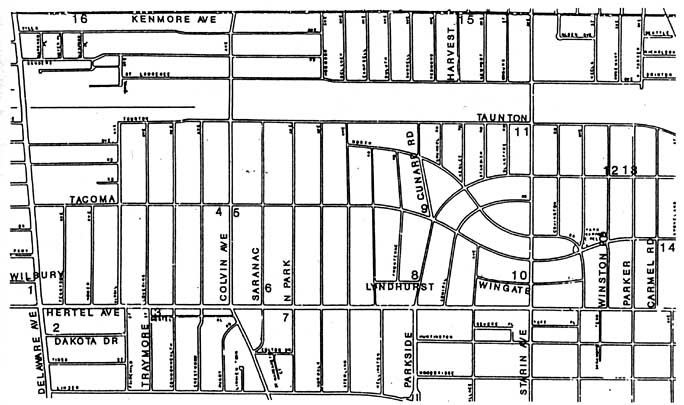
Contents

Notable businesses and institutions

These businesses and institutions utilizing the North Park name:

  1. North Park Community School (Public School 50) - Formerly known as North Park Academy (Public School 66)
  2. North Park Theatre
  3. North Park Branch of the Buffalo & Erie County Public Library system.
  4. North Park Lutheran Church
  5. North Park Branch - Bank of America
  6. North Park Florists
  7. North Park Community Preschool
  8. Hertel North Park Youth Baseball
  9. North Park Station (former Beltline railroad station)

See also

Related Research Articles

<span class="mw-page-title-main">Depew, New York</span> Village in New York, United States

Depew is a village in Erie County, New York. The population was 15,303 at the time of the 2010 census. It is part of the Buffalo–Niagara Falls metropolitan area. The village is named for Chauncey Depew, a politician and one of the original investors who bought the land for the village, which was incorporated in 1894.

<span class="mw-page-title-main">North Tonawanda, New York</span> City in New York, United States

North Tonawanda is a city in Niagara County, New York, United States. The population was 31,568 at the 2010 census. It is part of the Buffalo–Niagara Falls Metropolitan Statistical Area. The city is named after Tonawanda Creek, its south border.

<span class="mw-page-title-main">Hornell, New York</span> City in New York, United States

Hornell is a city in Steuben County, New York, United States. The population was 8,259 at the 2020 census. The city is named after the Hornell family, early settlers.

<span class="mw-page-title-main">Olean, New York</span> City in New York, United States

Olean is a city in Cattaraugus County, New York, United States. Olean is the largest city in Cattaraugus County and serves as its financial, business, transportation and entertainment center. It is one of the principal cities of the Southern Tier region of Western New York.

<span class="mw-page-title-main">Orchard Park, New York</span> Town in New York, United States

Orchard Park is an incorporated town in Erie County, New York. It is an outer ring suburb southeast of Buffalo. As of the 2010 census, the population was 29,054, representing an increase of 5.13% from the 2000 census figure. The town contains a village also named Orchard Park. Orchard Park is one of the Southtowns of Erie County and is best known as the site of Highmark Stadium, home of the National Football League's Buffalo Bills.

<span class="mw-page-title-main">West Seneca, New York</span> Town in New York, United States

West Seneca is a town in Erie County, New York, United States. The population was 45,500 at the 2020 census. West Seneca is a centrally located interior town of the county, and a suburb of Buffalo. West Seneca, Orchard Park and Hamburg form the inner "Southtowns", a cluster of middle-class suburban towns.

<span class="mw-page-title-main">Albany Park, Chicago</span> Community area in Chicago

Albany Park is one of 77 well-defined community areas of Chicago. Located on the Northwest Side of the City of Chicago with the North Branch of the Chicago River forming its east and north boundaries, it includes the ethnically diverse Albany Park neighborhood, with one of the highest percentages of foreign-born residents of any Chicago neighborhood.

<span class="mw-page-title-main">Mariners Harbor, Staten Island</span> Neighborhood in Staten Island

Mariners Harbor is a neighborhood located in the northwestern part of New York City's borough of Staten Island. It is bordered by Lake Avenue to the east, Forest Avenue to the south, Richmond Terrace to the north, and Holland Avenue to the west. The northwestern section of Mariners Harbor is often known as Arlington.

The Atlanta BeltLine is a 22 miles (35 km) open and planned loop of multi-use trail and light rail transit system on a former railway corridor around the core of Atlanta, Georgia. The Atlanta BeltLine is designed to reconnect neighborhoods and communities historically divided and marginalized by infrastructure, improve transportation, add green space, promote redevelopment, create and preserve affordable housing, and showcase arts and culture. The project is in varying stages of development, with several mainline and spur trails complete and others in an unpaved, but hikeable, state. Since the passage of the More MARTA sales tax in 2016, construction of the light rail streetcar system is overseen by MARTA in close partnership with Atlanta BeltLine, Inc.

<span class="mw-page-title-main">Richmond Hill, Queens</span> Neighborhood in New York City

Richmond Hill is a commercial and residential neighborhood located in the southeastern section of the New York City borough of Queens. The area borders Kew Gardens and Forest Park to the north, Jamaica and South Jamaica to the east, South Ozone Park to the south, and Woodhaven and Ozone Park to the west. The neighborhood is split between Queens Community Board 9 and 10.

<span class="mw-page-title-main">Black Rock, Buffalo</span> Neighborhood in Buffalo, New York, United States

Black Rock, once an independent municipality, is now a neighborhood of the northwest section of the city of Buffalo, New York. In the 1820s, Black Rock was the rival of Buffalo for the terminus of the Erie Canal, but Buffalo, with its larger harbor capacity and greater distance from the shores of Canada, a recent antagonist during the War of 1812, won the competition. Black Rock took its name from a large outcropping of black limestone along the Niagara River, which was blasted away in the early 1820s to make way for the canal.

The University Heights District is a neighborhood in Buffalo, New York.

Lake View is a hamlet in Erie County, New York, United States.

<span class="mw-page-title-main">Capitol View Manor</span>

Capitol View Manor is a small community in Southwest Atlanta that was named for the excellent view of the Georgia State Capitol building. Its boundaries include I-75/85 to the east, the Beltline to the north, Metropolitan Parkway to the west, and Atlanta Technical College to the south.

West Valley is a hamlet in the Town of Ashford in Cattaraugus County, New York, United States. The population was 518 at the 2010 census, which lists the community as a census-designated place.

<span class="mw-page-title-main">North Buffalo, Buffalo</span> Neighborhood in New York, United States

North Buffalo, is a neighborhood in the city of Buffalo, New York.

The Upper West Side is a neighborhood in Buffalo, New York.

<span class="mw-page-title-main">Capitol View, Atlanta</span>

Capitol View is a historic intown southwest Atlanta, Georgia neighborhood. The neighborhood is 2.5 miles from downtown and was named for its views of the Georgia State Capitol building. Its boundaries include Metropolitan Parkway to the east, Lee Street to the west, and the Beltline to the north. On the south, the border follows Arden Street, Deckner Avenue, and Perkerson Park.

The Lovejoy District is a neighborhood in Buffalo, New York. Lovejoy is the easternmost portion of the city, running along the city's border with Cheektowaga. The councilman of the area in 2017 is Richard Fontana.

Central Park is a residential neighborhood in Buffalo, New York, United States. Its boundaries are Main Street to the west, Parkside Avenue to the east, Hertel Avenue to the north, and Amherst Street to the south, with its southwestern limit running along the railroad lining Linden Avenue. Amherst Street Station sits at Central Park's southeastern corner.

References

  1. James, Napora. "History of North Park" . Retrieved 20 January 2014.
  2. "Map of North Park Area" . Retrieved 20 January 2014.
  3. "City Data".

42°56′52″N78°51′21″W / 42.9477166°N 78.85586°W / 42.9477166; -78.85586