
A ZIP Code is a system of postal codes used by the United States Postal Service (USPS). The term ZIP was chosen to suggest that the mail travels more efficiently and quickly when senders use the code in the postal address.
Androscoggin County is a county in the U.S. state of Maine. As of the 2020 census, the county's population was 111,139. Its county seat is Auburn and its largest city is Lewiston.

Lewiston is the second most populous city in the U.S. state of Maine, with the city's population at 37,121 as of the 2020 United States Census. It is the most central city in Androscoggin County. The city lies halfway between Augusta, the state's capital, and Portland, the state's most populous city. It is one-half of the Lewiston-Auburn Metropolitan Statistical Area, commonly referred to as "L/A." or "L-A." Lewiston exerts a significant impact upon the diversity, religious variety, commerce, education, and economic power of Maine. It is known for having an overall low cost of living, substantial access to medical care, and a low violent-crime rate. In recent years, the city of Lewiston has also seen a spike in economic and social growth. While the dominant language spoken in the city is English, it is home to a significant Somali population as well as the largest French-speaking population in the United States while it is second to St. Martin Parish, Louisiana, in percentage of speakers.

China Village is an unincorporated village in the town of China, Kennebec County, Maine, United States. The community is located at the junction of U.S. Route 202, Maine State Route 9, and Maine State Route 137, 7.6 miles (12.2 km) southeast of Waterville. China Village has a post office, with ZIP code 04926. Most of the village is part of the China Village Historic District, added to the National Register of Historic Places in 1977.

South Casco is an unincorporated village in the town of Casco, Cumberland County, Maine, United States. The community is located along U.S. Route 302 and Maine State Route 35 near the town's border with Raymond and the north shore of Sebago Lake. South Casco has a post office with ZIP code 04077.
Dryden is an unincorporated village in the town of Wilton, Franklin County, Maine, United States. The community is located along U.S. Route 2, Maine State Route 4, and Maine State Route 156, 6.5 miles (10.5 km) south-southwest of Farmington. Dryden has a post office, with ZIP code 04225, which opened on January 30, 1899.
East Dixfield is an unincorporated village in the towns of Wilton in Franklin County and Dixfield in Oxford County, in the U.S. state of Maine. The community is located along U.S. Route 2 and Maine State Route 17, 10 miles (16 km) southwest of Farmington. East Dixfield has a post office with ZIP code 04227.
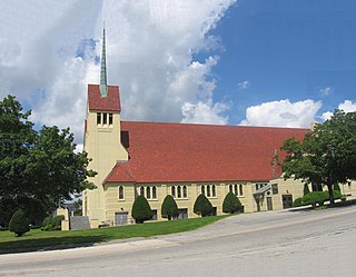
East Livermore is an unincorporated village in the town of Livermore Falls, Androscoggin County, Maine, United States. It is included both the Lewiston-Auburn, Maine Metropolitan Statistical Area and the Lewiston-Auburn, Maine Metropolitan New England City and Town Area. The community is located along Maine State Route 133 and the Androscoggin River, 22 miles (35 km) north of Lewiston. East Livermore has a post office with ZIP code 04228.

East Poland is an unincorporated village in the town of Poland, Androscoggin County, Maine, United States. It is included in the Lewiston-Auburn, Maine metropolitan statistical area. The community is 5.2 miles (8.4 km) west-southwest of Auburn. East Poland has a post office with ZIP code 04230, which opened on September 4, 1826.
North Monmouth is an unincorporated village in the town of Monmouth, Kennebec County, Maine, North Monmouth is included in the Lewiston-Auburn, Maine metropolitan New England City and town area. United States. The community is 12.7 miles (20.4 km) west of Augusta. North Monmouth has a post office with ZIP code 04265.
West Minot is an unincorporated village in the town of Minot, Androscoggin County, Maine, United States. It is included in the Lewiston-Auburn, Maine metropolitan statistical area. The community is located at the intersection of Maine State Route 119 and Maine State Route 124, 8.4 miles (13.5 km) northwest of Auburn. West Minot has a post office with ZIP code 04288.

West Poland is an unincorporated village in the town of Poland, Androscoggin County, Maine, United States. It is included in the Lewiston-Auburn, Maine metropolitan statistical area. The community is located on the south shore of Tripp Pond, 11.2 miles (18.0 km) west-southwest of Auburn. West Poland has a post office with ZIP code 04291, which opened on May 19, 1837.
Coopers Mills is an unincorporated village in the town of Whitefield, Lincoln County, Maine, United States. The community is located along Maine State Route 17, 11.8 miles (19.0 km) east-southeast of Augusta. Coopers Mills has a post office with ZIP code 04341.
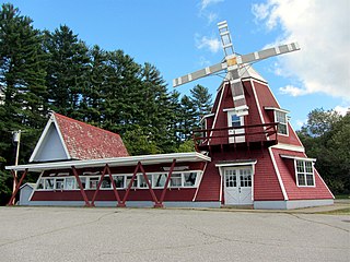
Greenville Junction is an unincorporated village in the town of Greenville, Piscataquis County, Maine, United States. The community is located along Maine State Route 6 and the south shore of Moosehead Lake, 27 miles (43 km) northwest of Dover-Foxcroft. Greenville Junction has a post office, with ZIP code 04442.
Chamberlain is an unincorporated village in the town of Bristol, Lincoln County, Maine, United States. The community is located along Maine State Route 32, 12.1 miles (19.5 km) southeast of Wiscasset. Chamberlain has a post office, with ZIP code 04541, which opened on September 30, 1905.
West Boothbay Harbor is an unincorporated village in the town of Boothbay Harbor, Lincoln County, Maine, United States. The community is located along Maine State Route 27, 10.7 miles (17.2 km) south of Wiscasset. West Boothbay Harbor has a post office, with ZIP code 04575.
Birch Harbor is an unincorporated village in the town of Gouldsboro, Hancock County, Maine, United States. The community is located along Maine State Route 186, 22 miles (35 km) east-southeast of Ellsworth. Birch Harbor has a post office with ZIP code 04613, which opened on March 26, 1880.
Salsbury Cove is an unincorporated village in the town of Bar Harbor, Hancock County, Maine, United States. The community is located along Maine State Route 3, 10.3 miles (16.6 km) southeast of Ellsworth. Salsbury Cove has a post office with ZIP code 04672.
Sargentville is an unincorporated village in the town of Sedgwick, Hancock County, Maine, United States. The community is located along Maine State Route 175, 21 miles (34 km) southwest of Ellsworth. Sargentville had a post office from February 10, 1855, until April 23, 2005; it still has its own ZIP code, 04673.
Sunset is an unincorporated village in the town of Deer Isle, Hancock County, Maine, United States. The community is located along Maine State Route 15A, 27 miles (43 km) south-southeast of Ellsworth. Sunset has a post office, with ZIP code 04683.

