
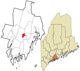
Turner is a town in Androscoggin County, Maine, United States. The population was 5,817 at the 2020 census. The town includes the villages of Turner, Turner Center and North Turner. The town is part of the Lewiston-Auburn, Maine Metropolitan New England City and Town Area.

South Paris is a census-designated place (CDP) located within the town of Paris in Oxford County, Maine, in the United States. The population was 2,237 at the 2000 census. While the CDP refers only to the densely settled area in the southern part of the town of Paris, the entire town, outside of Paris Hill, is located within the South Paris ZIP code, resulting in many residents referring to the entire town as South Paris.

Suncook is a census-designated place (CDP) in Merrimack County, New Hampshire, United States. The population was 5,501 at the 2020 census. Approximately two-thirds of Suncook is located in the town of Pembroke, with the remainder in Allenstown.

Van Buren is a census-designated place (CDP) comprising the main village within the town of Van Buren in Aroostook County, Maine, United States. The population of the CDP was 1,937 at the 2010 census, out of a population of 2,171 for the entire town.
Gorham is a census-designated place (CDP) and the main village in the town of Gorham in Coos County, New Hampshire, United States. The population of the CDP was 1,851 at the 2020 census, out of 2,698 people in the entire town of Gorham.

State Route 4 is a 168.85-mile (271.74 km) long state highway located in southern and western Maine. It is a major interregional route and the first such route to be designated in the state. The southern terminus is at the New Hampshire border in South Berwick, where it connects to New Hampshire Route 4, and the northern terminus is at Haines Landing on Mooselookmeguntic Lake in Rangeley. Major cities and towns along the length of SR 4 include Sanford, Gorham, Windham, Auburn and Farmington.

Damariscotta is a census-designated place (CDP) comprising the main village of the town of Damariscotta in Lincoln County, Maine, United States. The population was 1,142 at the 2010 census, out of 2,218 in the entire town. In the 2000 census, the village was part of the Damariscotta-Newcastle CDP.
Newcastle is a census-designated place (CDP) comprising the main village of the town of Newcastle in Lincoln County, Maine, United States. The population was 667 at the 2010 census, out of 1,752 in the entire town. In the 2000 census, the village was part of the Damariscotta-Newcastle CDP.

Wiscasset is a census-designated place (CDP) comprising the primary settlement in the town of Wiscasset in Lincoln County, Maine, United States. The population was 1,097 at the 2010 census, out of 3,732 people in the entire town. Wiscasset is the county seat of Lincoln County.
Alfred is a census-designated place (CDP) and the primary village in the town of Alfred, York County, Maine, United States. It is in central York County and the center of the town of Alfred, 4 miles (6 km) northeast of Sanford and 13 miles (21 km) west of Biddeford. U.S. Route 202 passes through the village, leading northeast 23 miles (37 km) to Gorham and southwest through Sanford 20 miles (32 km) to Rochester, New Hampshire. Maine State Route 4 leads south 13 miles (21 km) to North Berwick and leads north out of town with US 202. State Route 111 leads east from Alfred to Biddeford.
Greene is a census-designated place (CDP) and the primary village in the town of Greene, Androscoggin County, Maine, United States. It is northeast of the center of the county, and in the center of the town of Greene. U.S. Route 202 passes through the village, leading southwest 7 miles (11 km) to the center of Lewiston and northeast 22 miles (35 km) to Augusta, the state capital.
Lisbon is a census-designated place (CDP) in the town of Lisbon, Androscoggin County, Maine, United States. It is one of the two main villages in the town, the other being Lisbon Falls. Lisbon village is in the western half of the town of Lisbon and is located on the Sabattus River, a south-flowing tributary of the Androscoggin River. Maine State Route 196 passes through the village, leading southeast 3 miles (5 km) to Lisbon Falls and northwest 7 miles (11 km) to Lewiston. The small village of Lisbon Center is in the southeast part of the CDP.
Sabattus is a census-designated place (CDP) comprising the primary village in the town of Sabattus, Androscoggin County, Maine, United States. It is situated in the northwest corner of the town, at the outlet of Sabattus Pond and the start of the Sabattus River, a south-flowing tributary of the Androscoggin River. Maine State Route 126 forms the southern edge of the CDP; the highway leads west 6 miles (10 km) to the center of Lewiston and northeast 20 miles (32 km) to Gardiner. State Route 9 runs south from Sabattus 9 miles (14 km) to Lisbon Falls and follows Route 126 northeast to Gardiner.
Island Falls is a census-designated place (CDP) and the primary village in the town of Island Falls, Aroostook County, Maine, United States. It is in the northwest part of the town, situated on the West Branch Mattawamkeag River, part of the Penobscot River watershed. U.S. Route 2 passes through the village, leading northeast 27 miles (43 km) to Houlton and south 38 miles (61 km) to Mattawamkeag. Maine State Route 159 has its eastern terminus at U.S. in the center of Island Falls and leads west 10 miles (16 km) to Patten. Interstate 95 passes just west of the village of Island Falls, with access from Exit 276 ; I-95 leads northeast to Houlton and southwest 92 miles (148 km) to Bangor.
Bethel is a census-designated place (CDP) and the primary village in the town of Bethel, Oxford County, Maine, United States. It is in the southwestern part of the town, south of the Androscoggin River. U.S. Route 2 passes through the northwest side of the CDP, leading northeast 23 miles (37 km) to Rumford and west 22 miles (35 km) to Gorham, New Hampshire. Maine State Route 5 joins Route 2 in Bethel but runs south through the village center and continues southwest 36 miles (58 km) to Fryeburg. State Route 26 leads southeast from Bethel 24 miles (39 km) to South Paris.
Corinna is a census-designated place (CDP) and the primary village in the town of Corinna, Penobscot County, Maine, United States. It is in the southern part of the town, on both sides of the East Branch Sebasticook River, part of the Kennebec River watershed.
Mattawamkeag is a census-designated place (CDP) and the primary village in the town of Mattawamkeag, Penobscot County, Maine, United States. It is in the southwest corner of the town, where the Mattawamkeag River joins the Penobscot. The community is bordered to the south by the town of Winn and to the west, across the Penobscot, by the town of Woodville.
Patten is a census-designated place (CDP) and the primary village in the town of Patten, Penobscot County, Maine, United States. It is in the northeast part of the town, mostly on the north side of Fish Stream, an east-flowing tributary of the West Branch Mattawamkeag River and part of the Penobscot River watershed.
Vanceboro is a census-designated place (CDP) and the primary village in the town of Vanceboro, Washington County, Maine, United States. It is in northeastern Washington County, on the west side of the St. Croix River, which forms the Canada–United States border. Directly across the border is the small community of St. Croix, New Brunswick.
South Berwick is a census-designated place (CDP) and the primary village in the town of South Berwick, York County, Maine, United States. It is in southwestern York County, in the northwest corner of the town of South Berwick. It is bordered to the north by the town of Berwick, and to the southwest, across the Salmon Falls River, by the town of Rollinsford, New Hampshire.


