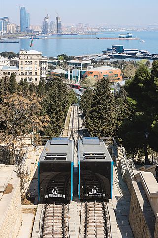
A funicular is a type of cable railway system that connects points along a railway track laid on a steep slope. The system is characterized by two counterbalanced carriages permanently attached to opposite ends of a haulage cable, which is looped over a pulley at the upper end of the track. The result of such a configuration is that the two carriages move synchronously: as one ascends, the other descends at an equal speed. This feature distinguishes funiculars from inclined elevators, which have a single car that is hauled uphill.
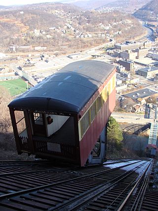
The Johnstown Inclined Plane is a 896.5-foot (273.3 m) funicular in Johnstown, Cambria County, Pennsylvania, U.S. The incline and its two stations connect the city of Johnstown, situated in a valley at the confluence of the Stonycreek and the Little Conemaugh rivers, to the borough of Westmont on Yoder Hill. The Johnstown Inclined Plane is billed as the "world's steepest vehicular inclined plane". It can carry automobiles and passengers, up or down a slope with a grade of 71.9%. The travel time between stations is 90 seconds.

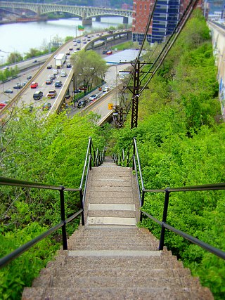
Fineview — known to older generations as Nunnery Hill — is a neighborhood on Pittsburgh's North Side with expansive views of downtown Pittsburgh. The most famous of these views is from the Fineview Overlook at the corner of Catoma Street and Meadville Street.

The Duquesne Incline is a funicular scaling Mount Washington near the South Side neighborhood of Pittsburgh, Pennsylvania, United States. Designed by Hungarian-American engineer Samuel Diescher, the incline was completed in 1877.

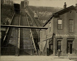
The Monongahela Incline is a funicular on the South Side in Pittsburgh, Pennsylvania, United States, near the Smithfield Street Bridge. Designed and built by Prussian-born engineer John Endres in 1870, it is the oldest continuously operating funicular in the U.S.

The Knoxville Incline was a broad gauge inclined railway that ran between Pittsburgh's South Side and Allentown neighborhoods. The incline was built in 1890 and had a track gauge of 9 feet (2,700 mm).

The Castle Shannon Incline was a funicular railroad in Pittsburgh, Pennsylvania that was part of the Pittsburgh and Castle Shannon Railroad. It ran down the southern slope of Mount Washington, as part of the route to the suburb of Castle Shannon, 6 miles south of the incline's location. It replaced an earlier incline dating to 1825 that brought coal down from a mine in Mount Washington.
The Clifton Incline was a funicular that operated from 1889 to 1905 in what is now the Perry Hilltop neighborhood of Pittsburgh, Pennsylvania. It extended from its base at Sarah Street at the intersection with Myrtle Street to its top landing at Clifton Park near the end of Clifton Street.
The Fort Pitt Incline was a 10 ft gauge funicular railroad in the Bluff neighborhood of Pittsburgh. Opened in 1882, the incline ran from 2nd Avenue to Bluff Street, a distance of 350 feet (107 m), and a vertical distance of 135 feet (41 m). The designer was Samuel Diescher.
Samuel Diescher was a prominent Hungarian-American civil and mechanical engineer who had his career in the United States. After being educated at universities in Karlsruhe and Zurich in Europe, he immigrated to the United States in 1866 and settled in Cincinnati, Ohio. There he supervised construction of his first inclined plane. He later moved to Pittsburgh, Pennsylvania, where he worked with John Endres on the Monongahela Incline (1870), the first passenger incline in the city.

The Mount Oliver Incline was a funicular on the South Side of Pittsburgh, Pennsylvania. It was designed in 1871 by the Prussian-born engineer John Endres and his American daughter Caroline Endres, one of the first women engineers in the United States.

Castle Shannon Incline Number 2 was an inclined cable railway in Pittsburgh, Pennsylvania. It was originally designed by Samuel Diescher, and opened in 1892 as part of the Pittsburgh and Castle Shannon Railroad as a means of transporting passenger traffic over Mt. Washington in concert with the Castle Shannon Incline. From the top station at Bailey Street, adjacent to the Castle Shannon Incline top station, No. 2 ran down hill west of Haberman Avenue, ending at Warrington Avenue.
The St. Clair Incline, also known as the South Twenty-second Street Incline, was built in 1886–1888 and operated by St. Clair Incline Plane Company. It was a double track incline on the South Side Slopes of Pittsburgh from Josephine St. to Salisbury St. The lower station was near the intersection of S. 22nd Street and Josephine. The upper station was on Salisbury Street across from the former Fort Laughlin site eventually occupied by Arlington Playground. The incline was 2,060 ft (628 m) long, with a vertical rise of 361 ft (110 m). It was designed by engineer J. H. McRoberts. As it carried both freight and passengers over steep tracks laid on the ground, it could be considered to be a cable railway. Its path was not of constant slope but became progressively steeper toward the top, tracing a parabolic arc. It is uncertain exactly when the incline closed permanently, but it was reported as shut down in a 1932 Associated Press article about the "passing" of Pittsburgh's inclines. The structure was dismantled in 1934.
The Monongahela Freight Incline was a funicular railway that scaled Mount Washington in Pittsburgh, Pennsylvania, United States.

The Troy Hill Incline, also known as the Mount Troy Incline, was a funicular railway located in old Allegheny, Pennsylvania, which is now the North Side of the city of Pittsburgh.
The following is a timeline of the history of the city of Pittsburgh, Pennsylvania, US.

The Penn Incline, also known as the 17th Street Incline, was a funicular railroad that ran between the Strip and Hill districts in Pittsburgh, Pennsylvania. It operated from 1884 to 1953.
The Ridgewood Incline was an inclined plane railroad in Allegheny City, Pennsylvania, in what is now the Perry South neighborhood of Pittsburgh. Built in 1886 and burned the next year, it was Allegheny's first and shortest-lived incline.
James Andrews was a Scottish-American stonemason, engineer, and capitalist who collaborated with civil engineer James Buchanan Eads on such projects as the Eads Bridge in St. Louis, the Mississippi River jetties, and a proposed railway system across the Isthmus of Tehuantepec. He was reportedly a millionaire by the end of his life, having accrued a fortune of at least $32 million in 2022 dollars. His Heathside Cottage in the Fineview neighborhood of Pittsburgh is listed on the National Register of Historic Places. He was known for much of his life as "Col. James Andrews," though he never served in the military.
