The Nimrod Glacier is a major glacier about 135 km (85 mi) long, flowing from the polar plateau in a northerly direction through the Transantarctic Mountains between the Geologists and Miller Ranges, then northeasterly between the Churchill Mountains and Queen Elizabeth Range, and finally spilling into Shackleton Inlet and the Ross Ice Shelf between Capes Wilson and Lyttelton.
The Dennistoun Glacier is a glacier, 50 nautical miles long, draining the northern slopes of Mounts Black Prince, Royalist and Adam in the Admiralty Mountains of Victoria Land in Antarctica. It flows northwest between the Lyttelton Range and Dunedin Range, turning east on rounding the latter range to enter the sea south of Cape Scott. The coastal extremity of the glacier was charted in 1911–12 by the Northern Party, led by Victor Campbell, of the British Antarctic Expedition, 1910–13. The geographical feature lies situated on the Pennell Coast, a portion of Antarctica lying between Cape Williams and Cape Adare.
The Lucy Glacier is a wide glacier which flows southeast from the Antarctic polar plateau, between Laird Plateau and McKay Cliffs, into Nimrod Glacier. It is named after W.R. Lucy, surveyor with 1963-64 Scott Base projects, who wintered over in 1964, and was surveyor with the 1964-65 Geologists Range field party of the New Zealand Geological Survey Antarctic Expedition (NZGSAE).

The Byrd Glacier is a major glacier in Antarctica, about 136 km (85 mi) long and 24 km (15 mi) wide, draining an extensive area of the polar plateau and flowing eastward between the Britannia Range and Churchill Mountains to discharge into the Ross Ice Shelf at Barne Inlet. Its valley below the glacier used to be recognised as one of the lowest points not to be covered by water on Earth, reaching 2,780 metres below sea level. It was named by the NZ-APC after Rear Admiral Byrd, US Navy Antarctic explorer.
Academy Glacier is a major Antarctic glacier in the Pensacola Mountains, draining northwestward between the Patuxent and Neptune ranges to enter Foundation Ice Stream.

Darwin Glacier is a large glacier in Antarctica. It flows from the polar plateau eastward between the Darwin Mountains and the Cook Mountains to the Ross Ice Shelf. The lower part of the glacier was mapped by the British National Antarctic Expedition, 1901–04, and the whole area traversed by New Zealand parties of the Commonwealth Trans-Antarctic Expedition (1956–58). The glacier was named in association with the Darwin Mountains.

Ebbe Glacier is a tributary glacier about 60 nautical miles long, draining northwest from the Homerun Range and the Robinson Heights, and then west-northwest between the Everett Range and the Anare Mountains into Lillie Glacier, Victoria Land, Antarctica. This feature saddles with Tucker Glacier, the latter draining southeast to the Ross Sea. The glacier lies situated on the Pennell Coast, a portion of Antarctica lying between Cape Williams and Cape Adare. Robertson Glacier is a tributary glacier to Ebbe Glacier.

Borchgrevink Glacier is a large glacier in the Victory Mountains, Victoria Land, draining south between Malta Plateau and Daniell Peninsula, and thence projecting into Glacier Strait, Ross Sea, as a floating glacier tongue, the Borchgrevink Glacier Tongue, just south of Cape Jones. It was named by the New Zealand Geological Survey Antarctic Expedition, 1957–58, for Carsten Borchgrevink, leader of the British Antarctic Expedition, 1898–1900. Borchgrevink visited the area in February 1900 and first observed the seaward portion of the glacier.
Mellor Glacier is a tributary glacier, flowing north-northeast between Mount Newton and Mount Maguire and coalescing with Collins Glacier just prior to its junction with Lambert Glacier at Patrick Point, in the Prince Charles Mountains of Antarctica. It was mapped from air photos taken by the Australian National Antarctic Research Expeditions in 1956, and was named by the Antarctic Names Committee of Australia after English-born glaciologist Malcolm Mellor (1933–91), who worked at Mawson Station in 1957, and as an engineer with the U.S. Army's Cold Regions Research and Engineering Laboratory from 1961 to 1991.
Scott Glacier is a glacier, 7 miles (11.3 km) wide and over 20 miles (32 km) long, flowing north-northwest to the Antarctic coast between Denman Glacier and Mill Island. It was discovered by the Western Base Party of the Australasian Antarctic Expedition (1911-1914) under Mawson and named for Capt. Robert F. Scott.
Beaver Glacier is a glacier about 15 miles (24 km) long and 4 miles (6 km) wide, flowing west into Amundsen Bay between Auster Glacier and Mount Gleadell. The head of Beaver Glacier is located very close to the base of Mount King in Enderby Land. It was visited by an Australian National Antarctic Research Expeditions (ANARE) party on October 28, 1956, and named after the Beaver aircraft used by ANARE in coastal exploration.
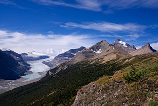
The Saskatchewan Glacier is located in Banff National Park, Alberta, Canada, approximately 120 km (75 mi) northwest of the town of Banff, and can be accessed from the Icefields Parkway. Saskatchewan Glacier is the largest outflow glacier from the Columbia Icefield, which rests along the Continental Divide. The glacier is a primary water source for the North Saskatchewan River. The glacier is approximately 13 kilometres (8.1 mi) long and covers an area of 30 km2 (11.5 mi2) and was measured in 1960 to be over 400 metres (1,310 ft) thick at a distance of 8 kilometres (5.0 mi) from the terminal snout. Between the years 1893 and 1953, Saskatchewan Glacier had retreated a distance of 1,364 metres (4,475 ft), with the rate of retreat between the years 1948 and 1953 averaging 55 metres (180 ft) per year. The glacier, which flows northeast, exhibits a prominent medial morraine.
Utstikkar Glacier is a broad glacier flowing north from the vicinity of Moyes Peak in Antarctica and terminating in Utstikkar Glacier Tongue between Utstikkar Bay to the east and Allison Bay to the west. The glacier was mapped and named Utstikkarbreen by Norwegian cartographers working from aerial photographs taken by the Lars Christensen Expedition in January–February 1937.

Il Polo Glacier is a small glacier draining northward between Polar Times Glacier and Polarforschung Glacier into the Publications Ice Shelf, Antarctica. It was delineated in 1952 by John H. Roscoe from air photos taken by U.S. Navy Operation Highjump, 1946–47, and was named by Roscoe for Il Polo, a polar journal published by the Istituto Geografico, Forlì, Italy.

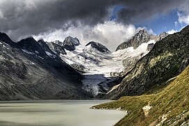
The Oberaarjoch is a high mountain pass across the eastern Bernese Alps, connecting the Fiescher Glacier in the canton of Valais to the Oberaar Glacier in the canton Bern. The pass is located between the Oberaarhorn on the north and the Oberaarrothorn on the south. Above the col, on the Valais side, lies the Oberaarjoch Hut.
Anderton Glacier is a tributary glacier, 7 nautical miles (13 km) long, descending the south slopes of the Eisenhower Range to enter Reeves Glacier between Mount Matz and Andersson Ridge, in Victoria Land, Antarctica. The glacier is situated on the Pennell Coast, a portion of Antarctica lying between Cape Williams and Cape Adare. It was mapped by the United States Geological Survey from surveys and from U.S. Navy air photos, 1955–63, and was named by the Advisory Committee on Antarctic Names for Peter W. Anderton, a glaciologist at McMurdo Station, summer 1965–66.
Ball Glacier is a glacier 7 nautical miles (13 km) long with the head located between Mount Lister and Mount Hooker on the east side of the Royal Society Range. The glacier flows northeast between Craw Ridge and Tasman Ridge into Blue Glacier. It was named by the New Zealand Geographic Board after Gary Ball, a New Zealand mountaineer who climbed Mount Lister with an Italian field party, 1976–77, and camped on this glacier; he was field assistant with R.H. Findlay's New Zealand Antarctic Research Program party to this area, 1980–81.

Childs Glacier is a glacier in the Neptune Range of the Pensacola Mountains, draining westward from Roderick Valley to enter Foundation Ice Stream. It was mapped by the United States Geological Survey from surveys and from U.S. Navy air photos, 1956–66, and named by the Advisory Committee on Antarctic Names for John H. Childs, a builder at Ellsworth Station, winter 1958.
Graveson Glacier is a broad north-flowing tributary to the Lillie Glacier, draining that portion of the Bowers Mountains between the Posey Range and the southern part of Explorers Range, Victoria Land, Antarctica. The geographical feature is fed by several lesser tributaries and enters Lillie Glacier via Flensing Icefall. The glacier was so named by the northern party of the New Zealand Geological Survey Antarctic Expedition, 1963–64, for F. Graveson, a mining engineer who wintered at Scott Base in 1963 and was field assistant on this expedition. The glacier lies situated on the Pennell Coast, a portion of Antarctica lying between Cape Williams and Cape Adare.
The Firehorn is a mountain of the Bernese Alps, located north of Reckingen in the canton of Valais. It lies south of the Oberaarrothorn, between the Minstigergletscher and the Bächigletscher.