Garmisch-Partenkirchen is a Landkreis (district) in Bavaria, Germany. It is bounded by the districts of Ostallgäu, Weilheim-Schongau and Bad Tölz-Wolfratshausen, and by the Austrian state of Tyrol.

Benediktbeuern is a municipality in the district of Bad Tölz-Wolfratshausen in Bavaria, Germany, 2 kilometers, or 1.25 miles from Bichl. The village has 3,602 residents as of 31 December 2019.
Ettal is a German municipality in the district of Garmisch-Partenkirchen, in Bavaria.

Uffing am Staffelsee is a municipality in the district of Garmisch-Partenkirchen, in Bavaria, Germany. It consists of the two villages of Uffing and Schöffau and is located on Staffelsee, the warmest lake in Germany. The River Ach flows through Uffing.
Bad Bayersoien is a German municipality in the district of Garmisch-Partenkirchen, in Bavaria.

Bad Kohlgrub is a German municipality in the district of Garmisch-Partenkirchen, in Bavaria. It lies 12 kilometres (7.5 mi) west of Murnau am Staffelsee and 8 kilometres (5.0 mi) north of Oberammergau, and is connected to both by the Ammergau Railway.

Eschenlohe is a German municipality in the district of Garmisch-Partenkirchen, in Bavaria, on the Loisach River.
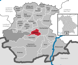
Farchant is a municipality in the district of Garmisch-Partenkirchen, in Bavaria, Germany.

Grainau is a municipality in the district of Garmisch-Partenkirchen, in southern Bavaria, Germany. It is located at the foot of the Zugspitze mountain, the tallest mountain in Germany in the sub-mountain range of the Wetterstein Alps which is a branch off the main mountain range it is connected to, the Alps. Lake Eibsee in Grainau lies at the foot of the Zugspitze surrounded by forest.

Großweil is a municipality in the district of Garmisch-Partenkirchen, in Bavaria, Germany.
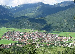
Krün is a municipality in the Upper Bavarian district of Garmisch-Partenkirchen. It belongs with Garmisch-Partenkirchen as district capital and cultural center as well as other municipalities to the region Werdenfelser Land. A few kilometers south runs the German-Austrian border.

Ohlstadt is a municipality in the district of Garmisch-Partenkirchen, in Bavaria, Germany.

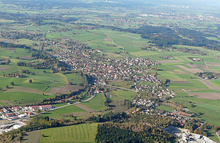
Riegsee is a municipality in the district of Garmisch-Partenkirchen, in Bavaria, Germany. The town lies on Riegsee Lake, of the same name.
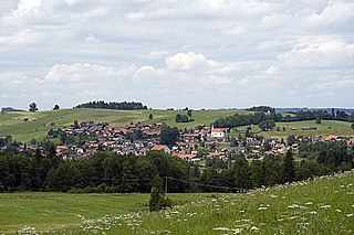
Saulgrub is a municipality in the district of Garmisch-Partenkirchen, in Bavaria, Germany.

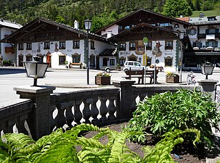
Schwaigen is a municipality in the district of Garmisch-Partenkirchen, in Bavaria, Germany.

Seehausen am Staffelsee is a municipality in the district of Garmisch-Partenkirchen, in Bavaria, Germany. The main village, Seehausen, lies on the eastern shore of the Staffelsee lake.

Spatzenhausen is a municipality in the district of Garmisch-Partenkirchen, in Bavaria, Germany.

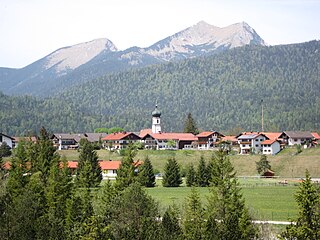
Unterammergau is a municipality in the district of Garmisch-Partenkirchen, in Bavaria, Germany. It is the site of the 11th-century Chapel of St Leonhard, patron saint of horses, which is the terminus of the annual Leonhardritt and Blessing of the Animals.
Wallgau is a municipality in the district of Garmisch-Partenkirchen, in Bavaria, Germany.
Huglfing is a municipality in the Weilheim-Schongau district, in Bavaria, Germany.