Ogoja is a Local Government Area in Cross River State, Nigeria. [1] Its headquarters is Ogoja town in the northeast of the area near the A4 highway at 6°39′17″N8°47′51″E / 6.65472°N 8.79750°E . [2]
It has an area of 972 km² and a population of 171,901 at the 2006 census. [3]
Its St. Benedict’s Cathedral is the episcopal see of the Roman Catholic Diocese of Ogoja. [4]
The postal code of the area is 550. [5]
The town was one of the provinces during colonial times. [6] It consists of many tribal units, including Ishibori (this village has different clans such as Uhmuria, Ikaptang, Ikajor, Ishinyema, Ikariku, Imerakorm) and Igoli as the central town. Mbube, being one of the major tribes, comprises different villages, including: Odajie, Adagum, Ekumtak, Idum, Ojerim, Egbe, Ogberia Ogang & Ogberia Ochoro, Oboso, Benkpe, Edide, Bansan, Aragban, Nkim, etc. Their major source of livelihood is subsistence agriculture, basically farming of cassava, yams, palm oil, palm wine etc. [7] Ekajuk, is one of the major clans in Ogoja Local government area. Divided into Ward I and Ward II, and includes major communities such as Nwang, Ekpogrinya, Esham, Egbong, Nnang, Ewinimba and Bansara (which are collection of a group of villages. [8]
In Ogoja, the dry season is hot, muggy, and partly cloudy whereas the wet season is warm, oppressive, and overcast. The average annual temperature fluctuates between 65 °F and 90 °F, rarely falling below 60 °F or rising above 93 °F.
The distinction between hot and cold seasons in Ogoja is somewhat arbitrary because the city's temperature hardly changes from one season to the next. [9] [10] [11] [12]
Climate data for Ogoja (1991–2020) | |||||||||||||
---|---|---|---|---|---|---|---|---|---|---|---|---|---|
Month | Jan | Feb | Mar | Apr | May | Jun | Jul | Aug | Sep | Oct | Nov | Dec | Year |
Record high °C (°F) | 39.4 (102.9) | 40.4 (104.7) | 41 (106) | 40.4 (104.7) | 38 (100) | 36.2 (97.2) | 36 (97) | 34.2 (93.6) | 34.8 (94.6) | 35.5 (95.9) | 37.5 (99.5) | 38 (100) | 41.0 (105.8) |
Mean daily maximum °C (°F) | 34.9 (94.8) | 36.7 (98.1) | 36.6 (97.9) | 34.8 (94.6) | 33.1 (91.6) | 31.8 (89.2) | 30.6 (87.1) | 30.1 (86.2) | 31.0 (87.8) | 32.0 (89.6) | 33.7 (92.7) | 34.7 (94.5) | 33.3 (91.9) |
Daily mean °C (°F) | 27.5 (81.5) | 29.3 (84.7) | 30.1 (86.2) | 29.1 (84.4) | 28.0 (82.4) | 27.3 (81.1) | 26.6 (79.9) | 26.2 (79.2) | 26.8 (80.2) | 27.3 (81.1) | 28.1 (82.6) | 27.0 (80.6) | 27.8 (82.0) |
Mean daily minimum °C (°F) | 20.2 (68.4) | 21.9 (71.4) | 23.7 (74.7) | 23.5 (74.3) | 22.9 (73.2) | 22.7 (72.9) | 22.6 (72.7) | 22.4 (72.3) | 22.5 (72.5) | 22.6 (72.7) | 22.5 (72.5) | 19.4 (66.9) | 22.2 (72.0) |
Record low °C (°F) | 9 (48) | 9 (48) | 13 (55) | 15 (59) | 13 (55) | 17 (63) | 18 (64) | 17 (63) | 16 (61) | 17 (63) | 14 (57) | 9 (48) | 9.0 (48.2) |
Average precipitation mm (inches) | 8.7 (0.34) | 11.1 (0.44) | 34.9 (1.37) | 139.0 (5.47) | 276.3 (10.88) | 284.4 (11.20) | 280.1 (11.03) | 269.3 (10.60) | 351.4 (13.83) | 290.1 (11.42) | 30.5 (1.20) | 6.5 (0.26) | 1,982.2 (78.04) |
Average precipitation days (≥ 1.0 mm) | 0.4 | 0.9 | 2.3 | 7.2 | 13.9 | 14.1 | 15.1 | 15.4 | 17.4 | 14.8 | 1.9 | 0.3 | 103.8 |
Average relative humidity (%) | 67.8 | 71.5 | 81.4 | 85.8 | 88.1 | 89.5 | 90.0 | 90.1 | 90.6 | 90.3 | 83.0 | 72.0 | 83.4 |
Source: NOAA [13] |
The average proportion of sky covered by clouds in Ogoja varies significantly seasonally throughout the year. [9] [14]
In Ogoja, the clearer season starts about November 17 and lasts for 3.1 months, coming to a finish around February 22. [15] [16] December is the clearest month of the year, with the sky remaining clear, mostly clear, or partly overcast 44% of the time. [17] [18]
Beginning about February 22 and lasting for 8.9 months, the cloudier season ends around November 17. [19] [20]
May is the cloudiest month of the year in Ogoja, with the sky being overcast or mostly cloudy 86% of the time on average. [21] [22]
A day is considered to be wet if there has been at least 0.04 inches of liquid or liquid-equivalent precipitation. In Ogoja, the likelihood of rainy days fluctuates a great deal from season to season. [23] [24]
The 7.4-month wetter season, which runs from March 25 to November 6, has a probability of precipitation of more than 43% on any one day. With an average of 25.1 days with at least 0.04 inches of precipitation, September is the month with the most rainy days in Ogoja. [25] [26]
From November 6 to March 25, the drier season lasts 4.6 months. With an average of 0.7 days with at least 0.04 inches of precipitation, December is the month with the fewest wet days in Ogoja. [27] [28]
We categorize wet days into those that include snow, rain, or a combination of the three. In Ogoja, September has an average of 25.1 days of rain, which is the most of any month. According to this classification, rain alone is the most frequent type of precipitation throughout the year, with a high likelihood of 85% on October 1. [29]
Currently, Ogoja has three arms of government, namely: executive, legislature and judiciary. The executive arm is made up of an elected Chairman, a deputy chairman and supervisors. They are appointed by the chairman and confirmed by the legislature. The previous chairman was Madam Rita Atom from 2013 to 2016. An election has not been conducted, while the Vice Chairman is Mr. John Orim still remains on seat. The legislative arm comprises ten Councillors who represent the ten wards in Ogoja. The leader of the legislature is Mr Austin Ayungbe - Ekajuk ward II, while the deputy leader is Mr Thomas Ori - Mbube east ward II. Others are; Ms Sarah Amu - Mbube east ward I, Mr Tom Egbang - Mbube west ward I, Mr Peter Odu - Mbube west ward II, Mr Vincent Uga - Nkum-Irede ward, Mr Iyang Nnang - Nkum-Iborr ward, Mr Paul Aganyi - Ekajuk ward I, Mr Anthony Ntaji - Urban ward I, Mr Wogor Umari - Urban ward II. All the officials in the executive and legislative arms are members of the People's Democratic Party (PDP). Their tenure expires in December 2016. The judiciary is headed by the Chief Judge of Ogoja. Ogoja is a town of many reputable families such as:The MOKOSHE’s The Egabe's,The Ogabi's, The Aggrey's, The Ntaji’s, The Ogabo's, The Ukpo's, The Uga-ifu's, The Amu's, The Moffi’s.
Ogoja is home to the Federal College of Science.
Bebi Airport, a small airstrip, is close to Ogoja.
![]() | This article needs to be updated.(November 2011) |
Arochukwu Local Government Area, sometimes referred to as Arochuku or Aro Oke-Igbo, is the third largest local government area in Abia State in southeastern Nigeria and homeland of the Igbo subgroup, Aro people.
Yenagoa is a Local Government Area and capital city of Bayelsa State, Southern Nigeria. It is located at the Niger-Delta region of the country at coordinates 4°55′29″N6°15′51″E.
Bebeji is a Local Government Area in Kano State, Nigeria. Its headquarters are in the town of Bebeji.
Agaie is a Local Government Area in Niger State, Nigeria. Its headquarters are in the town of Agaie on the A124 highway.
Bende is a Local Government Area in Abia State, Nigeria with headquarters located in Bende Community. Bende Local Government Area (L.G.A) of Abia state lies on 70 30I of the Greenwich Meridian and latitude 50 30I North of the Equator. It is composed of thirteen (13) communities, namely: Alayi, Bende, Ezukwu, Igbere, Item, Itumbuzo, Nkpa, Ntalakwu, Ozuitem, Ugwueke, Umu-imenyi, Umuhu-Ezechi, and Uzuakoli.
Vandeikya is a local government area in Benue State Nigeria. The capital is Vandeikya town.
Ankpa is a Local Government Area in Kogi State, Nigeria. Its headquarters are in the town of Ankpa on the A233 highway in the west of the area at 7°22′14″N7°37′31″E.
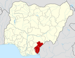
Demsa is a Local Government Area of Adamawa State, Nigeria with headquarters located in Demsa. Demsa lies on the Benue River.
Ganye is a town and Local Government Area of Adamawa State, Nigeria. Jada and Toungo Local Governments were carved out from Ganye local government area of Adamawa state Nigeria. Ganye is bordered by Jada Local Government Area to the North and East, Toungo Local Government Area to the South and Taraba State to the West. It is the headquarter of the Sama (Chamba) people worldwide.
Gombi is the Local Government Headquarter of Gombi Local Government Area of Adamawa State, Nigeria.
Jada is a town and Local Government Area of Adamawa State, Nigeria.
Mubi North is a Local Government Area of Adamawa State, Nigeria. The town is the location of the Adamawa State University and the Federal Polytechnic, Mubi.
Mangu is a Local Government Area in Plateau State, Nigeria. Governor Caleb Mutfwang appointed Markus Artu as the Transition Committee Chairman of the LGA. Its headquarters are in the town of Mangu at 9°31′00″N9°06′00″E.
Ife South is a Local Government Area in Osun State, Nigeria. Its headquarters are in the town of Ifetedo at 7°11′00″N4°42′00″E.
Ede North is a Local Government Area in Osun State, Nigeria. Its headquarters as Abere.
Bwari is a local government area in the Federal Capital Territory in Nigeria. The original inhabitants of the town are the Gbagyi speaking people. The paramount ruler is the Esu who is otherwise known as Sa-bwaya. However, with the establishment of FCT in Abuja many changes occurred; including the turbaning of late Musa Ijakoro as District Head of Bwari in 1976, and his elevation as Sarki of Bwari to the position of a second class status in 1997 by the Ministry of the Federal Capital Territory under the then minister, General Jeremiah Useni.
Akwete town is the headquarters of Ukwa East local government area of Abia state, Nigeria. Akwete is located 18 Kilometers northeast of the oil-rich city of Port Harcourt and 18 Kilometers southeast of the commercial city of Aba. Akwete is an important community of the Ndoki and Igbo people in general, they belong to the Umuihueze II clan. Akwete is known in West Africa for its unique weaving.
Okpuala Ngwa is a town in Isiala-Ngwa North. It serves as the administrative headquarters for the local government. It was the first settlement and headquarters of the Ngwa people. The people of Okpuala Ngwa speak the Ngwa dialect of the Ngwa people.
Iperindo town is situated in the Osun region. Osogbo (Osogbo), the capital of Osun, lies about 42 kilometers from Iperindo. Iperindo and Abuja, the capital of Nigeria, are separated by a distance of roughly 341 kilometers.
Bode Osi is a town in Osun State, Nigeria. It is located around 36 kilometres (22 mi) away from Osogbo, the capital of Osun State, and 370 kilometres (230 mi) from Abuja, the capital of Nigeria. Bode Osi is also the headquarters of Ola Oluwa Local Government Area.
{{cite web}}
: |last=
has generic name (help)