"},"map":{"wt":"OH 19 map.svg"},"established":{"wt":"1932"},"direction_a":{"wt":"South"},"terminus_a":{"wt":"{{jct|state=OH|US|42|CR|22|county2=Morrow}}near [[Mount Gilead,Ohio|Mount Gilead]]"},"junction":{"wt":"*{{jct|state=OH|US|30}}in [[Bucyrus,Ohio|Bucyrus]]\n*{{jct|state=OH|US|224}}near [[Bloomville,Ohio|Bloomville]]\n*{{jct|state=OH|US|20}}in [[Green Creek Township,Sandusky County,Ohio|Green Creek Township]]\n*{{jct|state=OH|SR|611}}in [[Fremont,Ohio|Fremont]]\n*{{jct|state=OH|US|20|SR|53|SR|611}}in Fremont\n*{{jct|state=OH|I|90}}near [[Oak Harbor,Ohio|Oak Harbor]]\n*{{jct|state=OH|SR|2}}near [[Oak Harbor,Ohio|Oak Harbor]]"},"direction_b":{"wt":"North"},"terminus_b":{"wt":"{{jct|state=OH|US|6}}near [[Oak Harbor,Ohio|Oak Harbor]]"},"counties":{"wt":"[[Morrow County,Ohio|Morrow]],[[Crawford County,Ohio|Crawford]],[[Seneca County,Ohio|Seneca]],[[Sandusky County,Ohio|Sandusky]],[[Ottawa County,Ohio|Ottawa]]"},"previous_type":{"wt":"SR"},"previous_route":{"wt":"18"},"next_type":{"wt":"US"},"next_route":{"wt":"20"},"browse":{"wt":"{{oh browse|previous_type=US|previous_route=62|route=[[File:OH-62 (1927).svg|20px]]|next_type=SR|next_route=63}}"}},"i":0}}]}" id="mwBg">.mw-parser-output .hlist dl,.mw-parser-output .hlist ol,.mw-parser-output .hlist ul{margin:0;padding:0}.mw-parser-output .hlist dd,.mw-parser-output .hlist dt,.mw-parser-output .hlist li{margin:0;display:inline}.mw-parser-output .hlist.inline,.mw-parser-output .hlist.inline dl,.mw-parser-output .hlist.inline ol,.mw-parser-output .hlist.inline ul,.mw-parser-output .hlist dl dl,.mw-parser-output .hlist dl ol,.mw-parser-output .hlist dl ul,.mw-parser-output .hlist ol dl,.mw-parser-output .hlist ol ol,.mw-parser-output .hlist ol ul,.mw-parser-output .hlist ul dl,.mw-parser-output .hlist ul ol,.mw-parser-output .hlist ul ul{display:inline}.mw-parser-output .hlist .mw-empty-li{display:none}.mw-parser-output .hlist dt::after{content:":"}.mw-parser-output .hlist dd::after,.mw-parser-output .hlist li::after{content:" ·";font-weight:bold}.mw-parser-output .hlist dd:last-child::after,.mw-parser-output .hlist dt:last-child::after,.mw-parser-output .hlist li:last-child::after{content:none}.mw-parser-output .hlist dd dd:first-child::before,.mw-parser-output .hlist dd dt:first-child::before,.mw-parser-output .hlist dd li:first-child::before,.mw-parser-output .hlist dt dd:first-child::before,.mw-parser-output .hlist dt dt:first-child::before,.mw-parser-output .hlist dt li:first-child::before,.mw-parser-output .hlist li dd:first-child::before,.mw-parser-output .hlist li dt:first-child::before,.mw-parser-output .hlist li li:first-child::before{content:" (";font-weight:normal}.mw-parser-output .hlist dd dd:last-child::after,.mw-parser-output .hlist dd dt:last-child::after,.mw-parser-output .hlist dd li:last-child::after,.mw-parser-output .hlist dt dd:last-child::after,.mw-parser-output .hlist dt dt:last-child::after,.mw-parser-output .hlist dt li:last-child::after,.mw-parser-output .hlist li dd:last-child::after,.mw-parser-output .hlist li dt:last-child::after,.mw-parser-output .hlist li li:last-child::after{content:")";font-weight:normal}.mw-parser-output .hlist ol{counter-reset:listitem}.mw-parser-output .hlist ol>li{counter-increment:listitem}.mw-parser-output .hlist ol>li::before{content:" "counter(listitem)"\a0 "}.mw-parser-output .hlist dd ol>li:first-child::before,.mw-parser-output .hlist dt ol>li:first-child::before,.mw-parser-output .hlist li ol>li:first-child::before{content:" ("counter(listitem)"\a0 "}
![]() | ||||
Route information | ||||
Maintained by ODOT | ||||
Length | 86.48 mi [1] (139.18 km) | |||
Existed | 1932–present | |||
Major junctions | ||||
South end | ![]() ![]() | |||
| ||||
North end | ![]() | |||
Location | ||||
Country | United States | |||
State | Ohio | |||
Counties | Morrow, Crawford, Seneca, Sandusky, Ottawa | |||
Highway system | ||||
| ||||
| ||||
|
State Route 19 (SR 19) is a north–south route in northern and central Ohio. Its southern terminus is at U.S. Route 42 in the unincorporated village of Williamsport, and its northern terminus is at State Route 2 north of Oak Harbor.
The current State Route 19 was certified in 1932 and originally went from Galion to Oak Harbor, going through Fremont on State Street (U.S. Route 20) and Stone Street. The route was extended in the north to State Route 2 in 1938, and in the south to U.S. Route 42 in 1939. In 1960, State Route 19 was rerouted around Fremont along with U.S. Route 20, U.S. Route 6, and State Route 53 (Ohio) via a freeway bypass.
The route number 19 was used for the route of an original state highway that went from Columbus to the Pennsylvania state line. This route is now the eastern Ohio portion of U.S. Route 62. The route number was then given to the route of the former State Route 62, which the U.S. highway system had made defunct.
County | Location | mi [1] | km | Exit | Destinations | Notes |
---|---|---|---|---|---|---|
Morrow | Congress Township | 0.00 | 0.00 | ![]() ![]() | ||
North Bloomfield Township | 8.78 | 14.13 | ![]() | |||
Crawford | Galion | 11.90 | 19.15 | ![]() ![]() | Southern end of SR 97 concurrency | |
12.60 | 20.28 | ![]() ![]() ![]() ![]() ![]() ![]() | Northern end of SR 97 concurrency; southern end of SR 61 / SR 309 concurrency | |||
13.87 | 22.32 | ![]() ![]() ![]() ![]() ![]() ![]() | Northern end of SR 61 / SR 309 concurrency; southern terminus of SR 598 | |||
Polk–Whetstone township line | 17.05 | 27.44 | ![]() ![]() | Southern terminus of SR 602 | ||
Whetstone Township | 21.51 | 34.62 | ![]() ![]() | Southern end of SR 100 concurrency | ||
Bucyrus | 24.92 | 40.10 | ![]() ![]() ![]() ![]() | Southern end of SR 4 / SR 98 concurrency | ||
25.12 | 40.43 | ![]() ![]() | Northern end of SR 98 concurrency | |||
25.92 | 41.71 | ![]() | Interchange | |||
26.48 | 42.62 | ![]() ![]() | Northern end of SR 4 concurrency | |||
Lykens Township | 33.68 | 54.20 | ![]() ![]() ![]() | Northern end of SR 100 concurrency | ||
35.69 | 57.44 | ![]() | ||||
Seneca | Bloom–Scipio township line | 44.75 | 72.02 | ![]() | ||
Republic | 47.75 | 76.85 | ![]() | |||
47.86 | 77.02 | ![]() ![]() ![]() | Northern terminus of SR 67 | |||
Adams Township | 53.86 | 86.68 | ![]() ![]() ![]() | Southern terminus of SR 228 | ||
55.49 | 89.30 | ![]() | ||||
55.89 | 89.95 | ![]() ![]() ![]() | Northern terminus of SR 778 | |||
Sandusky | Green Creek Township | 64.23 | 103.37 | ![]() ![]() | Southern end of US 20 concurrency | |
64.53– 64.70 | 103.85– 104.12 | 105 | State Street – Fremont | Interchange; northbound exit / southbound entrance only | ||
Sandusky Township | 66.52 | 107.05 | 103 | ![]() ![]() | Interchange; western terminus of SR 412 | |
Fremont | 67.47 | 108.58 | 102 | ![]() ![]() | Interchange; southern end of US 6 concurrency | |
68.88 | 110.85 | 101 | ![]() ![]() ![]() ![]() | Interchange; southern end of SR 53 concurrency | ||
69.64 | 112.07 | 100 | ![]() ![]() ![]() ![]() ![]() ![]() | Interchange; northern end of US 6 / US 20 / SR 53 concurrency | ||
Rice Township | 74.93 | 120.59 | ![]() ![]() | Western terminus of SR 523 | ||
Ottawa | Oak Harbor | 79.85 | 128.51 | ![]() ![]() ![]() | Eastern terminus of SR 105 | |
Carroll Township | 86.48 | 139.18 | ![]() ![]() | |||
1.000 mi = 1.609 km; 1.000 km = 0.621 mi
|
U.S. Route 77 is a major north–south United States Numbered Highway which extends for 1,305 miles (2,100 km) in the central United States. As of 2005, Its southern terminus is in Brownsville, Texas, at Veteran's International Bridge on the Mexican border, where it connects with both Mexican Federal Highway 101 and Mexican Federal Highway 180, and the highway's northern terminus is in Sioux City, Iowa, at an interchange with Interstate 29 (I-29), less than 1⁄2 mile (800 m) north of the Nebraska state line.
U.S. Route 45 is a major north-south United States highway and a border-to-border route, from Lake Superior to the Gulf of Mexico. A sign at the highway's northern terminus notes the total distance as 1,297 miles (2,087 km).
U.S. Route 25 or U.S. Highway 25 (US 25) is a north–south United States Numbered Highway that runs for 750 miles (1,210 km) in the Southern and Midwestern U.S. Its southern terminus is in Brunswick, Georgia, from where it proceeds mostly due north, passing through the cities of Augusta, Georgia; Greenville, South Carolina; and Asheville, North Carolina, before dividing into two branches, known as US 25W and US 25E between Newport, Tennessee, and North Corbin, Kentucky. After passing through Richmond and Lexington, Kentucky, it reaches its northern terminus at Ohio state line in Covington, Kentucky. The route is an important crossing of the Appalachian Mountains, and it is covered by three of the corridors of the Appalachian Development Highway System (ADHS). When the highway was originally established in 1926, the route extended from North Augusta, South Carolina, to Port Huron, Michigan. The southern end was extended to its current terminus in 1936, while the northern end was truncated in 1974.
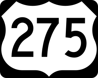
U.S. Route 275 (US 275) is a north–south United States highway that is a branch of US 75. It originally terminated at US 75 in Council Bluffs, Iowa. The highway's northern terminus is in O'Neill, Nebraska, at an intersection with U.S. Highway 20 and U.S. Highway 281. Its southern terminus is near Rock Port, Missouri, at an intersection with U.S. Highway 136.
U.S. Route 33 (US 33) is a United States Numbered Highway that runs northwest–southeast for 709 miles (1,141 km) from northern Indiana to Richmond, Virginia, passing through Ohio and West Virginia en route. Although most odd-numbered U.S. routes are north–south, US 33 is labeled east–west throughout its route, except in Indiana where it is labeled north–south. It roughly follows a historic trail used by Native Americans from Chesapeake Bay to Lake Michigan.
U.S. Route 42 is an east–west United States highway that runs southwest–northeast for 350 miles (560 km) from Louisville, Kentucky to Cleveland, Ohio. The route has several names including Pearl Road from Cleveland to Medina in Northeast Ohio, Reading Road in Cincinnati, Cincinnati and Lebanon Pike in southwestern Ohio and Brownsboro Road in Louisville. Traveling northeast, the highway ends in downtown Cleveland and traveling southwest ends in Louisville.
State Route 561 (SR 561) is a north–south state highway in the southwestern portion of the U.S. state of Ohio. Its southern terminus is at U.S. Route 50 approximately 9 miles (14 km) east of Downtown Cincinnati – this point also serves as the western termini for both SR 32 and SR 125; the route’s northern terminus is at its intersection with Vine and Seymour Streets. The route takes many different names along its length, being first known as Linwood Avenue, Observatory Avenue, and Edwards Road in Cincinnati; then it is named Smith Road and Carthage Avenue as it passes through Norwood; its final stretch in Cincinnati once again is as Seymour Avenue.
State Route 53 is a north–south state highway in the U.S. state of Ohio. Its southern terminus is at the beginning of the U.S. 68/S.R. 67 concurrency in Kenton, Ohio, and its northern terminus is on Catawba Island in Ottawa County, north of Port Clinton.
State Route 18 is an east–west highway in northern Ohio. It is the sixth longest state route in the state. Its western terminus is at the Indiana state line near Hicksville, where the route continues in Indiana as State Road 8, and its eastern terminus is at State Route 91 in Akron.
State Route 412 is an east–west state highway in northern Ohio. The western terminus of State Route 412 is just northeast of Fremont at a diamond interchange with the U.S. Route 20/State Route 19 duplex, which follows the Fremont Bypass at that point. The eastern terminus of the state highway is at a T-intersection with State Route 101 approximately 3 miles (4.8 km) southwest of Castalia.
State Route 54 (SR 54) is a 70.5-mile-long (113.5 km) state highway that travels southwest-to-northeast through portions of Troup, Meriwether, Coweta, Fayette, Clayton, and Fulton counties in the northwestern part of the U.S. state of Georgia. The highway connects Hogansville with Atlanta, via Peachtree City, Fayetteville, Jonesboro, and Forest Park.
State Route 13 is a north–south state highway in the northern and southeastern portion of the U.S. state of Ohio. It is the tenth longest state route in Ohio. Its southern terminus is at State Route 550 near Athens, and its northern terminus is at U.S. Route 6 in Huron.
State Route 510 is a north–south state highway in the northern portion of Ohio. The entirety of SR 510 lies within Sandusky County. Its southern terminus is at SR 101 in Clyde, and its northern terminus is at U.S. Route 6 (US 6) between Fremont and Sandusky.
State Route 72 is a north–south state highway in the U.S. state of Ohio. Its southern terminus is at US 62 near Highland, and its northern terminus is at SR 334 just north of Springfield. As it travels through Springfield, Ohio, it is known as Limestone Street.
State Route 358 (SR 358) is a 0.92-mile-long (1.48 km) north–south state highway in the northern portion of the U.S. state of Ohio. The southern terminus of SR 358 is at a T-intersection with SR 163 nearly 5.75 miles (9.25 km) east of Oak Harbor, just north of the Portage River. Its northern terminus is at SR 2 at an intersection just outside Camp Perry about three and a half miles (5.6 km) west of Port Clinton.
U.S. Route 6 (US 6) is a part of the United States Numbered Highway System that runs from Bishop, California, to Provincetown, Massachusetts. In Ohio, the road runs west–east from the Indiana state line near Edgerton to the Pennsylvania state line near Andover. The 248.002 miles (399.121 km) that lie in Ohio are maintained by the Ohio Department of Transportation (ODOT). US 6 serves the major cities of Sandusky, Lorain, and Cleveland. The highway is also called the Grand Army of the Republic Highway to honor the Union forces of the U.S. Civil War. The alternate name was designated in 1953.