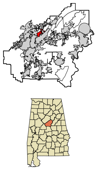
Indian Springs Village is a rural town in Shelby County, Alabama, United States, in the Birmingham metropolitan area. It incorporated effective November 14, 1990. At the 2010 census the population was 2,363, up from 2,225 in 2000.

Ragland is a town in St. Clair County, Alabama, United States southeast of Ashville. It incorporated in 1899. At the 2020 census, the population was 1,693, up slightly from 1,639 in 2010. It is part of the Birmingham-Hoover-Cullman Combined Statistical Area.

Minden is a city in Pottawattamie County, Iowa, United States. The population was 600 at the time of the 2020 census.

Forada is a city in Douglas County, Minnesota, United States. The population was 170 at the 2020 census.

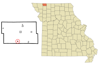
Carl Junction is a city in Jasper County, Missouri, United States. The population was 8,143 at the 2020 census.

Duquesne is a Fourth-Class City in Jasper County, Missouri, United States. The population was 2,159 at the 2020 census. It is part of the Joplin, Missouri Metropolitan Statistical Area.

Cedar Hill Lakes is a village in Jefferson County, Missouri, United States. The population was 203 at the 2020 census.

Coleridge is a village in Cedar County, Nebraska, United States. The population was 537 at the 2020 census.

Oconto is a village in Custer County, Nebraska, United States. The population was 151 at the 2010 census.

Beaver Crossing is a village in Seward County, Nebraska, United States. The population was 403 at the 2010 census.

Herman is a village in Washington County, Nebraska, United States. The population was 268 at the 2010 census.
Worth is a village in Worth County, Missouri, United States. The population was 63 at the 2010 census.

Addyston is a village in Miami Township, Hamilton County, Ohio, United States. Located along the Ohio River, it is a western suburb of the neighboring city of Cincinnati. The population was 927 at the 2020 census.

Russells Point is a village located in northwest Logan County, Ohio, United States. The population was 1,320 at the 2020 census. It is situated on Indian Lake, which had long been a popular summer resort destination.

Cardington is a village in Morrow County, Ohio, United States. The population was 2,051 at the 2020 census. Mount Gilead, Ohio, the county seat, is located northeast of Cardington on U.S. Route 42.

Millbury is a village in Wood County, Ohio, United States. The population was 1,193 at the 2020 census.

Roseville is a village in Muskingum and Perry counties in the U.S. state of Ohio, along Moxahala Creek. The population was 1,746 at the 2020 census. It is part of the Zanesville micropolitan area. Roseville is served by a branch of the Muskingum County Library System.

Wyocena is a village in Columbia County, Wisconsin, United States. The population was 768 at the 2010 census. The village is located within the Town of Wyocena. It is part of the Madison Metropolitan Statistical Area.

Black Earth is a village in Dane County, Wisconsin, United States. The population was 1,338 at the 2010 census. The village is located within the Town of Black Earth. It is part of the Madison Metropolitan Statistical Area.

Hazel Green is a village in Grant and Lafayette counties in the U.S. state of Wisconsin. The population was 1,256 at the 2010 census. Of this, 1,243 were in Grant County, and only 13 were in Lafayette County. The village is located mostly within the Town of Hazel Green in Grant County; only a small portion extends into the Town of Benton in Lafayette County.


