Republic, Ohio

Last updated

Republic, Ohio
Republic, altitude 2450, 240o.jpg
Aerial view of Republic
OHMap-doton-Republic.png
Location of Republic, Ohio
Map of Seneca County Ohio Highlighting Republic Village.png
Location of Republic in Seneca County
Coordinates: 41°07′22″N83°01′02″W / 41.12278°N 83.01722°W / 41.12278; -83.01722
Country United States
State Ohio
County Seneca
Government
  Type Village council
Area
[1]
  Total0.86 sq mi (2.23 km2)
  Land0.86 sq mi (2.23 km2)
  Water0.00 sq mi (0.00 km2)
Elevation
[2]
869 ft (265 m)
Population
 (2020)
  Total556
  Density645.01/sq mi (248.97/km2)
Time zone UTC-5 (Eastern (EST))
  Summer (DST) UTC-4 (EDT)
ZIP code
44867
Area code 419
FIPS code 39-66320 [3]
GNIS feature ID2399059 [2]

Republic is a village in Seneca County, Ohio, United States. The population was 556 at the 2020 census.

Contents

History

In 1834, Sidney Smith hired R.M. Shoemaker of Cincinnati to survey a new town at the corners of sections 15, 16, 21, and 22 in Scipio Township. He called it "Republic," though it was known by many early settlers simply as "Scipio Center." [4]

With the arrival of a rail line from Sandusky in 1841, Republic became a popular trading center. Stores, warehouses, shops, and factories sprang up almost overnight. A second rail line was contemplated to run between Republic and Melmore in Eden Township.

When the old Seneca County courthouse at Tiffin burned on May 21, 1841, efforts were made to designate Republic as the county seat, but these were unsuccessful. Republic's fortunes began to decline when the new Cincinnati, Sandusky & Cleveland Railroad bypassed it to make a straight run to Tiffin.

The town was stimulated by the construction of the Baltimore and Ohio Railroad. The railroad passes via an arch bridge over what is now State Route 19. On January 4, 1887, just west of town on the railroad was the site of an accident designated the "Republic Horror" when the westbound B & O Express No. 5 collided head on with a stalled eastbound freight train. [5]

Republic's motto is "Small in Size, Big in Heart." Written by Seneca East student Michelle Wheatley, it was selected in a contest of popular submissions.

Geography

According to the United States Census Bureau, the village has a total area of 0.86 square miles (2.23 km2), all land. [6]

Demographics

Historical population
CensusPop.Note
1850 917
1860 636−30.6%
1870 481−24.4%
1880 71548.6%
1890 584−18.3%
1900 65612.3%
1910 475−27.6%
1920 393−17.3%
1930 51230.3%
1940 5466.6%
1950 61512.6%
1960 72918.5%
1970 705−3.3%
1980 656−7.0%
1990 611−6.9%
2000 6140.5%
2010 549−10.6%
2020 5561.3%
U.S. Decennial Census [7]

2010 census

As of the census [8] of 2010, there were 549 people, 220 households, and 151 families living in the village. The population density was 638.4 inhabitants per square mile (246.5/km2). There were 245 housing units at an average density of 284.9 per square mile (110.0/km2). The racial makeup of the village was 98.2% White, 0.4% African American, 0.5% Native American, 0.2% Asian, and 0.7% from two or more races. Hispanic or Latino of any race were 1.8% of the population.

There were 220 households, of which 35.9% had children under the age of 18 living with them, 47.7% were married couples living together, 14.1% had a female householder with no husband present, 6.8% had a male householder with no wife present, and 31.4% were non-families. 25.9% of all households were made up of individuals, and 13.1% had someone living alone who was 65 years of age or older. The average household size was 2.50 and the average family size was 2.93.

The median age in the village was 35.5 years. 25.9% of residents were under the age of 18; 7.4% were between the ages of 18 and 24; 29.1% were from 25 to 44; 26.2% were from 45 to 64; and 11.3% were 65 years of age or older. The gender makeup of the village was 50.1% male and 49.9% female.

2000 census

As of the census [3] of 2000, there were 614 people, 223 households, and 165 families living in the village. The population density was 711.4 inhabitants per square mile (274.7/km2). There were 237 housing units at an average density of 274.6 per square mile (106.0/km2). The racial makeup of the village was 99.67% White, 0.33% from other races. Hispanic or Latino of any race were 1.79% of the population.

There were 223 households, out of which 39.0% had children under the age of 18 living with them, 58.3% were married couples living together, 10.3% had a female householder with no husband present, and 26.0% were non-families. 22.9% of all households were made up of individuals, and 9.4% had someone living alone who was 65 years of age or older. The average household size was 2.72 and the average family size was 3.19.

In the village, the population was spread out, with 29.6% under the age of 18, 9.4% from 18 to 24, 28.7% from 25 to 44, 19.1% from 45 to 64, and 13.2% who were 65 years of age or older. The median age was 33 years. For every 100 females there were 101.3 males. For every 100 females age 18 and over, there were 99.1 males.

The median income for a household in the village was $37,813, and the median income for a family was $45,083. Males had a median income of $32,813 versus $20,956 for females. The per capita income for the village was $14,875. About 7.5% of families and 7.6% of the population were below the poverty line, including 6.9% of those under age 18 and 3.7% of those age 65 or over.

Related Research Articles

<span class="mw-page-title-main">Seneca, Nebraska</span> Unincorporated community in Blaine County, Nebraska, United States

Seneca is an unincorporated community in Thomas County, Nebraska in the Great Plains region of the United States. The population was 33 at the 2010 census.

<span class="mw-page-title-main">Gordon, Ohio</span> Village in Ohio, United States

Gordon is a village in Darke County, Ohio, United States. The population was 245 at the 2020 census.

<span class="mw-page-title-main">New Weston, Ohio</span> Village in Ohio, United States

New Weston is a village in Darke County, Ohio, United States. The population was 124 at the 2020 census.

<span class="mw-page-title-main">Rossburg, Ohio</span> Village in Ohio, United States

Rossburg is a village in Darke County, Ohio, United States. The population was 159 at the 2020 census.

<span class="mw-page-title-main">Ostrander, Ohio</span> Village in Ohio, United States

Ostrander is a village in Delaware County, Ohio, United States. The population was 1,094 at the 2020 census.

<span class="mw-page-title-main">Senecaville, Ohio</span> Village in Ohio, United States

Senecaville is a village in Guernsey County, Ohio, United States. The population was 422 at the 2020 census.

<span class="mw-page-title-main">Evendale, Ohio</span> Village in Ohio, United States

Evendale is a village in Hamilton County, Ohio, United States, within the Cincinnati metropolitan area. The population was 2,669 at the 2020 census.
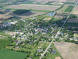
<span class="mw-page-title-main">Kipton, Ohio</span> Village in Ohio, United States

Kipton is a village in Lorain County, Ohio, United States. The population was 209 at the 2020 census.

<span class="mw-page-title-main">Whitehouse, Ohio</span> Village in Ohio, United States

Whitehouse is a village within the Toledo Metropolitan Area in Lucas County, Ohio, United States. The population was 4,990 at the 2020 census.

<span class="mw-page-title-main">Ludlow Falls, Ohio</span> Village in Ohio, United States

Ludlow Falls is a village in Miami County, Ohio, United States. The population was 175 at the 2020 census. It is part of the Dayton Metropolitan Statistical Area. Ludlow Falls is named after surveyor Israel Ludlow.

<span class="mw-page-title-main">Belle Valley, Ohio</span> Village in Ohio, United States

Belle Valley is a village in Noble County, Ohio, United States. The population was 201 at the 2020 census.

<span class="mw-page-title-main">Glenford, Ohio</span> Village in Ohio, United States

Glenford is a village in Perry County, Ohio, United States. The population was 165 at the 2020 census.

<span class="mw-page-title-main">Shawnee, Perry County, Ohio</span> Village in Ohio, United States

Shawnee is a village in Perry County, Ohio, United States. The population was 505 at the 2020 census. It is 9 miles (14 km) south of the county seat of New Lexington.

<span class="mw-page-title-main">Cloverdale, Ohio</span> Village in Ohio, United States

Cloverdale is a village in Perry Township, Putnam County, Ohio, United States. The population was 170 at the 2020 census.

<span class="mw-page-title-main">Attica, Ohio</span> Village in Ohio, United States

Attica is a village in Seneca County, Ohio, United States. The population was 873 at the 2020 census.

<span class="mw-page-title-main">Bettsville, Ohio</span> Village in Ohio, United States

Bettsville is a village in Seneca County, Ohio, United States. The population was 595 at the 2020 census.

<span class="mw-page-title-main">Bloomville, Ohio</span> Village in Ohio, United States

Bloomville is a village in Seneca County, Ohio, United States. The population was 867 at the 2020 census.

<span class="mw-page-title-main">Haskins, Ohio</span> Village in Ohio, United States

Haskins is a village in Wood County, Ohio, United States. The population was 1,245 at the 2020 census.

<span class="mw-page-title-main">Burkettsville, Ohio</span> Village in Ohio, United States

Burkettsville is a village in Darke and Mercer counties in the U.S. state of Ohio. The population was 272 at the 2020 census.

<span class="mw-page-title-main">Green Springs, Ohio</span> Village in Ohio, United States

Green Springs is a village in Sandusky and Seneca counties in the U.S. state of Ohio. The population was 1,233 at the 2020 census.

References

  1. "ArcGIS REST Services Directory". United States Census Bureau. Retrieved September 20, 2022.
  2. 1 2 U.S. Geological Survey Geographic Names Information System: Republic, Ohio
  3. 1 2 "U.S. Census website". United States Census Bureau . Retrieved January 31, 2008.
  4. Lang, William (1880). History of Seneca County, from the Close of the Revolutionary War to July, 1880. Transcript Printing Company. pp.  587.
  5. Krejci, William G. (2019). Ghosts and Legends of Northern Ohio. Haunted America, A Division of The History Press. pp. [45–47].
  6. "US Gazetteer files 2010". United States Census Bureau. Archived from the original on February 20, 2011. Retrieved January 6, 2013.
  7. "Census of Population and Housing". Census.gov. Retrieved June 4, 2015.
  8. "U.S. Census website". United States Census Bureau . Retrieved January 6, 2013.

Further reading