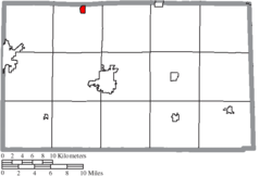
Bettsville, Ohio | |
---|---|
Coordinates: 41°14′48″N83°13′58″W / 41.24667°N 83.23278°W | |
Country | United States |
State | Ohio |
County | Seneca |
Area | |
• Total | 0.52 sq mi (1.35 km2) |
• Land | 0.52 sq mi (1.35 km2) |
• Water | 0.00 sq mi (0.00 km2) |
Elevation | 702 ft (214 m) |
Population (2020) | |
• Total | 595 |
593 | |
• Density | 1,142.03/sq mi (440.58/km2) |
Time zone | UTC-5 (Eastern (EST)) |
• Summer (DST) | UTC-4 (EDT) |
ZIP code | 44815 |
Area code | 419 |
FIPS code | 39-06194 [4] |
GNIS feature ID | 2398113 [2] |
Bettsville is a village in Seneca County, Ohio, United States. The population was 595 at the 2020 census.
Bettsville was laid out in 1838. It was named for its founder, John Betts. [5]
According to the United States Census Bureau, the village has a total area of 0.52 square miles (1.35 km2), all land. [6]
Census | Pop. | Note | %± |
---|---|---|---|
1880 | 515 | — | |
1890 | 513 | −0.4% | |
1900 | 492 | −4.1% | |
1910 | 486 | −1.2% | |
1920 | 451 | −7.2% | |
1930 | 656 | 45.5% | |
1940 | 692 | 5.5% | |
1950 | 687 | −0.7% | |
1960 | 776 | 13.0% | |
1970 | 833 | 7.3% | |
1980 | 752 | −9.7% | |
1990 | 752 | 0.0% | |
2000 | 784 | 4.3% | |
2010 | 661 | −15.7% | |
2020 | 595 | −10.0% | |
2023 (est.) | 593 | [3] | −0.3% |
U.S. Decennial Census [7] |
As of the census [8] of 2010, there were 661 people, 281 households, and 187 families living in the village. The population density was 1,271.2 inhabitants per square mile (490.8/km2). There were 318 housing units at an average density of 611.5 per square mile (236.1/km2). The racial makeup of the village was 97.3% White, 0.2% Native American, 1.2% Asian, 1.1% from other races, and 0.3% from two or more races. Hispanic or Latino of any race were 8.3% of the population.
There were 281 households, of which 31.0% had children under the age of 18 living with them, 47.3% were married couples living together, 12.1% had a female householder with no husband present, 7.1% had a male householder with no wife present, and 33.5% were non-families. 27.8% of all households were made up of individuals, and 12.1% had someone living alone who was 65 years of age or older. The average household size was 2.35 and the average family size was 2.83.
The median age in the village was 40.3 years. 23.4% of residents were under the age of 18; 9.9% were between the ages of 18 and 24; 22% were from 25 to 44; 29.1% were from 45 to 64; and 15.6% were 65 years of age or older. The gender makeup of the village was 50.7% male and 49.3% female.
As of the census [4] of 2000, there were 784 people, 298 households, and 210 families living in the village. The population density was 1,506.7 inhabitants per square mile (581.7/km2). There were 319 housing units at an average density of 613.0 per square mile (236.7/km2). The racial makeup of the village was 95.28% White, 0.13% African American, 0.13% Native American, 0.51% Asian, 2.93% from other races, and 1.02% from two or more races. Hispanic or Latino of any race were 5.74% of the population.
There were 298 households, out of which 37.6% had children under the age of 18 living with them, 54.7% were married couples living together, 8.7% had a female householder with no husband present, and 29.5% were non-families. 23.5% of all households were made up of individuals, and 9.7% had someone living alone who was 65 years of age or older. The average household size was 2.63 and the average family size was 3.12.
In the village, the population was spread out, with 29.1% under the age of 18, 9.8% from 18 to 24, 29.8% from 25 to 44, 19.1% from 45 to 64, and 12.1% who were 65 years of age or older. The median age was 33 years. For every 100 females there were 98.0 males. For every 100 females age 18 and over, there were 98.6 males.
The median income for a household in the village was $37,266, and the median income for a family was $39,219. Males had a median income of $30,481 versus $20,368 for females. The per capita income for the village was $15,933. About 6.5% of families and 7.4% of the population were below the poverty line, including 11.6% of those under age 18 and none of those age 65 or over.
Flushing is a village in Belmont County, Ohio, United States. The population was 830 at the 2020 census.
Warsaw is a village in Coshocton County, Ohio, United States, along the Walhonding River. The population was 624 at the 2020 census.
New Washington is a village in Cranberry Township in Crawford County, Ohio, United States. The population was 873 at the 2020 census.
Millersport is a village in Fairfield County, Ohio, United States. The population was 978 at the 2020 census. Millersport is most notable as the home of the Sweet Corn Festival, which is held in Millersport annually during the first week of September.
Brice is a village in Franklin County, Ohio, United States, on the southeast side of the Columbus metropolitan area. The population was 93 at the 2020 census.
Urbancrest is a village in Franklin County, Ohio, United States. The population was 1,031 at the 2020 census. Urbancrest is in the South-Western City Schools District.
Lyons is a village in Fulton County, Ohio, United States. The population was 602 at the 2020 census.
Metamora is a village in Fulton County, Ohio, United States. The population was 566 at the 2020 census.
Crown City is a village in Gallia County, Ohio, United States, along the Ohio River. The population was 424 at the 2020 census.
Cumberland is a village in Guernsey County, Ohio, United States. It is seventy miles east of Columbus. The population was 317 at the 2020 census.
Kirkersville is a village in Licking County, Ohio, United States, along the South Fork of the Licking River. The population was 471 at the 2020 census.
Fulton is a village in Morrow County, Ohio, United States. The population was 250 at the 2020 census. Fulton is south of Mount Gilead, the county seat.
Sparta is a village in Morrow County, Ohio, United States. The population was 121 at the 2020 census. Sparta is southeast of Mount Gilead, the county seat.
Limaville is a census-designated place (CDP) and former village in Stark County, Ohio, United States. The population was 151 at the 2020 census. It is part of the Canton–Massillon Metropolitan Statistical Area.
Port Washington is a village in Tuscarawas County, Ohio, United States. The population was 548 at the 2020 census.
Apple Creek is a village in East Union Township, Wayne County, Ohio, United States. The population was 1,188 at the 2020 census.
Bellevue is a village in Brown County, Wisconsin. It was a town until incorporating as a village on February 14, 2003. The population was 15,935 at the time of the 2020 census. Bellevue is part of the Green Bay metropolitan area. Bellevue sits around 4.34 miles (6.99 km) east from central Green Bay.
Wilson is a village in Belmont and Monroe counties in the U.S. state of Ohio. The population was 129 at the 2020 census. It is part of the Wheeling metropolitan area.
Gratiot is a village in Licking and Muskingum counties in the U.S. state of Ohio. The population was 215 at the 2020 census.
Verona is a village in Montgomery and Preble counties in the U.S. state of Ohio. The population was 403 at the 2020 census. It is part of the Dayton Metropolitan Statistical Area.
History of Bettsville, Ohio. Durrett, John E, 1984 https://ohiomemory.org/digital/collection/p15005coll27/id/29643