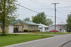
Siam, Ohio

Last updated

Siam
Siamese houses on SR 4.jpg
Houses on State Route 5
USA Ohio location map.svg
Red pog.svg
Siam
Location within the state of Ohio
Coordinates: 41°05′05″N82°52′42″W / 41.08472°N 82.87833°W / 41.08472; -82.87833
Country United States
State Ohio
County Seneca
Township Reed
Elevation
[1]
958 ft (292 m)
Time zone UTC-5 (Eastern (EST))
  Summer (DST) UTC-4 (EDT)
ZIP codes
44807
GNIS feature ID1049178 [1]

Siam is an unincorporated community in Reed Township, Seneca County, Ohio, United States. This town is also known as Attica Junction. CSX and NS intersect here. It is located along State Route 4, just north of Attica. The community is served by the Attica (44807) post office. [2]

History

Siam was originally called Detroit; under the latter name had its start in 1875 when the railroad was extended to that point. [3] A train station was soon built, which was called Attica Station. [3] The post office in the community was operated under the name Siam. [3] The Siam post office opened in 1878, and was discontinued in 1938. [4]

Related Research Articles

<span class="mw-page-title-main">Seneca County, Ohio</span> County in Ohio, United States

Seneca County is a county located in the northwestern part of the U.S. state of Ohio. As of the 2020 census, the population was 55,069. Its county seat is Tiffin. The county was created in 1820 and organized in 1824. It is named for the Seneca Indians, the westernmost nation of the Iroquois Confederacy. This people were based in present-day New York but had territory extending into Pennsylvania and Ohio.

<span class="mw-page-title-main">Darnestown, Maryland</span> Census-designated place in the United States

Darnestown is a United States census-designated place (CDP) and an unincorporated area in Montgomery County, Maryland. The CDP is 17.70 square miles (45.8 km2) with the Potomac River as its southern border and the Muddy Branch as much of its eastern border. Seneca Creek borders portions of its north and west sides. The Travilah, North Potomac, and Germantown census-designated places are adjacent to it, as is the city of Gaithersburg. Land area for the CDP is 16.39 square miles (42.4 km2). As of the 2020 census, the Darnestown CDP had a population of 6,723, while the village of Darnestown is considerably smaller in size and population. Downtown Washington, D.C. is about 22 miles (35 km) to the southeast.

<span class="mw-page-title-main">Attica, Ohio</span> Village in Ohio, United States

Attica is a village in Seneca County, Ohio, United States. The population was 873 at the 2020 census.

Racine is an unincorporated community in Newton County, Missouri, United States. It is part of the Joplin, Missouri Metropolitan Statistical Area.

<span class="mw-page-title-main">Bascom, Ohio</span> Census-designated place in Ohio, United States

Bascom is a census-designated place in western Hopewell Township, Seneca County, Ohio. It has a post office with the ZIP code 44809 and hosts Hopewell-Loudon High School. The community is located at the intersection of State Routes 18 and 635 east of Fostoria. The population was 397 at the 2020 census.

Flat Rock is a census-designated place in northeastern Thompson Township, Seneca County, Ohio, United States. It has a post office with the ZIP code 44828. The population was 227 at the 2020 census.

Amsden is an unincorporated community in Jackson Township, Seneca County, Ohio, United States. The community is served by the Fostoria (44830) post office.

Berwick is an unincorporated community in Seneca Township, Seneca County, Ohio, United States. It is located next to the intersection of East County Road 6 and State Route 587. The community is served by the New Riegel (44853) post office.

Caroline is an unincorporated community in Venice Township, Seneca County, Ohio, United States. It is located along State Route 4, just south of Attica. The community is served by the Attica (44807) post office.

Carrothers is an unincorporated community in Venice Township, Seneca County, Ohio, United States. It is located along State Route 4, just north of the border between Seneca and Crawford County. The community is served by the Attica (44807) post office.

Maple Grove is an unincorporated community in Seneca County, in the U.S. state of Ohio.

Watson is an unincorporated community in Seneca County, in the U.S. state of Ohio.

Omar is an unincorporated community in Seneca County, in the U.S. state of Ohio.

<span class="mw-page-title-main">Reedtown, Ohio</span> Unincorporated community in Ohio, U.S.

Reedtown is an unincorporated community in Seneca County, in the U.S. state of Ohio.

Fireside is an unincorporated community in Seneca County, in the U.S. state of Ohio.

Frenchtown is an unincorporated community in Seneca County, in the U.S. state of Ohio.

Rockaway is an unincorporated community in Seneca County, in the U.S. state of Ohio.

Saint Stephens is an unincorporated community in Seneca County, in the U.S. state of Ohio.

Swander is an unincorporated community in Seneca County, in the U.S. state of Ohio.

Cooper is an unincorporated community in Seneca County, in the U.S. state of Ohio.

References

  1. 1 2 U.S. Geological Survey Geographic Names Information System: Siam, Ohio
  2. Zip Code Lookup
  3. 1 2 3 Baughman, Abraham J. (1911). History of Seneca County, Ohio: A Narrative Account of Its Historical Progress, Its People, and Its Principal Interests. Lewis Publishing Company. p. 436.
  4. "Seneca County". Jim Forte Postal History. Retrieved December 27, 2015.