Custer County is a county located in the southeast part of the U.S. state of Montana. As of the 2020 U.S. census, the population was 11,867. Its county seat and largest town is Miles City. The county was established after the end of the American Civil War (1861-1865), on June 2, 1865, as one of the nine original counties of the new western federal Territory of Montana, which had been formed the previous May of 1864 by the United States Congress, with the approval of 16th President Abraham Lincoln. It was originally named Big Horn County of the old Montana Territory, and was renamed on February 16, 1877, in honor of Lieutenant Colonel George Armstrong Custer (1839-1876), commander of the famous 7th Cavalry Regiment of the United States Army, recently massacred and killed in the nearby Battle of the Little Bighorn, in the later portion of the American Indian Wars, the year before in June 1876.

Belt is a town in Cascade County, Montana, United States. The population was 510 according to the 2020 census. It is part of the Great Falls, Montana metropolitan area.

Glendive is a city in and the county seat of Dawson County, Montana, United States, and home to Dawson Community College. Glendive was established by the Northern Pacific Railway when they built the transcontinental railroad across the northern tier of the western United States from Minnesota to the Pacific Coast. The town was the headquarters for the Yellowstone Division that encompassed 875 route miles (1,408 km); 546 (879) in main line and 328 (528) in branches with the main routes from Mandan, North Dakota, to Billings, Montana, and from Billings to Livingston. The town of Glendive is an agricultural and ranching hub of eastern Montana sited between the Yellowstone River and the Badlands. Makoshika State Park is located just east of Glendive.

East Glacier Park is an unincorporated community and census-designated place (CDP) in Glacier County, Montana, United States. As of the 2020 census, it had a population of 354.

Boulder is a town in and the county seat of Jefferson County, Montana, United States. It is on the north bank of the Boulder River between Butte and Helena, slightly east of the Continental Divide, at the intersection of Interstate 15 and Montana Highway 69. The population was 1,201 at the 2020 census. It is part of the Helena Micropolitan Statistical Area, which includes all of Lewis and Clark and Jefferson counties; its population is 83,058 according to the 2020 Census.

Troy is a city in Lincoln County, Montana, United States. The population was 797 at the 2020 census. It lies at the lowest elevation of any settlement in Montana. The town is on U.S. Route 2, near Montana Highway 56, in the Kootenai River gorge by the Kootenai National Forest.

Winnett is a town in and the county seat of Petroleum County, Montana, United States. The population was 188 at the 2020 census.
Fort Peck is a town in Valley County, Montana, United States. The population was 239 at the 2020 census.

Billings is the most populous city in the U.S. state of Montana, with a population of 117,116 as of the 2020 census. Located in the south-central portion of the state, it is the seat of Yellowstone County and the principal city of the Billings Metropolitan Area, which had a population of 184,167 in the 2020 census. With one of the largest trade areas in the United States, Billings is the trade and distribution center for much of Montana east of the Continental Divide. Billings is also the largest retail destination for much of the same area. The Billings Chamber of Commerce claims the area of commerce covers more than 125,000 square miles (320,000 km2). In 2009, it was estimated to serve over 500,000 people.
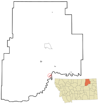
Alzada is a census-designated place in southern Carter County, Montana, United States. As of the 2010 census it had a population of 29. It is located at the intersection of U.S. Route 212 with Montana Secondary Highways 323 and 326, near the Wyoming and South Dakota borders. The Little Missouri River flows northwards to the west of the community. Alzada is in the Mountain Time Zone.

Neshanic is an unincorporated community and census-designated place (CDP) located within Hillsborough Township, in Somerset County, in the U.S. state of New Jersey. It is located near the South Branch Raritan River. The Neshanic Historic District was listed on the National Register of Historic Places in 1979.
Snow Camp is an unincorporated community in Alamance County, North Carolina, United States.

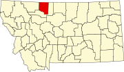
Polebridge is an unincorporated community in Flathead County, Montana, United States, 35 miles (56 km) northwest of Columbia Falls in the northwestern part of the state. This community was named in 1920 for the log bridge that formerly connected the "inner" North Fork Road in Glacier National Park to the "outer" North Fork Road which leads to Montana Secondary Highway 486, over the North Fork Flathead River. Polebridge is approximately 22 miles south of the Canada–United States border.

Lewis and Clark Caverns State Park is a 3,000-acre (1,200 ha) public recreation and nature preservation area located twelve miles (19 km) east of Whitehall in Jefferson County, Montana. The state park includes two visitor centers, ten miles of hiking trails, a campground, and its namesake limestone caverns. The Lewis and Clark Caverns Historic District was placed on the National Register of Historic Places in 2018.
Beech Island is an unincorporated community and census-designated place (CDP) in Aiken County, South Carolina, United States. It was first listed as a CDP in the 2020 census with a population of 1,421.

Pony is an unincorporated community and census-designated place in northeastern Madison County, Montana, United States, on the eastern edge of the Tobacco Root Mountains. As of the 2020 census, it had a population of 127. It includes the 192-acre (78 ha) Pony Historic District, a historic district with 95 contributing buildings listed on the National Register of Historic Places.
Babb is a small unincorporated farming and ranching community in Glacier County, Montana, United States, on the Blackfeet Indian Reservation. The community experiences a large influx of tourists in the summer months as it is the gateway to the Many Glacier area of Glacier National Park. For statistical purposes, the United States Census Bureau has defined Babb as a census-designated place (CDP). It had a population of 174 at the 2010 census.

Sunderland is an unincorporated community located at the crossroads of Maryland routes 2, 4, and 262, Dalrymple and Pushaw Station roads in Calvert County, Maryland, United States, approximately five miles south of Dunkirk and 10 miles north of Prince Frederick. Although Sunderland is not incorporated and does not have a central business district, it does have a zip code, 20689. However, as of November 2007, the former Sunderland post office had closed its doors due to a lease dispute, without opening a new location, and postal officials are determining where to locate a new post office.
Haugan is an unincorporated community and census-designated place in Mineral County, Montana, United States. Haugan is situated 16 miles (26 km) east of the Idaho border and 90 miles (140 km) west of Missoula on Interstate 90 at the Haugan Exit #16. The St. Regis River flows through the community. As of the 2020 census, the population of Haugan was 58.
Sugar Grove is a community located in Pendleton County, West Virginia, United States. Its ZIP Code is 26815. It is located within the United States National Radio Quiet Zone.