Sunburst, Montana

Last updated

Sunburst, Montana
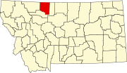
Toole County Montana Incorporated and Unincorporated areas Sunburst Highlighted.svg
Location of Sunburst, Montana
Coordinates: 48°53′0″N111°54′32″W / 48.88333°N 111.90889°W / 48.88333; -111.90889
Country United States
State Montana
County Toole
Area
[1]
  Total2.18 sq mi (5.65 km2)
  Land1.92 sq mi (4.97 km2)
  Water0.26 sq mi (0.68 km2)
Elevation
3,369 ft (1,027 m)
Population
 (2020)
  Total333
  Density173.62/sq mi (67.02/km2)
Time zone UTC-7 (Mountain (MST))
  Summer (DST) UTC-6 (MDT)
ZIP code
59482
Area code 406
FIPS code 30-72175
GNIS feature ID0777316

Sunburst is a town in Toole County, Montana, United States. The population was 333 in the 2020 census. [2]

Contents

It is roughly 30 miles north of Shelby and is near the Canada–US border.

History

Sunburst has its origins as a farming community and later saw significant population growth after oil development occurred in the 1920s. A refinery was built in 1922 with the discovery of oil in the Kevin Sunburst Oil Field. Since oil development in the area ceased in the 1970s, Sunburst has once again become a primarily agricultural town. The local high school gives homage to its past, as its students are known as the Sunburst Refiners. Its name comes from what is considered a dramatic sunrise that occurs when the sun comes over the Sweetgrass Hills and illuminates the local fields. [3]

Sunburst incorporated in 1924. [3]

Geography

Sunburst is located at 48°53′0″N111°54′32″W / 48.88333°N 111.90889°W / 48.88333; -111.90889 (48.883255, -111.908754). [4] Interstate 15 passes through the community, with access from Exit 389. The Long Lake Waterfowl Production Area is nearby.

According to the United States Census Bureau, the town has a total area of 1.99 square miles (5.15 km2), of which 1.75 square miles (4.53 km2) is land and 0.24 square miles (0.62 km2) is water. [5]

Climate

According to the Köppen Climate Classification system, Sunburst has a semi-arid climate, abbreviated "BSk" on climate maps. [6]

Demographics

Historical population
CensusPop.Note
1930 486
1940 70945.9%
1950 84519.2%
1960 8824.4%
1970 604−31.5%
1980 476−21.2%
1990 437−8.2%
2000 415−5.0%
2010 375−9.6%
2020 333−11.2%
U.S. Decennial Census [7] [2]

As of 2000 the median income for a household in the town was $58,250, and the median income for a family was $56,038. Males had a median income of $34,500 versus $11,333 for females. The per capita income for the town was $20,244. About 1.7% of families and 4.1% of the population were below the poverty line, including 4.4% of those under age 18 and 3.7% of those age 65 or over.

2010 census

As of the census [8] of 2010, there were 375 people, 150 households, and 107 families residing in the town. The population density was 214.3 inhabitants per square mile (82.7/km2). There were 176 housing units at an average density of 100.6 per square mile (38.8/km2). The racial makeup of the town was 94.9% White, 0.5% Native American, 0.5% from other races, and 4.0% from two or more races. Hispanic or Latino of any race were 2.7% of the population.

There were 150 households, of which 34.0% had children under the age of 18 living with them, 60.7% were married couples living together, 6.7% had a female householder with no husband present, 4.0% had a male householder with no wife present, and 28.7% were non-families. 27.3% of all households were made up of individuals, and 12% had someone living alone who was 65 years of age or older. The average household size was 2.50 and the average family size was 2.98.

The median age in the town was 39.4 years. 25.1% of residents were under the age of 18; 7.2% were between the ages of 18 and 24; 22.1% were from 25 to 44; 31.9% were from 45 to 64; and 13.6% were 65 years of age or older. The gender makeup of the town was 49.6% male and 50.4% female.

Education

Sunburst Schools educates students from kindergarten through 12th grade. [9] North Toole County High School's team name is the Refiners. [10]

North Toole County Library is a public library in Sunburst. [11]

Related Research Articles

<span class="mw-page-title-main">Toole County, Montana</span> County in Montana, United States

Toole County is a county in the northern portion of the U.S. state of Montana. As of the 2020 census, the population was 4,971. Its county seat is Shelby. The county was established in 1914 from parts of Hill County and Teton County and was named after Joseph Toole, the first and fourth governor of Montana. Its northern boundary is the Canada–United States border south of Alberta.

<span class="mw-page-title-main">Liberty County, Montana</span> County in Montana, United States

Liberty County is a county located in the U.S. state of Montana. As of the 2020 census, the population was 1,959. Its county seat is Chester. The decision to separate the future Liberty County area from the previous Hill and Chouteau counties was carried in a 1919 vote; the organization was authorized to commence in the following February.

<span class="mw-page-title-main">Kearny, Arizona</span> Town in Pinal County, Arizona

Kearny is a town in Pinal County, Arizona, United States. The town was named after General Stephen Watts Kearny, who passed through the area on November 7, 1846, while leading 100 dragoons to California. According to the 2010 census, the population of the town is 1,950. The economic base of Kearny and nearby towns is the Ray mine and Hayden Smelter, both owned and operated by ASARCO.

<span class="mw-page-title-main">McPherson, Kansas</span> City in McPherson County, Kansas

McPherson is a city in and the county seat of McPherson County, Kansas, United States. As of the 2020 census, the population of the city was 14,082. The city is named after Union General James Birdseye McPherson, a Civil War general. It is home to McPherson College and Central Christian College.

<span class="mw-page-title-main">Radersburg, Montana</span> Village in Montana, United States

Radersburg is an unincorporated rural village in Broadwater County, Montana, United States.

<span class="mw-page-title-main">Winston, Montana</span> Census-designated place in Montana, United States

Winston is a census-designated place (CDP) in Broadwater County, Montana, United States. The population was 147 at the 2010 census.

<span class="mw-page-title-main">Black Eagle, Montana</span> CDP in Montana, United States

Black Eagle is a census-designated place (CDP) in Cascade County, Montana, United States. The population was 904 at the 2010 census. It is a suburb of Great Falls.

<span class="mw-page-title-main">Simms, Montana</span> CDP in Montana, United States

Simms is a census-designated place (CDP) in Cascade County, Montana, United States. The population was 354 at the 2010 census. It is part of the Great Falls, Montana Metropolitan Statistical Area.

<span class="mw-page-title-main">Ulm, Montana</span> CDP in Montana, United States

Ulm is a census-designated place (CDP) in Cascade County, Montana, United States. It was originally a large ranch owned by Indiana-born cattleman William Ulm. The population was 738 at the 2010 census. It is part of the Great Falls, Montana Metropolitan Statistical Area. The Zip Code is 59485.

<span class="mw-page-title-main">Circle, Montana</span> Town in Montana, United States

Circle is a town in and the county seat of McCone County, Montana, United States. The population was 591 at the 2020 census.

<span class="mw-page-title-main">Winnett, Montana</span> Town in Montana, United States

Winnett is a town in and the county seat of Petroleum County, Montana, United States. The population was 188 at the 2020 census.

<span class="mw-page-title-main">Fairfield, Montana</span> Town in Montana, United States

Fairfield is a town in Teton County, Montana, United States. The population was 759 at the 2020 census. Fairfield is the self-proclaimed "Malting Barley Capital of the World" due to their large crops each year of malt barley.

<span class="mw-page-title-main">Kevin, Montana</span> Town in Montana, United States

Kevin is a town in Toole County, Montana, United States. The population was 154 at the 2020 census, equal to the 2010 Census population. The town was named after Thomas Kevin, superintendent of the Alberta Railway & Irrigation Company. Locals pronounce Kevin with a long E, like Keevin.

<span class="mw-page-title-main">Shelby, Montana</span> City in Montana, United States

Shelby is a city in and the county seat of Toole County, Montana, United States. The population was 3,169 at the 2020 census.

<span class="mw-page-title-main">Nashua, Montana</span> Town in Montana, United States

Nashua is a town in Valley County, Montana, United States. The population was 301 at the 2020 census.

<span class="mw-page-title-main">Broadview, Montana</span> Town in Montana, United States

Broadview is a town in Yellowstone County, Montana, United States. The population was 139 at the 2020 census.

<span class="mw-page-title-main">Clancy, Montana</span> Census-designated place in Montana, United States

Clancy is an unincorporated community and census-designated place (CDP) in Jefferson County, Montana, United States. The population was 1,661 at the 2010 census, up from 1,406 in 2000. It is part of the Helena Micropolitan Statistical Area.

<span class="mw-page-title-main">Annin Township, Pennsylvania</span> Township in Pennsylvania, United States

Annin Township is a township in McKean County, Pennsylvania, United States.

<span class="mw-page-title-main">Sanctuary, Texas</span> Town in Texas, United States

Sanctuary is a town in Parker County, Texas, United States. The population was 329 at the 2010 census, and the community was incorporated in the early 1980s.

<span class="mw-page-title-main">Power, Montana</span> CDP in Montana, United States

Power is a census-designated place (CDP) in Teton County, Montana, United States. The population was 171 at the 2000 census. The town is named after Montana pioneer, Thomas Charles Power, who platted the townsite in 1910.

References

  1. "ArcGIS REST Services Directory". United States Census Bureau. Retrieved September 5, 2022.
  2. 1 2 "U.S. Census website". United States Census Bureau . Retrieved November 2, 2021.
  3. 1 2 "Sunburst". Montana Place Names Companion. Montana Historical Society. Retrieved April 9, 2021.
  4. "US Gazetteer files: 2010, 2000, and 1990". United States Census Bureau. February 12, 2011. Retrieved April 23, 2011.
  5. "US Gazetteer files 2010". United States Census Bureau. Archived from the original on January 12, 2012. Retrieved December 18, 2012.
  6. Climate Summary for Sunburst, Montana
  7. "Census of Population and Housing". Census.gov. Retrieved June 4, 2015.
  8. "U.S. Census website". United States Census Bureau . Retrieved December 18, 2012.
  9. "Sunburst Schools". Sunburst Schools. Retrieved April 20, 2021.
  10. "Member Schools". Montana High School Association. Retrieved April 19, 2021.
  11. "North Toole County Library". Toole County Library. Retrieved April 13, 2021.