Durham is a cathedral city and civil parish in the county of Durham, England. It is the county town and contains the headquarters of Durham County Council, the unitary authority which governs the district of County Durham. The built-up area had a population of 50,510 at the 2021 Census.

Durham County is a county located in the U.S. state of North Carolina. As of the 2020 census, the population was 324,833, making it the sixth-most populous county in North Carolina. Its county seat is Durham, which is the only incorporated municipality predominantly in the county, though very small portions of cities and towns mostly in neighboring counties also extend into Durham County. The central and southern parts of Durham County are highly urban, consisting of the city as well as several unincorporated suburbs. Southeastern Durham County is dominated by the Research Triangle Park, most of which is in Durham County. The northern third of Durham County is rural in nature. Durham County is the core of the Durham-Chapel Hill, NC Metropolitan Statistical Area, which is also included in the Raleigh-Durham-Cary, NC Combined Statistical Area, which had an estimated population of 2,368,947 in 2023.

Bedlington is a town and former civil parish in Northumberland, England, with a population of 18,470 measured at the 2011 Census.

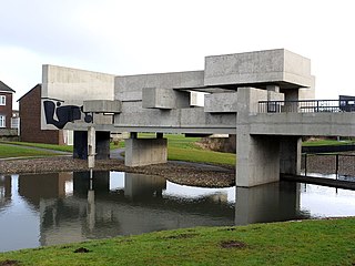
Peterlee is a town in County Durham, England. It is located south of Sunderland, north of Hartlepool, west of the Durham Coast and east of Durham. It gained town status in 1948 under the New Towns Act 1946. The act also created the nearby settlement of Newton Aycliffe and later Washington, Tyne and Wear.

Thornaby-on-Tees, commonly referred to as Thornaby, is a town and civil parish in the North Yorkshire part of the borough of Stockton-on-Tees, England. The parish had a population of 24,741 at the 2011 census, in the Teesside built-up area. It is located on the south bank of the River Tees.

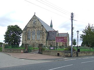
Stanley is a town and civil parish in the ceremonial county and district of County Durham, England. Centred on a hilltop between Chester-le-Street and Consett, Stanley lies south-west of Gateshead.

Cassop is a village and former civil parish, now in the parish of Cassop-cum-Quarrington, in the County Durham district, in the ceremonial county of Durham, England. It has a population of about 500 and is located near the city of Durham. A former mining village, mining is no longer the main occupation of Cassop's inhabitants due to extensive mine closure over the last 30 years.

Newbottle is a village in the Sunderland district, in Tyne and Wear, England. The village is situated between Durham 8 miles (13 km) and Sunderland is 5 miles (8.0 km). It was historically a part of County Durham.

Bowburn is a village in County Durham, England. It is situated about 3 miles (4.8 km) to the south-east of Durham, on the A177, between Coxhoe to the south-east, and High Shincliffe to the north-west.

Pittington is a village and civil parish in County Durham, in England. It is situated a few miles north-east of Durham. The population as taken at the 2011 census was 2,534.

Shildon is a town and civil parish in County Durham, in England. The population taken at the 2011 Census was 9,976. The town has the Locomotion Museum, due to it having the first station, built in 1825, and locomotive works on the Stockton and Darlington Railway.

Wingate is a village in County Durham, England.

Thornley is a village and civil parish in County Durham, England, about 5 miles (9 km) to the east of Durham and 5 miles (7 km) west of Peterlee. The community grew around a coal mine established in 1835, which remained open until 1970.

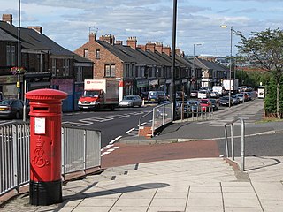
Deckham is a residential suburb in the Metropolitan Borough of Gateshead in Tyne and Wear, England. It is bordered by Gateshead town centre to the north, Sheriff Hill to the south, Felling and Carr Hill to the east and Shipcote to the west. It lies on the B1296, the route of the old Great North Road, 1 mile (1.6 km) south of Gateshead town centre, 1.5 miles (2.4 km) south of Newcastle-upon-Tyne and 13 miles (21 km) north of the city of Durham. In 2011, Deckham had a population of 9,938.
Cassop-cum-Quarrington is a civil parish in County Durham, England. According to the 2001 census it had a population of 4,735, increasing to 5,219 at the 2011 census.

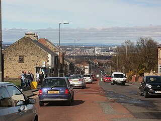
Sheriff Hill is a suburb in the Metropolitan Borough of Gateshead in Tyne and Wear, England. It lies on the B1296 road 2 miles (3.2 km) south of Gateshead, 2.5 miles (4.0 km) south of Newcastle upon Tyne and 12 miles (19 km) north of the historic city of Durham. According to the 2001 UK census it had a population of 5,051.

Westoe was originally a village near South Shields, in the South Tyneside district, in Tyne and Wear, England, but has since become part of the town and is now used to refer to the area of the town where the village once was. It is also an electoral ward for local political purposes.

Cassop Vale is a Site of Special Scientific Interest in the Durham City district of County Durham, England. It lies between the villages of Bowburn and Cassop, 7 km south-east of the centre of Durham..
The Bottoms is a Site of Special Scientific Interest in County Durham, England. It lies just south of the A181 road, roughly midway between the villages of Cassop and Wheatley Hill, some 10 km south-east of Durham city.


