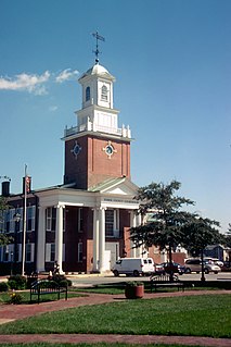
Leipsic is a town in Kent County, Delaware, United States. It is part of the Dover, Delaware Metropolitan Statistical Area. The population was 183 at the 2010 census.

Bridgeville is a town in Sussex County, Delaware, United States. According to the 2010 census, the population is 2,048, an increase of 42.6% from the previous decade. It is part of the Salisbury, Maryland-Delaware Metropolitan Statistical Area.

Slaughter Beach is a town in Sussex County, Delaware, United States. The population was 207 at the 2010 census, an increase of 4.5% over the past decade. It is part of the Salisbury, Maryland-Delaware Metropolitan Statistical Area.

Folcroft is a borough in Delaware County, Pennsylvania, United States. The population was 6,606 at the 2010 census, down from 6,978 at the 2000 census.
Old Furnace may refer to:

Old Furnace is an unincorporated community located in Sussex County, Delaware. The community is located in a rural area a few miles east of Seaford and about 40 miles south of Dover, Delaware. It is adjacent to the Old Furnace Wildlife Area.
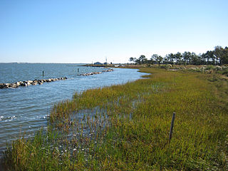
Indian River Bay is a body of water in Sussex County, Delaware. It is part of Delaware's inland bay system, along with Little Assawoman Bay and Rehoboth Bay. Fed by the Indian River at its western end, the bay is connected to the Atlantic Ocean to the east via the Indian River Inlet. A natural waterway that shifted up and down a two-mile stretch of the coast until 1928, the inlet was kept in its current location by dredging between 1928 and 1937, and in 1938 was fixed in place by the construction of jetties. The Charles W. Cullen Bridge, commonly known as the Indian River Inlet Bridge, spans the inlet.
The Old Furnace Town Heritage Museum is an outdoor museum near Snow Hill, Maryland that uses a living history format with live demonstrations to re-create a vanished 19th-century community. The museum contains various historic buildings, including most importantly the Nassawango Iron Furnace, an early 19th-century brick blast furnace that was used to smelt bog iron ore to make pig iron. Other buildings, all of which have been moved to the site, include a church, a store, and several houses, one of which is used as an information center.
Pocomoke State Forest is a state forest of Maryland that lies on both banks of the Pocomoke River in Worcester County. The portion north of the Pocomoke lies between Dividing and Nassawango Creeks. The Pocomoke River Wildlife Management Area borders the southern portion of the forest.
Johnson Wildlife Management Area is a Wildlife Management Area in Wicomico County, Maryland.
Nanticoke River Wildlife Management Area is a Wildlife Management Area in Wicomico County, Maryland near Quantico, Maryland.
Wellington Wildlife Management Area is a Wildlife Management Area in Somerset County, Maryland.
Le Compte Wildlife Management Area is a Wildlife Management Area in Dorchester County, Maryland.
Baltimore Hundred is a hundred in the southeastern section of Sussex County, Delaware, United States. Baltimore Hundred was formed in 1775 from Worcester County, Maryland. Its primary community is Millville. The old colonial term "hundred" is used to describe a sectioned area of the county in which 100 farms should fit. The Hundred was home to 3 villages, Selbyville, Roxanna and Ocean View.

Woodland Beach Wildlife Area is a state wildlife area located in Kent County, Delaware, along shore of the Delaware Bay. It is 6,320 acres (2,558 ha) in size and is managed by Delaware Department of Natural Resources and Environmental Control (DNREC), Division of Fish & Wildlife.

Cedar Swamp Wildlife Area is a state wildlife area located in New Castle County, Delaware, along shore of the Delaware Bay. It is 5,515 acres (2,232 ha) in size and is managed by Delaware Department of Natural Resources and Environmental Control (DNREC), Division of Fish & Wildlife.
Nanticoke Wildlife Area is a state wildlife area located in Sussex County, Delaware, along the Nanticoke River and Broad Creek, near to Seaford, Delaware, and Bethel, Delaware. There is a monument commenmorating Captain John Smith's journey into the Chesapeake Bay and its tributaries at Phillips Landing along Broad Creek, a tributary of the Nanticoke River in Delaware. It is made up of three large land tracts totaling 4,510 acres (1,825 ha), it is managed by Delaware Department of Natural Resources and Environmental Control (DNREC), Division of Fish and Wildlife.
Marshy Hope Wildlife Area is a state wildlife area located in Sussex County, Delaware, near the town of Bridgeville, Delaware, and along the Maryland and Delaware border and along the Delaware side of the Marshyhope Creek. It is made up of three land tracts totaling 1,079 acres (437 ha). It is managed by Delaware Department of Natural Resources and Environmental Control (DNREC), Department of Fish and Wildlife.

The Cape Henlopen Region, or the Cape Region, is a region in Sussex County, in southern Delaware, on the Delmarva Peninsula. The region is part of the Salisbury, Maryland-Delaware Metropolitan Statistical Area. The region takes its name from Cape Henlopen, as does the Cape Henlopen School District and Cape Henlopen State Park. Much of the region's populated areas are found along the Delaware Bay, Rehoboth Bay and the Atlantic Ocean. Northern and western parts of the Cape Region are rural areas dominated by farmland and wetlands. The area is often referred to as the Delaware Beaches.