Oneida Corners, New York

Last updated

Oneida Corners
Oneida Corners New York.JPG
Sign along New York State Route 9L indicating Oneida Corners.
USA New York location map.svg
Red pog.svg
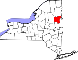
Oneida Corners
Location within the state of New York
Coordinates: 43°22′31″N73°37′44″W / 43.37528°N 73.62889°W / 43.37528; -73.62889
CountryUnited States
State New York
County Warren
TownQueensbury
unincorporatedc.1800
Elevation
376 ft (115 m)
Time zone UTC-5 (Eastern (EST))
  Summer (DST) UTC-4 (EDT)
Area code 518

Oneida Corners is a hamlet within the town of Queensbury in Warren County in the U.S. state of New York. [1]

Contents

Geography

Oneida Corners is situated at the intersection of New York State Route 9L (Ridge Road), extending west along County Route 54 (Sunnyside Road) and east along County Route 39 (Sunnyside Road East). [1] [2]

History

Around the time of the American Revolutionary War, the hamlet was a prominent settlement featuring two inns, three shops, a lumber business, mechanic shops, and a church. Court was held at least once weekly in the hamlet. Shortly before the war, an Oneida Indian by the name of Thomas Hammond ran a thriving business at the corner. His establishment being a frame of reference, the area came to be known as "the Oneidas" — and later as Oneida Corners — around 1800. [1] [3]

Related Research Articles

<span class="mw-page-title-main">Warren County, New York</span> County in New York, United States

Warren County is a county in the U.S. state of New York. As of the 2020 census, the population was 65,737. The county seat is Queensbury. The county was established in 1813 and is named in honor of General Joseph Warren, an American Revolutionary War hero of the Battle of Bunker Hill.

<span class="mw-page-title-main">Sullivan, New York</span> Town in Madison County, New York, US

<span class="mw-page-title-main">Queensbury, New York</span> Town in New York, United States

Queensbury is a town in Warren County, New York, United States. The population was 27,901 at the 2010 census.

<span class="mw-page-title-main">New York State Route 5</span> State highway in New York, US

New York State Route 5 (NY 5) is a state highway that extends for 370.80 miles (596.74 km) across the state of New York in the United States. It begins at the Pennsylvania state line in the Chautauqua County town of Ripley and passes through Buffalo, Syracuse, Utica, Schenectady, and several other smaller cities and communities on its way to downtown Albany in Albany County, where it terminates at U.S. Route 9 (US 9), here routed along the service roads for Interstate 787 (I-787). Prior to the construction of the New York State Thruway, it was one of two main east–west highways traversing upstate New York, the other being US 20. West of New York, the road continues as Pennsylvania Route 5 (PA 5) to Erie.

<span class="mw-page-title-main">New York State Route 13</span> State highway in New York, US

New York State Route 13 (NY 13) is a state highway that runs mainly north–south for 152.30 miles (245.10 km) between NY 14 in Horseheads and NY 3 west of Pulaski in Central New York in the United States. In between, NY 13 intersects with Interstate 81 (I-81) in Cortland and Pulaski and meets the New York State Thruway (I-90) in Canastota. NY 13 is co-signed with several routes along its routing, most notably NY 34 and NY 96 between Newfield and Ithaca; NY 80 between DeRuyter and Cazenovia; and NY 5 between Chittenango and Canastota.

<span class="mw-page-title-main">New York State Route 9L</span> State highway in Warren County, New York, in the United States

New York State Route 9L (NY 9L) is a state highway in Warren County, New York, in the United States. The road is 18.58 miles (29.90 km) long and is a suffixed highway of U.S. Route 9 (US 9). NY 9L goes through three municipalities in Warren County: the city of Glens Falls, the town of Queensbury and the town of Lake George. It starts at an intersection with US 9 and NY 32 in Glens Falls and ends at a junction with US 9 and NY 9N in Lake George. NY 9L is a scenic route for people traveling to Lake George as the road provides many views of the lake. The route was assigned as part of the 1930 renumbering of state highways in New York along the path of an old military road originally built during the American Revolution.

<span class="mw-page-title-main">New York State Route 149</span> Highway in New York and Vermont

New York State Route 149 (NY 149) is an east–west state highway that runs for 32.20 miles (51.82 km) through the Capital District of New York in the United States. It begins at exit 20 on the Adirondack Northway in the Warren County town of Queensbury and intersects U.S. Route 9 (US 9), US 4, and NY 22, among other routes, as it progresses eastward to its eastern end at the Vermont state line in the Washington County village of Granville. Here, the highway becomes Vermont Route 149 (VT 149) and continues for an additional 1.302 miles (2.095 km) to an intersection with VT 30 in Rutland County. Both NY 149 and VT 149 traverse mostly rural areas.

<span class="mw-page-title-main">New York State Route 31</span> Highway in New York

New York State Route 31 (NY 31) is a state highway that extends for 208.74 miles (335.93 km) across western and central New York in the United States. The western terminus of the route is at an intersection with NY 104 in the city of Niagara Falls. Its eastern terminus is at a traffic circle with NY 26 in Vernon Center, a hamlet within the town of Vernon. Over its routing, NY 31 spans 10 counties and indirectly connects three major urban areas in Upstate New York: Buffalo–Niagara Falls, Rochester, and Syracuse. The route is one of the longest routes in New York State, paralleling two similarly lengthy routes, NY 104 to the north and NY 5 to the south, as well as the Erie Canal, as it proceeds east.

<span class="mw-page-title-main">New York State Route 365</span> State highway in central New York, US

New York State Route 365 (NY 365) is an east–west state highway in the central portion of New York, United States. It extends for 44.26 miles (71.23 km) from an intersection with NY 5, east of the Madison County city of Oneida to a junction with NY 8 in the Herkimer County town of Ohio. The portion of NY 365 in western and central Oneida County is a regionally important highway that serves densely populated areas, including the cities of Oneida and Rome. In Verona, a town situated midway between the two locations, NY 365 passes by the Turning Stone Resort & Casino and connects to the New York State Thruway. East of Barneveld, a village in eastern Oneida County, NY 365 is a rural connector road that runs along the Hinckley Reservoir, a waterbody that extends into Herkimer County and Adirondack Park.

<span class="mw-page-title-main">New York State Route 93</span> State highway in western New York, US

New York State Route 93 (NY 93) is a 43.08-mile (69.33 km) state highway in western New York in the United States. The route begins at an intersection with NY 18F in the village of Youngstown and runs in a general northwest–southeast direction across Niagara and Erie counties to its east end at an intersection with NY 5 in the town of Newstead, just south of the village of Akron. NY 93 serves as a connector between several major arterials, including NY 104 in Cambria, NY 31 just west of the city of Lockport, and NY 78 south of the city.

<span class="mw-page-title-main">New York State Route 26</span> Highway in New York

New York State Route 26 (NY 26) is a north–south state highway that runs for 203.80 miles (327.98 km) through Central New York in the United States. Its southern terminus is located at the Pennsylvania state line south of the town of Vestal in Broome County, where it becomes Pennsylvania Route 267 (PA 267). Its northern terminus is located at a junction with NY 12 in the village of Alexandria Bay in Jefferson County. NY 26 serves three cities along its routing; one directly (Rome) and two via other roadways. NY 26 also intersects several other primary routes including I-81 in Barker, an overlap with U.S. Route 20 (US 20) in Madison, NY 12 in Lowville, and an overlap with US 11 in the Jefferson County town of Philadelphia.

<span class="mw-page-title-main">New York State Route 49</span> State highway in central New York, US

New York State Route 49 (NY 49) is an east–west state highway in central New York in the United States. It runs for just over 64 miles (103 km) from an intersection with NY 3 in the town of Volney in Oswego County, New York to an interchange with Interstate 790 (I-790), NY 5, NY 8 and NY 12 in the city of Utica in Oneida County. The route follows a generally northwest–southeast alignment between the two points, passing along the north shore of Oneida Lake and directly serving the city of Rome. As NY 49 heads east, it connects to several highways of regional importance, such as I-81 in the village of Central Square and NY 13 in the town of Vienna. Most of NY 49 is a two-lane surface road; however, the section between Rome and Utica is a freeway known as the Utica–Rome Expressway.

<span class="mw-page-title-main">New York State Route 233</span> State highway in Oneida County, New York, US

New York State Route 233 (NY 233) is a state highway in Oneida County, New York, United States. The southern terminus of the route is at an intersection with NY 12B southwest of the Clinton. Its northern terminus is at an interchange with the Utica–Rome Expressway within the Rome city limits but southeast of the inner tax boundary. NY 233 is the most direct connection between Rome and the New York State Thruway, which it meets at exit 32 in Westmoreland.

<span class="mw-page-title-main">New York State Route 46</span> State highway in central New York, US

New York State Route 46 (NY 46) is a state highway in Central New York in the United States. It extends from NY 12B in the Madison County town of Eaton to NY 12D in the Oneida County village of Boonville. NY 46 passes through the cities of Oneida and Rome.

<span class="mw-page-title-main">New York State Route 274</span> State highway in Oneida County, New York, US

New York State Route 274 (NY 274) is a 10.44-mile (16.80 km) state highway located entirely in Oneida County, New York, in the United States. The route begins at an intersection with NY 365 in the village of Holland Patent and heads north and west for 5 miles (8 km) in each direction to a junction with NY 46 at the hamlet of Frenchville in the town of Western. A two-lane highway its entire length, much of NY 274 is narrow and winding. The northwesternmost 2 miles (3.2 km) of the highway are particularly narrow and curved, running alongside a tributary of the Mohawk River. NY 274 was originally designated as part of New York State Route 46A, an alternate route of NY 46 between Rome and Western, in 1930 before gaining its current designation in the early 1950s.

<span class="mw-page-title-main">New York State Route 316</span> State highway in Madison County, New York, US

New York State Route 316 (NY 316) is a state highway in Madison County, New York, in the United States. It extends for 4.03 miles (6.49 km) in a northwest–southeast direction from an intersection with NY 46 in the city of Oneida to a junction with NY 31 in the hamlet of Oneida Valley, located in the town of Lenox. NY 316 serves as a connector between Oneida Lake and the city of Oneida, and it parallels Oneida Creek for its entire length. The route was assigned as part of the 1930 renumbering of state highways in New York, following what had previously been part of NY 31 during the 1920s.

<span class="mw-page-title-main">County Route 18 (Otsego County, New York)</span>

County Route 18 (CR 18) is a county-maintained highway in western Otsego County, New York, in the United States. It extends for 34.83 miles (56.05 km) from an intersection with New York State Route 51 (NY 51) in the town of Butternuts to the Oneida County line at Plainfield, where it becomes CR 2. The highway runs along the eastern bank of the Unadilla River and parallels NY 8, which follows the western bank of the river. CR 18 enters the vicinity of several villages and hamlets, including the village of New Berlin and the hamlet of Unadilla Forks.

<span class="mw-page-title-main">New York State Route 285</span> Former highway in New York

New York State Route 285 (NY 285) was a state highway in Oneida County, New York, in the United States. The southern terminus of the 6.87-mile (11.06 km) route was at an intersection with NY 69 west of the hamlet of Taberg in the town of Annsville. Its northern terminus was in the community of Thompson Corners, where it ended at a junction with County Route 67A (CR 67A) and CR 70. NY 285 was little more than a connector between NY 69 and Thompson Corners, as it did not pass through any other areas of interest.

<span class="mw-page-title-main">East Lake George, New York</span> Hamlet in New York, United States

East Lake George is a hamlet within the towns of Queensbury and Fort Ann in the U.S. state of New York. East Lake George attempted to incorporate as a village, a measure rejected by voters in 2010.

<span class="mw-page-title-main">Fort Ann, New York</span> Town in New York, United States

Fort Ann is a town in Washington County, New York, United States. It is part of the Glens Falls Metropolitan Statistical Area. The town population was 6,417 at the 2000 census. The town contains a village, also called Fort Ann, located in its southeastern corner.

References

  1. 1 2 3 VanDyke, Marilyn. "Oneida Hamlet". Town of Queensbury, Historian. Archived from the original on May 8, 2009. Retrieved March 22, 2009.
  2. Map showing Oneida Corners (Map). Cartography by NAVTEQ. Yahoo!, Inc. Retrieved June 8, 2009.
  3. "An Open Space Vision for the Town of Queensbury" (PDF). Town of Queensbury Open Space Plan Committee, et al. July 7, 2003. p. 22 / PDF p. 25. Retrieved July 12, 2010.