Hämeenlinna is a city and municipality of about 68,000 inhabitants in the heart of the historical province of Tavastia and the modern province of Kanta-Häme in the south of Finland. Hämeenlinna is the oldest inland city of Finland and was one of the most important Finnish cities until the 19th century. It remains an important regional center. The medieval Häme Castle is located in the city.
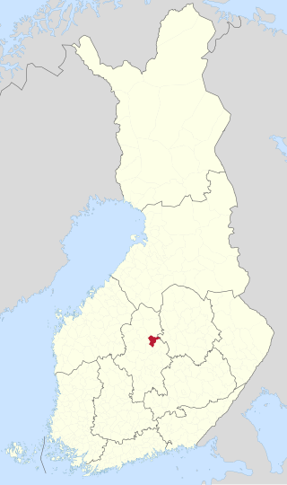
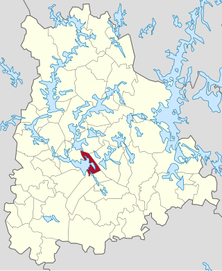
Muurame is a municipality of Finland, located 16 kilometres (10 mi) south-west of Jyväskylä. Muurame itself is located between two lakes, Lake Päijänne and Lake Muuratjärvi. These two lakes are connected to each other via River Muurame. All together there are 37 lakes in Muurame. Biggest lakes beside Päijänne are Muuratjärvi and Lake Kuusjärvi. River Muurame streams through the population center of Muurame. Muurame was founded in 1921.

Valkeakoski is a town and municipality in Finland. It is located 35 kilometres (22 mi) south of Tampere, 45 km (28 mi) north of Hämeenlinna and 150 km (93 mi) north of Helsinki in the Pirkanmaa region. The municipality has a population of 20,732 (28 February 2023) and covers an area of 372.03 square kilometres (143.64 sq mi) of which 100.06 km2 (38.63 sq mi) is water. The population density is 76.23 inhabitants per square kilometre (197.4/sq mi).

Keuruu is a town and municipality of Finland. It is located in the province of Western Finland and is part of the Central Finland region. The municipality has a population of 9,240 and covers an area of 1,430.57 square kilometres (552.35 sq mi) of which 172.4 km2 (66.6 sq mi) is water. The population density is 7.34 inhabitants per square kilometre (19.0/sq mi). The town center and Haapamäki village are both the most populated places in Keuruu.

Loimaa is a town and municipality of Finland.

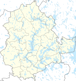
Loppi is a municipality in Finland. It is located in the province of Southern Finland and is part of the Kanta-Häme region, located about 50 kilometers south of the city of Hämeenlinna. Loppi was founded in 1632. The municipality has a population of 7,746 and covers an area of 655.97 square kilometres (253.27 sq mi) of which 58.36 km2 (22.53 sq mi) is water. The population density is 12.96 inhabitants per square kilometre (33.6/sq mi). The municipality is unilingually Finnish.

Pälkäne is a municipality of Finland. It is part of the Pirkanmaa region. The municipality has a population of 6,340 and covers an area of 738.15 square kilometres (285.00 sq mi) of which 177.65 km2 (68.59 sq mi). The population density is 11.31 inhabitants per square kilometre (29.3/sq mi). Onkkaala is the administrative center of the municipality. Tampere is located 38 kilometres (24 mi) northwest of the center of Pälkäne.

Sysmä is a municipality of Finland. It is situated in the Päijät-Häme region. The municipality has a population of 3,498 (28 February 2023) and covers an area of 936.18 square kilometres (361.46 sq mi) of which 269.14 km2 (103.92 sq mi) is water. The population density is 5.24 inhabitants per square kilometre (13.6/sq mi). Neighbouring municipalities are Asikkala, Hartola, Heinola, Kuhmoinen, Luhanka, and Padasjoki. The municipality is unilingually Finnish.

Sääksmäki is a village and a former municipality, currently part of Valkeakoski in the Pirkanmaa region of Western Finland. A past president of Finland, Pehr Evind Svinhufvud, the Finnish film producer and director Veikko Aaltonen, eminent Finnish historian Eino Jutikkala, and actress Pirkko Mannola, were born there.

Rapola hill fort is a hill fort in Sääksmäki in the municipality of Valkeakoski, Finland. Its walls have circled an area of 58 000 square meters and it is the biggest hill fort found in Finland.

Akaa Solar System Scale Model is located at the center of the city of Akaa, Finland. The Sun is located at the school campus of Toijalan Yhteiskoulu in Toijala district. The scale of the model is 1 : 3 000 000 000, meaning that each centimetre in the scale model represents 30 000 km in real life. The Sun is 464 mm in diameter and the Earth is 4 mm in diameter and located 49.86 meters away from the Sun. Neptune is 1500 meters away from the Sun, for example. Akaa Solar System Scale Model was built in 2017 by amateur astronomer Kari-Pekka Arola.

Ancient kings of Finland are kings of Finland mentioned in early historical sources. The word kuningas is an old Finnic word deriving from the ancient Germanic word kuningaz. In the time the sources were written, "Finland" mainly referred to the Finland Proper area, and depending on the source, the "kings of Finland" could also refer to kings of the Sami people.

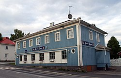
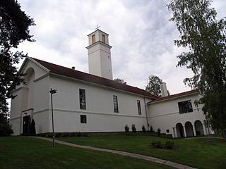
The Loppi church village is the largest village in the Loppi municipality on the northern shore of Lake Loppi (Loppijärvi) in Tavastia Proper, Finland, and also its administrative center with a population of more than 2,000. The distance from the village to the eastern town of Riihimäki is 19 kilometres (12 mi).

The Sahalahti church village is a village in the eastern part of the Kangasala town and former administrative center of the former Sahalahti municipality in Pirkanmaa, Finland. At the end of 2018, the village had 1,195 inhabitants. It is 17 kilometres (11 mi) from the village to the town center of Kangasala and 34 kilometres (21 mi) to the city of Tampere. Right in the southern part of the village is Lake Kirkkojärvi.

Aitoo is a village of the Pälkäne municipality in Pirkanmaa, Finland. At the end of 2020, the village had 2,569 inhabitants. Aitoo is located 15 kilometres (9.3 mi) east of Onkkaala, the municipal center of Pälkäne, along the regional road 322.
Konginkangas is a settlement and former municipality of Finland in the Central Finland region. It was consolidated with Äänekoski in 1993.
Tyrväntö is a former municipality of Finland in the Häme Province, now in Tavastia Proper. It was consolidated with Hattula in 1971. The northern part of the former municipality was transferred to Valkeakoski in 1978.
Keljo is a district of Jyväskylä and a former village of Jyväskylän maalaiskunta. The distance to central Jyväskylä is about 4 km.
Vesanka is a district of Jyväskylä and a village in Central Finland, formerly one of the villages of Jyväskylän maalaiskunta. It is located in the far western part of Jyväskylä near the borders with Petäjävesi and Muurame, before 2009 also Korpilahti.

Keljonkangas is a district of Jyväskylä, Finland. It is located in the southern part of the city near the border with Muurame. The district is mainly residential, with the predominant types of housing being terraces and detached houses built between the 1950s and 1980s.