
The North York Moors is an upland area in north-eastern Yorkshire, England. It contains one of the largest expanses of heather moorland in the United Kingdom. The area was designated as a National Park in 1952, through the National Parks and Access to the Countryside Act 1949. Covering an area of 554 sq mi (1,430 km2), the National Park has a population of 23,380. It is administered by the North York Moors National Park Authority, whose head office is based in Helmsley.

The Pennines, also known as the Pennine Chain or Pennine Hills, are a range of uplands mainly located in Northern England. Commonly described as the "backbone of England" because of its length and position, the range runs from Derbyshire and Staffordshire in the North Midlands to Northumberland in North East England, near the Anglo-Scottish border. The range starts near the valley of the River Trent to the south and extends northwards across the Peak District, South Pennines, Yorkshire Dales, and North Pennines, ending at the Tyne Gap. Beyond the gap are the Border Moors and Cheviot Hills, which are included in some definitions of the range.

The Yorkshire Dales are a series of valleys, or dales, in the Pennines, a range of hills in England. They are mostly located in the ceremonial county of North Yorkshire, but extend into Cumbria and Lancashire; they were historically entirely within Yorkshire. The majority of the dales are within the Yorkshire Dales National Park, created in 1954. The exception is the area around Nidderdale, which forms the separate Nidderdale Area of Outstanding Natural Beauty.
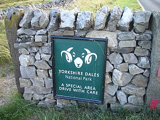
The Yorkshire Dales National Park is a 2,178 km2 (841 sq mi) national park in England covering most of the Yorkshire Dales, with the notable exception of Nidderdale. Most of the park is in North Yorkshire, with a sizeable area in Cumbria and a small part in Lancashire. The park was designated in 1954, and extended in 2016. Over 95% of the land in the Park is under private ownership; there are over 1,000 farms in this area.

Swaledale is a valley in North Yorkshire, England. It is one of the Yorkshire Dales, which are part of the Pennines, and within the Yorkshire Dales National Park. It is named after the River Swale, which runs through it. Swaledale is the most northerly of the major dales.
The Howgill Fells are uplands in Northern England between the Lake District and the Yorkshire Dales, lying roughly within a triangle formed by the town of Sedbergh and the villages of Ravenstonedale and Tebay. The name Howgill derives from the Old Norse word haugr meaning a hill or barrow, plus gil meaning a narrow valley.
Orton is a village and civil parish in Cumbria, England. It lies 15 miles (24 km) south of Penrith, 8 miles (13 km) from Appleby-in-Westmorland and 1.5 miles (2.4 km) from the M6 motorway. The village is in the upper Lune Valley, at the foot of Orton Scar in the Orton Fells. The Lake District is nearby. The parish includes a wide area outside the village, and had a population of 594 in 2001, decreasing to 588 at the 2011 Census.

England comprises most of the central and southern two-thirds of the island of Great Britain, in addition to a number of small islands of which the largest is the Isle of Wight. England is bordered to the north by Scotland and to the west by Wales. It is closer to continental Europe than any other part of mainland Britain, divided from France only by a 33 km (21 mi) sea gap, the English Channel. The 50 km (31 mi) Channel Tunnel, near Folkestone, directly links England to mainland Europe. The English/French border is halfway along the tunnel.
Crosby Ravensworth is a village and civil parish in the Eden district of Cumbria, England. The village is about 4 miles (6.4 km) east of the M6 motorway, and Shap. At the 2001 census the parish had a population of 538, decreasing to 517 at the 2011 Census.

The mountains and hills of England comprise very different kinds of terrain, from a mountain range which reaches almost 1,000 metres high, to several smaller areas of lower mountains, foothills and sea cliffs. Most of the major upland areas have been designated as Areas of Outstanding Natural Beauty (AONB) or national parks. The highest and most extensive areas are in the north and west, while the midlands, south-east and east of the country tend to be low-lying.

The South Pennines is a region of moorland and hill country in northern England lying towards the southern end of the Pennines. In the west it includes the Rossendale Valley and the West Pennine Moors. It is bounded by the Greater Manchester conurbation in the west and the Bowland Fells and Yorkshire Dales to the north. To the east it is fringed by the towns of West Yorkshire whilst to the south it is bounded by the Peak District. The rural South Pennine Moors constitutes both a Site of Special Scientific Interest and Special Area of Conservation.
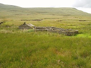
Birkdale is a dale in the Yorkshire Dales National Park, in North Yorkshire, England. It lies at the far western end of Swaledale, close to the border with Cumbria. The dale is one of the smallest of the Yorkshire Dales. The hamlet of Birkdale is in the lower part of the dale, 2 miles (3.2 km) west of Keld. The area forms part of the civil parish of Muker.

Maulds Meaburn is a village in Cumbria, England. It is located in the Lyvennet Valley and Yorkshire Dales National Park and is 13 miles from Penrith. Its origins are connected with the nearby village King's Meaburn.

Great Asby is a village in Cumbria, England. Historically part of Westmorland, it is located approximately 15 miles (24 km) south east of Penrith and approximately 5 miles (8.0 km) south of Appleby-in-Westmorland. Its name is said to be derived from the Old Norse: askr, meaning ash and by, meaning farm.

Grass Wood is an ancient woodland of 88 hectares in Wharfedale, North Yorkshire, England, that has an exceptional ground flora of woodland wildflowers.

Aire Gap is a pass through the Pennines in England formed by geologic faults and carved out by glaciers. The term is used to describe a geological division, a travel route, or a location that is an entry into the Aire river valley.
A National Character Area (NCA) is a natural subdivision of England based on a combination of landscape, biodiversity, geodiversity and economic activity. There are 159 National Character Areas and they follow natural, rather than administrative, boundaries. They are defined by Natural England, the UK government's advisors on the natural environment.

Great Asby Scar is a Site of Special Scientific Interest (SSSI) and National Nature Reserve in Cumbria, UK. It is an area of limestone pavement, south of the village of Great Asby.
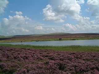
Sunbiggin Tarn is a tarn near Sunbiggin in Cumbria. It is in a Site of Special Scientific Interest (SSSI) which also includes the surrounding moorland and limestone pavement of Little Asby Scar.
