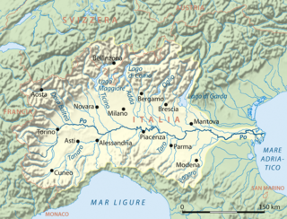
Padania is an alternative name and proposed independent state encompassing Northern Italy, derived from the name of the Po River, whose basin includes much of the region, centered on the Po Valley, the major plain of Northern Italy.

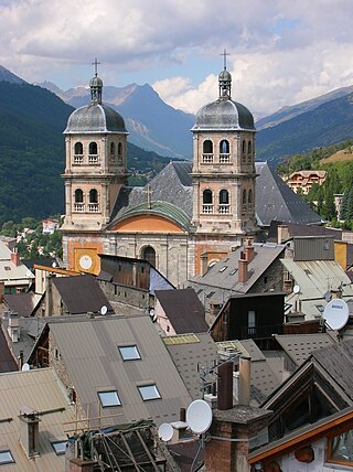
Briançon is the sole subprefecture of the Hautes-Alpes department in the Provence-Alpes-Côte d'Azur region in Southeastern France. It is the highest city in France at an altitude of 1,326 metres, based on the national definition as a community containing more than 2,000 inhabitants. Its most recent population estimate is 11,084 for the commune.

Pinerolo is a town and comune in the Metropolitan City of Turin, Piedmont, northwestern Italy, 40 kilometres (25 mi) southwest of Turin on the river Chisone. The Lemina torrent has its source at the boundary between Pinerolo and San Pietro Val di Lemina.

The Dora Riparia is an alpine river, a left-bank tributary of the Po. It is 125 kilometres (78 mi) long, with a 1,231 square kilometres (475 sq mi) drainage basin. It originates in the Cottian Alps, close to the Col de Montgenèvre in France, where it is called the Piccola Dora. Its name becomes the Dora Riparia after the confluence with the Ripa in the Argentera Valley and the Thuras de Bousson close to Cesana.

Sestriere is a ski resort in Piedmont, Italy, a comune (municipality) of the Metropolitan City of Turin. It is situated in Val Susa, 17 km (11 mi) from the French border. Its name derives from Latin: ad petram sistrariam, that is at sixty Roman miles from Turin.

Mont Cenis is a massif in Savoie (France), which forms the limit between the Cottian and Graian Alps.

L'Escarène is a commune in the Alpes-Maritimes department in the southeastern Provence-Alpes-Côte d'Azur region in France.

The Susa Valley is a valley in the Metropolitan City of Turin, Piedmont region of northern Italy, located between the Graian Alps in the north and the Cottian Alps in the south. It is one of the longest valleys of the Italian Alps. It extends over 50 kilometres (31 mi) in an east-west direction from the French border to the outskirts of Turin. The valley takes its name from the city of Susa which lies in the valley. The Dora Riparia river, a tributary of the Po, flows through the valley.

Bardonecchia is an Italian town and comune located in the Metropolitan City of Turin, in the Piedmont region, in the western part of Susa Valley. It grew out of a small village with the works for the Fréjus Rail Tunnel, the first crossing the Alps.

Pragelato is a comune (municipality) in the Metropolitan City of Turin in the Italian region Piedmont, located about 60 kilometres (37 mi) west of Turin, in the upper Val Chisone. The name Pragelato, meaning "icy meadow", has been derived from the harsh climate and the fact that the ground is covered with ice for long periods. On both sides of the Chisone, extensive forests of pine and larch provide protection from the avalanches which are a common occurrence in the winter season: for this reason in the nineteenth century the people of Pragelato were only permitted to fell trees close to the mountain summits, and even then only with the permission of the communal administration.

Sauze d'Oulx is a town and comune in the Metropolitan City of Turin, Piedmont located 80 km from Turin in the Val di Susa, at the foot of Monte Genevris.

Bruzolo ) is a comune of the Metropolitan City of Turin in the Italian region of Piedmont. Located some 43 kilometres (27 mi) west of Turin, in the lower Susa Valley, it is a member of the Comunità Montana Bassa Valle di Susa e Val Cenischia. Bruzolo borders the municipalities of Usseglio, Condove, Chianocco, San Didero, and San Giorio di Susa.

Exilles is a municipality in the Metropolitan City of Turin in the Italian region Piedmont, located about 60 kilometres (37 mi) west of Turin, on the border with France.

Gravere is a comune (municipality) in the Metropolitan City of Turin in the Italian region Piedmont, located about 50 kilometres (31 mi) west of Turin. Until 1713, it was the first commune in the Val di Susa in the Duchy of Savoy when coming from France, as the upper part of the valley was part of the latter kingdom.

Roure is a comune (municipality) in the Metropolitan City of Turin in the Italian region of Piedmont, located about 45 kilometres (28 mi) west of Turin in the Val Chisone.

Borgo San Dalmazzo is a comune (municipality) in the Province of Cuneo in the Italian region Piedmont, located about 80 kilometres (50 mi) south of Turin and about 8 kilometres (5 mi) southwest of Cuneo.

Castelmagno is a small comune (municipality) in the Province of Cuneo in the Italian region of Piedmont, located about 80 kilometres (50 mi) southwest of Turin and about 25 kilometres (16 mi) west of Cuneo.
Firenzuola is a comune (municipality) in the Metropolitan City of Florence, in the Italian region Tuscany, located about 40 kilometres (25 mi) northeast of Florence.

Montgenèvre is a commune on the Italian border in the Hautes-Alpes department in the Provence-Alpes-Côte d'Azur region in Southeastern France.

Col d'Étache in French,, is a pedestrian pass across the Cottian Alps. It connects Susa Valley and Maurienne.


