Susa Valley

Last updated
Susa Valley
Val di Susa (Italian)
Val de Suse (French)
Susatal.jpg
The central part of the valley
Val di Susa mappa.png
Map of the valley
Floor elevation300–3,612 metres (984–11,850 ft)
LengthAround 50 kilometres (31 mi)east-west
Naming
Native name
Geology
TypeMainly glacial valley
Geography
Location Piedmont (Italy); Provence-Alpes-Côte d'Azur and Auvergne-Rhône-Alpes (France)
Coordinates 45°08′N7°03′E / 45.133°N 7.050°E / 45.133; 7.050

The Susa Valley (Italian : Val di Susa; Piedmontese : Valsusa; French : Val de Suse; Occitan : Val d'Ors) is a valley in the Metropolitan City of Turin, Piedmont region of northern Italy, located between the Graian Alps in the north and the Cottian Alps in the south. It is one of the longest valleys of the Italian Alps. It extends over 50 kilometres (31 mi) in an east-west direction from the French border to the outskirts of Turin. The valley takes its name from the city of Susa which lies in the valley. The Dora Riparia river, a tributary of the Po, flows through the valley.

Contents

A motorway runs through the valley from Turin to Chambéry in France through the Fréjus tunnel or by crossing the Col du Mont Cenis (2083m), and to Briançon, also in France, over the Col de Montgenèvre.

Geography

Susa's Arch of Augustus. Augustan Arch, Susa.JPG
Susa's Arch of Augustus.

Peaks that surround the valley include:

History

During the Roman age, Augustus formed an alliance with the Segusini of Cottii Regnum to link Italy and France by building a road through the Valley and over the Col de Montgenevre ( Passo del Monginevro), now 2 km away from the Italian border.

During the Middle Ages, the road was called Via Francigena, and pilgrims arriving from France passed through Mont Cenis and the Susa Valley on their way to Rome. It was one of the most used Alpine passes from the Middle Ages to the Nineteenth Century. Several abbeys were built to accommodate pilgrims, such as Novalesa Abbey founded in 726AD on the foot of a mountain and the monumental Sacra di San Michele abbey.

Susa Valley in access to Italy from France Lac du Mont-Cenis, 210 degree panoramic.jpg
Susa Valley in access to Italy from France

Main sights

Saint Michael's Abbey and the Alps of Susa Valley. Sacra di San Michele e monti Valle di Susa.jpg
Saint Michael's Abbey and the Alps of Susa Valley.
Casaforte Chianocco. Casaforte Chianocco da sud-est.jpg
Casaforte Chianocco.

Turin–Lyon high-speed railway

Protesters have fought a 10-year battle to prevent a 57 kilometres (35 mi) rail tunnel being built through the valley. [1]

Related Research Articles

<span class="mw-page-title-main">Cottian Alps</span> Mountain range on the France–Italy border

The Cottian Alps are a mountain range in the southwestern part of the Alps. They form the border between France and Italy (Piedmont). The Fréjus Road Tunnel and Fréjus Rail Tunnel between Modane and Susa are important transportation arteries between France and Italy (Turin).

This article lists the principal mountain passes and tunnels in the Alps, and gives a history of transport across the Alps.

<span class="mw-page-title-main">Sestriere</span> Comune in Piedmont, Italy

Sestriere (/se'strjɛre/) is a ski resort in Piedmont, Italy, a comune (municipality) of the Metropolitan City of Turin. It is situated in Val Susa, 17 km (11 mi) from the French border. Its name derives from Latin: ad petram sistrariam, that is at sixty Roman miles from Turin.

<span class="mw-page-title-main">Mont Cenis</span> Mountain in France

Mont Cenis is a massif in Savoie (France), which forms the limit between the Cottian and Graian Alps.

<span class="mw-page-title-main">Geography of the Alps</span> Description of the landforms of the Alps mountain range

The Alps form a large mountain range dominating Central Europe, including parts of Italy, France, Switzerland, Liechtenstein, Austria, Slovenia, Germany and Hungary.

<span class="mw-page-title-main">Sauze d'Oulx</span> Comune in Piedmont, Italy

Sauze d'Oulx is a town and comune in the Metropolitan City of Turin, Piedmont located 80 km from Turin in the Val di Susa, at the foot of Monte Genevris.

<span class="mw-page-title-main">Maurienne</span> Former Savoy province

Maurienne is one of the provinces of Savoy, corresponding to the arrondissement of Saint-Jean-de-Maurienne in France. It is also the original name of the capital of the province, now Saint-Jean-de-Maurienne.

<span class="mw-page-title-main">Novalesa</span> Comune in Piedmont, Italy

Novalesa is a comune (municipality) in the Metropolitan City of Turin in the Italian region Piedmont, located about 60 km west of Turin, on the border with France. Novalesa borders the following municipalities: Bessans (France), Lanslebourg-Mont-Cenis (France), Mompantero, Moncenisio, Usseglio, and Venaus.

<span class="mw-page-title-main">Turin–Modane railway</span>

The Turin–Modane railway is the international rail connection from Turin, Italy to Modane, France. It passes through the Susa Valley and the Fréjus Rail Tunnel. Together with the French Culoz–Modane railway it is often called "Fréjus Railway" or "Mont Cenis Railway".

<span class="mw-page-title-main">Novalesa Abbey</span>

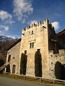
Novalesa Abbey is a Benedictine monastery in the Metropolitan City of Turin, Piedmont, Italy. It was founded in 726, and dedicated to Saint Peter and Saint Andrew.

<span class="mw-page-title-main">Cenischia</span> River in France: department of Savoie, Italy: Metropolitan City of Turin

The Cenischia is a mountain torrent which straddles the south-west French department of Savoie and the north-west Italian Metropolitan City of Turin, in Piedmont. Part of the Po basin, it is a left tributary of the Dora Riparia and forms the valley called the Val Cenischia which marks the boundary between the Graian Alps to the north and the Cottian Alps to the south.

<span class="mw-page-title-main">Val Chisone</span> Alpine valley in Piedmont (Italy)

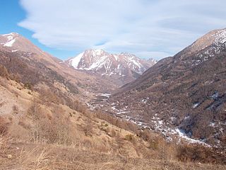
The Val Chisone is one of the Occitan valleys of western Piedmont, situated in the Cottian Alps in the Metropolitan City of Turin in north-west Italy.

<span class="mw-page-title-main">Mont d'Ambin</span> Mountain in the Cottian Alps on the French-Italian border

Mont d'Ambin or Rocca d'Ambin is a mountain on the border of Savoie, France and of the Province of Turin, Italy. It lies in the Ambin group of the Cottian Alps. On the Italian side, it commands the view of the Val di Susa. It has an elevation of 3,378 metres (11,083 ft) above sea level. The Mont d'Ambin base tunnel of the Lyon–Turin rail link is being dug at its base.

<span class="mw-page-title-main">Punta Sommeiller</span> Mountain in Italy

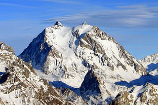
Punta Sommeiller or Pointe Sommeiller is a mountain of the Province of Turin, Italy and of Savoie, France. It lies in the Cottian Alps range. It has an elevation of 3,333 metres (10,935 ft) above sea level.

<span class="mw-page-title-main">Lanzo Valleys</span> Triple valley in North Italy

The Lanzo Valleys is a group of three valleys in the north-west of Piedmont in the Metropolitan City of Turin, Italy. They are located in the Graian Alps of Piedmont, between the Valle dell'Orco to the north and the Val di Susa to the south. Crossed by various streams which in each valley is called Stura and which flow into the river Stura di Lanzo, the valleys take their name from the town of Lanzo, located on an ancient glacial moraine at the end of the valleys.

<span class="mw-page-title-main">France–Italy border</span> International border

The France–Italy border is 515 km long. It runs from the Alps in the north, a region in which it passes over Mont Blanc, down to the Mediterranean coast in the south. Three national parks are located along the border: Vanoise National Park and Mercantour National Park on the French side and Gran Paradiso National Park on the Italian side.

<span class="mw-page-title-main">Pointe Rochers Charniers</span> Mountain in France

The Pointe Rochers Charniers is a mountain of the Cottian Alps at an elevation of 3,063 metres above sea level, located in France.

<span class="mw-page-title-main">Signal du Petit Mont-Cenis</span> Mountain in France

The Signal du Petit Mont-Cenis is a 3,162 m high mountain of the Cottian Alps.

<span class="mw-page-title-main">Pointe de Bellecombe</span> Mountain in France

The Pointe de Bellecombe is a 2,775 m high mountain of the northern Cottian Alps.

<span class="mw-page-title-main">Monte Gimont</span> Mountain in Italy and France

Mount Gimont is a mountain 2,646 m above sea level in the Montgenèvre Alps, in the Cottian Alps. It is located on the border between Italy and France (Hautes-Alpes).

References

  1. Fraser, Christian (15 February 2013). "Italy's 10-metre Alpine mega-tunnel". BBC News . Retrieved 19 December 2019.

Commons-logo.svg Media related to Val di Susa at Wikimedia Commons