
Mont d'Ambin or Rocca d'Ambin is a mountain on the border of Savoie, France and of the Province of Turin, Italy. It lies in the Ambin group of the Cottian Alps. On the Italian side, it commands the view of the Val di Susa. It has an elevation of 3,378 metres (11,083 ft) above sea level. The Mont d'Ambin base tunnel of the Lyon–Turin rail link is being dug at its base.

Aiguille de Scolette or Pierre Menue is a mountain of Savoie (F) and of the province of Turin (I). It lies in the Cottian Alps and has an elevation of 3,506 metres above sea level.
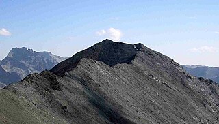
Pointe de Paumont or Cima del Vallone is a mountain of Savoie, France and of the Province of Turin, Italy. It lies in the Cottian Alps range. It has an elevation of 3,171 metres above sea level.

Punta Bagnà or Cime du Grand Vallon is a mountain of Savoie, France and of the Province of Turin, Italy. It lies in the Cottian Alps range. It has an elevation of 3,129 metres above sea level.

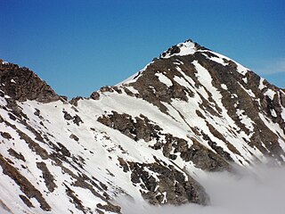
Punta Sommeiller or Pointe Sommeiller is a mountain of the Province of Turin, Italy and of Savoie, France. It lies in the Cottian Alps range. It has an elevation of 3,333 metres (10,935 ft) above sea level.

Rognosa d'Etiache or Rognosa d'Étache is a mountain in the Cottian Alps on the border of Turin, Italy, and Savoie, France. It has an elevation of 3,382 metres above sea level.

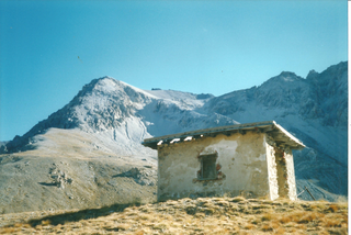
Col d'Étache in French,, is a pedestrian pass across the Cottian Alps. It connects Susa Valley and Maurienne.

The Ambin group is a sub-range of the Cottian Alps located on the French-Italian border.

Punta Sulè is a 3,384 m a.s.l.mountain of the Graian Alps, located in Italy.

Bric Ghinivert or Eiminàl is a mountain of the Cottian Alps located in Italy.

Monte Politri or Bric Rosso is a 3,026 m a.s.l. mountain of the Cottian Alps, located in Italy.
Monte Albergian is a 3,041 m a.s.l. mountain of the Cottian Alps, located in Italy. A battalion of 3rd Alpini Regiment, which during World War I earned a Silver Medal of Military Valor, was named after Monte Albergian.

Punta Tempesta is a 2,679 m a.s.l. mountain of the Cottian Alps, located in Italy.

The Punta Merciantaira or Grand Glaiza is a 3,293 metres high mountain of the Cottian Alps.

The Gran Queyron or Grand Queyron is a 3,060 metres high mountain of the Cottian Alps.

The Punta Nera is a mountain of Savoie (France) and of the Province of Turin (Italy). It lies in the Cottian Alps range. It has an elevation of 3,047 metres above sea level.
The Pointe Rochers Charniers is a mountain of the Cottian Alps at an elevation of 3,063 metres above sea level, located in France.

The Punta Cornour is a 2,868 metres high mountain on the Italian side of the Cottian Alps.

The Cima Ciantiplagna is a mountain in the Cottian Alps belonging to the Province of Turin (Italy).

The Monte Birrone is a 2,131-metre (6,991 ft) high mountain in the Cottian Alps, belonging to the Italian province of Cuneo.

