Pabil

Last updated

Pabil
Ganesh IV
Pabil, Nepal.jpg
South aspect
Highest point
Elevation 7,104 m (23,307 ft) [1] [2]
Prominence 964 m (3,163 ft) [2]
Parent peak Ganesh NW [2]
Isolation 4.33 km (2.69 mi) [1]
Coordinates 28°20′45″N85°04′49″E / 28.34583°N 85.08028°E / 28.34583; 85.08028
Geography
Nepal rel location map.svg
Red triangle with thick white border.svg
Pabil
Location in Nepal
Pabil
Interactive map of Pabil
Country Nepal
Province Bagmati / Gandaki
District Dhading / Gorkha
Parent range Himalayas
Ganesh Himal [3]
Climbing
First ascent October 1978

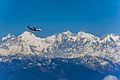
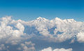
Pabil, also known as Ganesh IV, is a mountain in Nepal.

Contents

Description

Pabil is a 7,104-metre (23,307-foot) glaciated summit in the Ganesh Himal subrange of the Himalayas. It is situated 70 kilometres (43 mi) north-northwest of Kathmandu on the common boundary shared by Bagmati Province and Gandaki Province. The peak ranks as the highest point in Dhading District and the 69th-highest in Nepal. [2] Precipitation runoff from the mountain's slopes drains into tributaries of the Budhi Gandaki River. Topographic relief is significant as the west face rises 1,100 metres (3,609 ft) in one kilometre (0.62 mi), the northeast slope rises 2,300 metres (7,546 ft) in two kilometres (1.2 mi), and the south slope rises 3,900 metres (12,800 ft) in six kilometres (3.7 mi). The first ascent of the summit was achieved on October 20, 1978, via the south face and southeast ridge by T. Tomita, H. Yoshio, K. Aoyagi, M. Hashimoto, Y. Hashimoto, Y. Okuma, T. Shimoji, T. Suzuki, I. Yasuda, Yogendra Thapa, Kamal Bhandari, Mingma Tenzing Sherpa, and Sonan Wolang Sherpa. [3] [4]

Climate

Based on the Köppen climate classification, Pabil is located in a tundra climate zone with cold, snowy winters, and cool summers. [5] Weather systems coming off the Bay of Bengal are forced upwards by the Himalaya mountains (orographic lift), causing heavy precipitation in the form of rainfall and snowfall. Mid-June through early-August is the monsoon season. The months of April, May, September, and October offer the most favorable weather for viewing or climbing this peak. [6]

See also

References

  1. 1 2 "Pabil, Nepal". Peakbagger.com. Retrieved 5 May 2025.
  2. 1 2 3 4 "Pabil". Peakvisor.com. Retrieved 5 May 2025.
  3. 1 2 "Ganesh IV Overview". Nepal Himal Peak Profile. Government of Nepal. Retrieved 5 May 2025.
  4. Cheney, Michael J. (1979). "Asia, Nepal, Pabil (Ganesh IV)". American Alpine Journal . American Alpine Club . Retrieved 5 May 2025.
  5. Peel, M. C.; Finlayson, B. L.; McMahon, T. A. (2007). "Updated world map of the Köppen−Geiger climate classification". Hydrol. Earth Syst. Sci. 11 (5): 1633. Bibcode:2007HESS...11.1633P. doi: 10.5194/hess-11-1633-2007 . ISSN   1027-5606.
  6. Everest Treks: A Month By Month Review of the Best Seasons, Brinley Clark, Himalayanwonders.com, Retrieved May 5, 2025.