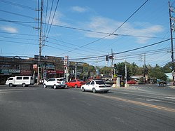
Laguna, officially the Province of Laguna, is a province in the Philippines located in the Calabarzon region in Luzon. Its capital is Santa Cruz while its largest city is the City of Calamba and the province is situated southeast of Metro Manila, south of the province of Rizal, west of Quezon, north of Batangas and east of Cavite. Laguna hugs the southern shores of Laguna de Bay, the largest lake in the country. As of the 2020 census, the province's total population is 3,382,193. It is the seventh richest province in the country in 2016.

Calabarzon, sometimes referred to as Southern Tagalog and designated as Region IV‑A, is an administrative region in the Philippines. The region comprises five provinces: Batangas, Cavite, Laguna, Quezon, and Rizal; and one highly urbanized city, Lucena. It is the most populous region in the Philippines, according to the Philippine Statistics Authority (PSA), having over 16.1 million inhabitants in 2020, and is also the country's second most densely populated after the National Capital Region. It is situated southeast of Metro Manila, and is bordered by Manila Bay and South China Sea to the west, Lamon Bay and the Bicol Region to the east, Tayabas Bay and the Sibuyan Sea to the south, and Central Luzon to the north. It is home to places like Mount Makiling near Los Baños, Laguna, and Taal Volcano in Batangas.

San Pablo, officially the City of San Pablo, is a 1st class component city in the province of Laguna, Philippines. According to the 2020 census, it has a population of 285,348 people.
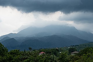
Los Baños, officially the Municipality of Los Baños, colloquialy 'elbi' or simply LB, is a 1st class municipality in the province of Laguna, Philippines. According to the 2020 census, it has a population of 115,353 people.

Calamba, officially the City of Calamba, is a 1st class component city in the province of Laguna, Philippines. According to the 2020 census, it has a population of 539,671 people making it the largest city in the province.

Teresa, officially the Municipality of Teresa, is a 2nd class municipality in the province of Rizal, Philippines. According to the 2020 census, it has a population of 64,072 people.

Bay, officially the Municipality of Bay, and colloquially known as Bae, is a 2nd class municipality in the province of Laguna, Philippines. According to the 2020 census, it has a population of 67,182 people.

Biñan, officially the City of Biñan, is a 1st class component city in the province of Laguna, Philippines. According to the 2020 census, it has a population of 407,437 people.

Kalayaan, officially the Municipality of Kalayaan, is a 3rd class municipality in the province of Laguna, Philippines. According to the 2020 census, it has a population of 24,755 people.

Cabuyao, officially the City of Cabuyao, is a 1st class component city in the province of Laguna, Philippines. According to the 2020 census, it has a population of 355,330 people.

Angono, officially the Municipality of Angono, is a 1st class urban municipality in the province of Rizal, Philippines. According to the 2020 census, it has a population of 130,494 people.

Jalajala, officially the Municipality of Jalajala, is a 4th class municipality in the province of Rizal, Philippines. According to the 2020 census, it has a population of 34,017 people, making it the least populated municipality in the province.

Canlubang is a major industrial zone located in the province of Laguna, Philippines. It was once a hacienda during the Spanish colonial period. Canlubang straddles two component cities of Laguna: Cabuyao, Calamba, the municipality of Silang in Cavite, and the town of Tagaytay.
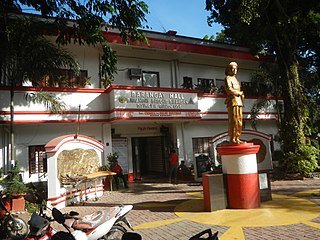
Bagong Silangan is a barangay located in the 2nd district of Quezon City, Philippines. Nearby barangays are Commonwealth, Batasan Hills and Payatas. Separated by a river in the east, the barangay leads to the Municipality of San Mateo in the province of Rizal.
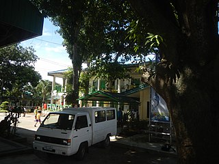
Punta is a rural barangay of Calamba, Laguna in the Philippines. It is situated in the central-south portion of the city.

Mayapa is an urban barangay, located to the east of Sirang Lupa and southeast of Canlubang in Calamba, Laguna, Philippines. It is next to the Mayapa-Canlubang exit of the South Luzon Expressway. As of the 2020 census, Mayapa had a population of 28,302.

Barandal is an industrial barangay of the city of Calamba in the province of Laguna, Philippines. It is geographically situated in the middle of the city. It houses various residential areas like Amaia Scapes by Ayala Land, Vista Hills by Filinvest Land, Calamba Hills Village Phase 2 by TESCO, Crescent Knoll by Major Homes, Laguna Buenavista Executive Homes by TESCO, Carmel Village Phase 2, Chateau Milano by TESCO, Andrea Paz Subdivision, and GK-Philipps Pabahay. The barangay is also the location of several companies in the Calamba Premier Industrial Park (CPIP).

Batino is a rural industrial barangay located at Calamba, Laguna, Philippines. Batino is located to the east of Barandal, south of Mayapa, north of Prinza and west of Paciano Rizal. Most of the establishments, if not all, are located on the west side of South Luzon Expressway (SLEX), leaving the east side of the barangay less developed than the west side of it, partly because the only access points are the SLEX and the Batino-Mayapa Road.
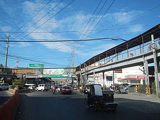
Calamba Poblacion, is a barangay district located at the east edge, in the city of Calamba, Laguna, Philippines. This district comprises seven barangays, Barangay I, II, III, IV, V, VI, VII. The Calamba Poblacion is bounded of Calamba River between Parian.

Mayapa–Canlubang Cadre Road, also known as Mayapa Road, is a two- to four-lane, tertiary national road, located in Calamba, Laguna in the Philippines. It spans 2.768 kilometers (1.720 mi) stretching from the "Checkpoint" area at the intersection with Manila South Road in barangay Paciano Rizal to Jose Yulo Sr. Avenue and Silangan Industrial Park Road in barangay Canlubang. This road adjoins the Canlubang Exit of South Luzon Expressway.
