
The Andaman and Nicobar Islands, a union territory of India, are a group of 836 objects, with 572 of them islands of which 38 are inhabited at the juncture of the Bay of Bengal and the Andaman Sea.

Gandhinagar is the capital of the state of Gujarat in India. Gandhinagar is located approximately 23 km north of Ahmedabad, on the west central point of the Industrial corridor between Delhi, the political capital of India, and Mumbai, the financial capital of India.

Manali is a resort town nestled in the mountains of the Indian state of Himachal Pradesh near the northern end of the Kullu Valley in the Beas River Valley. It is located in the Kullu district, about 270 km (168 mi) north of the state capital, Shimla, 309 km northeast of Chandigarh, and 544 km northeast of Delhi, the national capital. The small town, with a population of 8,096, is the beginning of an ancient trade route to Ladakh and from there over the Karakoram Pass on to Yarkand and Khotan in the Tarim Basin. It is a popular tourist destination and serves as the gateway to Lahaul and Spiti district as well as Leh.

Bharatpur is a city in the Indian state of Rajasthan. The city is situated 180 km (110 mi) south of India's capital, New Delhi, 178 km (111 mi) from Rajasthan's capital Jaipur, 55 km (34 mi) west of Agra of Uttar Pradesh and 38 km (24 mi) from Mathura of Uttar Pradesh. It is also the administrative headquarters of Bharatpur District and the headquarters of Bharatpur Division of Rajasthan State. Bharatpur is part of National Capital Region (NCR) of India. The city was the capital of the erstwhile, Bharatpur State. It became a municipal corporation with 65 wards in 2014.

Belur, is a Town Municipal Council and taluka in Hassan district in the state of Karnataka, India. The town is renowned for its Chennakeshava Temple, one of the finest examples of Hoysala architecture.

The National Capital Region (NCR) is a central planning region centred upon the National Capital Territory (NCT) of Delhi in India. It encompasses Delhi and several districts surrounding it from the states of Haryana, Uttar Pradesh and Rajasthan. The NCR and the associated National Capital Region Planning Board were created in 1985 to plan the development of the region and to evolve harmonized policies for the control of land-uses and development of infrastructure in the region. Prominent cities of NCR include Faridabad, Ghaziabad, Gurgaon, New Delhi and Noida.

Khordha district is an administrative division of the state of Odisha, India. It was formed on April 1, 1993, by the division of former Puri District into Puri, Khordha and Nayagarh districts. In the year 2000 the district name was changed to Khordha. The district headquarters is Khordha Town. The capital city of Bhubaneswar is located in this district. Khordha is the most urbanized of all the districts of Odisha. Khordha Road, the railway station that serves the town is also the divisional headquarters of the East Coast Railway of the Indian Railways. Khordha is known for its brass utensils, cottage industries, railway coach manufacturing, and cable manufacturing unit.

Thrissur is a district of Kerala situated in the central part of that state. Spanning an area of about 3,032 km2 (1,171 sq mi), Thrissur district is home to over 9% of Kerala's population.

Rajgad is a hill fort situated in the Pune district of Maharashtra, India. Formerly known as Murumdev, the fort was the capital of the Maratha Empire under the rule of Shivaji for almost 26 years, after which the capital was moved to the Raigad Fort. Treasures discovered from an adjacent fort called Torna were used to completely build and fortify the Rajgad Fort.
National Highway 44 is a major north–south National Highway in India, the longest in the country.
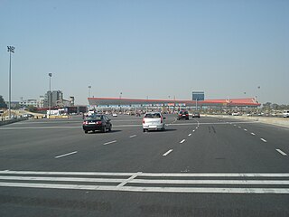
The Delhi-Gurugram Expressway on NH-48 is a 27.7 km (17.2 mi) six to eight lane expressway connecting the national capital, Delhi and the Millennium city of Gurgaon, Haryana in the National Capital Region of India. The expressway is a part of the Golden Quadrilateral project, which itself is a part of the National Highway Development Project. The ₹10 billion (US$140.2 million), 27.7 km (17.2 mi) brownfield expressway was opened in phases with the final section opening on January 23, 2008. This expressway is the busiest inter-city route in India and handles more than 180,000 PCUs daily. It starts at Dhaula Kuan in Delhi and terminates on the outskirts of Gurgaon. Gurgaon City is located at both sides of this Expressway.

Diggewadi is a village in Raybag taluk in Belgaum Panchayat in the southern state of Karnataka, India. The official language of Diggewadi is Kannada.
Halyal is a village in Belgaum district in the southern state of Karnataka, India. It is located 121 kilometres (75 mi) north of Belgaum, 10 kilometres (6.2 mi) from Athani, and 577 kilometres (359 mi) from the state capital of Bangalore.

National Highway 75 is one of major National Highway in India. passing through states of Karnataka, Andhra Pradesh, and Tamil Nadu. This national highway was earlier known as National Highway 48 (NH-48) before rationalisation of highway numbers in 2010. NH 48 connected the port city of Mangaluru (Mangalore) to the state capital of Karnataka at Bengaluru. NH-75 traveses all three geographical regions of Karnataka state namely Karavali, Malenadu and Bayaluseeme.

Turan is a small village in Phillaur tehsil of Jalandhar District of Punjab State, India. It is located 1 km (0.62 mi) away from the Apra-Banga road and 11 km (6.8 mi) away from the postal head office at Dosanjh Kalan. The village is 3 km (1.9 mi) away from the census town Apra, 16 km (9.9 mi) from Phillaur, 42 km (26 mi) from Jalandhar, and 120 km (75 mi) from the state capital Chandigarh. The village is administrated by Sarpanch who is elected representative of village.
Lohgarh is a medium size village in the Phillaur tehsil administrative region of Jalandhar District of Punjab State, India. It is located 3.5 km (2.2 mi) away from postal head office Apra. The village is 16.4 km (10.2 mi) away from Phillaur, 43 km (27 mi) from Jalandhar, and 120 km (75 mi) from the state capital Chandigarh. The village is administrated by a sarpanch who is an elected representative of the village as per the Panchayati raj (India) local government system.
Kadiana is a medium size village in Phillaur tehsil of Jalandhar District of Punjab State, India. It is located 4.4 km (2.7 mi) from Nagar, 10 km (6.2 mi) from Phillaur, 55 km (34 mi) from Jalandhar and 117 km (73 mi) from state capital Chandigarh. The village is administrated by a sarpanch who is an elected representative of village as per Panchayati raj (India).
Ladian or Ladhian is a village in Phillaur tehsil of Jalandhar District of Punjab State, India. It is located 36 km (22 mi) from postal head office Dosanjh Kalan, 9.8 km (6.1 mi) from Ludhiana, 53.4 km (33.2 mi) from Jalandhar and 108 km (67 mi) from state capital Chandigarh. The village is administrated by a Sarpanch, an elected representative of the village.

Padgampora is a village in Awantipora tehsil in Pulwama district of Jammu and Kashmir in India. It is located 11 km (6.8 mi) towards East from District headquarters Pulwama. 11 km (6.8 mi) from Tral. 25 km from State capital Srinagar.

