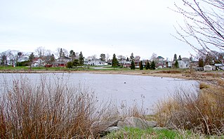
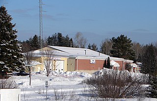
Blind River is a town situated on the North Channel of Lake Huron in the Algoma District, Ontario, Canada. The town, named after the nearby Blind River, celebrated its centennial in 2006.

The Seguin River is a river in Parry Sound District in central Ontario, Canada that empties into Parry Sound on Georgian Bay, Lake Huron at the town of Parry Sound. The river's name comes from the Ojibwe word ziigwan, meaning "spring".

Bala is a compact rural community in the township municipality of Muskoka Lakes, District Municipality of Muskoka in Central Ontario, Canada. It is well-known for the Bala Falls, the source of the Moon River, which flows from Lake Muskoka to the Georgian Bay.

Brent is a community on Cedar Lake on the Petawawa River in northern Algonquin Provincial Park and is located in geographic Deacon Township in the unorganized south part of Nipissing District in Northeastern Ontario, Canada.
Lost Channel is a ghost town in Parry Sound District, Ontario.

Nipissing is an incorporated (political) township in Parry Sound District in Central Ontario, Canada. It is on Lake Nipissing and is part of the Almaguin Highlands region. Nipissing was surveyed between 1874 and 1881, and was incorporated in 1888. Among the first settlers in the area were the Chapman and Beatty families. Nipissing Township annexed Gurd Township in 1970. The township also contains a community named Nipissing, which is located on the South River near Chapman's Landing, on the South Bay of Lake Nipissing. The township administrative offices are located in Nipissing.
Chapleau is a township in Sudbury District, Ontario, Canada. It is home to one of the world's largest wildlife preserves. Chapleau has a population of 1,942 according to the 2016 Canadian census.
Balaclava is a dispersed rural community in the township municipality of Bonnechere Valley, Renfrew County, in Eastern Ontario, Canada. It is on the former Ontario Highway 513 just off Ontario Highway 132 north of the community of Dacre, and at the outlet of Constant Creek, a tributary of the Madawaska River, from Constant Lake, approximately 30 minutes drive time from the town of Renfrew.

Highlands East is a township municipality located in Haliburton County, Ontario, Canada.
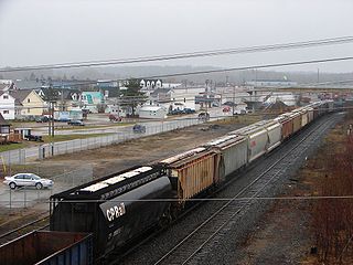
Foleyet is an unincorporated community in the Unorganized North Part of Sudbury District in Northeastern Ontario, Canada, midway between Chapleau and Timmins on Highway 101. The town was created during the construction of the Canadian Northern Railway (CNR) through the area in the early years of the 20th century.

Biscotasing, often referred to as simply Bisco, is a community in the Unorganized North Part of Sudbury District in Northeastern Ontario, Canada. It was founded on the shores of Lake Biscotasi on the Spanish River in 1884 by Canadian Pacific Railway as a railway construction town, and the first divisional point west of Sudbury. The rails of westward track laying gangs reached this area in October 1884.
Nairn and Hyman is a township in the Canadian province of Ontario. The township, located in the Sudbury District, borders on the southwestern city limits of Greater Sudbury west of the city's Walden district. The township had a population of 342 in the Canada 2016 Census.
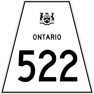
Secondary Highway 522, commonly referred to as Highway 522, is a provincially maintained highway in the Canadian province of Ontario. The highway is 109.6 kilometres (68.1 mi) in length, connecting Highway 69 near Cranberry with Highway 11 at the community of Trout Creek. Highway 522 serves as the only link between these two routes south of Highway 17 and north of Highway 124. It is often used to access Grundy Lake Provincial Park, a popular camping area for northbound travellers.
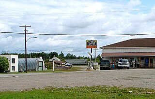
Britt is a community in the Canadian province of Ontario, located in the unincorporated township of Wallbridge in the Parry Sound District.
The Ottawa, Arnprior and Parry Sound Railway, or OA&PS, is a historic railway that operated in central and eastern Ontario, Canada from 1897 until 1959. It was, for a time, the busiest railway route in Canada, carrying both timber and wood products from today's Algonquin Provincial Park areas, as well as up to 40% of the grain traffic from the Canadian west from Depot Harbour at Parry Sound through to the St. Lawrence River valley.

South Algonquin is a township municipality in Nipissing District, Ontario, Canada. Located south of Algonquin Provincial Park, it is the sole populated portion of the district that lies south of the traditional dividing line between Northern Ontario and Southern Ontario and is closer connected to Renfrew County as opposed to the core portions of Nipissing District.
Benny is an unincorporated community in the geographic township of Moncrieff in the Unorganized North Part of Sudbury District in Northeastern Ontario, Canada. It is located on Bannerman Creek west of Ontario Highway 144 and about 11 kilometres (7 mi) northwest of the community of Cartier. Benny is on the Canadian Pacific Railway transcontinental main line and has a siding, and it is the location of the Benny railway station flag stop on the Via Rail Sudbury – White River train service.
Bervie is an unincorporated place and Compact Rural Community in the municipality of Kincardine, Bruce County in southwestern Ontario, Canada. It is located on Ontario Highway 9, and is on the Penetangore River, which flows to Lake Huron at the town centre of Kincardine.

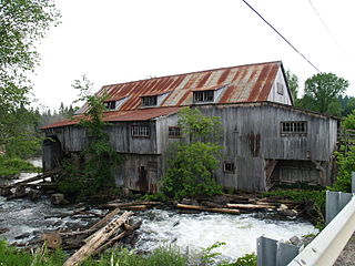
The Whitney and Opeongo Railway (W&OR) was a logging railway in Ontario, Canada. It ran from Opeongo Lake to Whitney, where it connected to the Canada Atlantic Railway (CAR), running a total distance of about 14 miles (23 km). It opened in 1902 and closed in the 1920s with the end of major logging operations in the area.
The Key Valley Railway was a logging railway built in Ontario, Canada. Opened in 1916, it ran 16 miles (26 km) eastward from the Canadian Pacific Railway (CPR) mainline at Pakesley, Ontario to the logging camp and mill at Lost Channel on the Pickerel River. The line operated until 1933, when plunging prices of wood during the Great Depression caused the company to enter bankruptcy. In 1935 the rails and rolling stock were sold for scrap while the locomotives were sold to other lines.
