
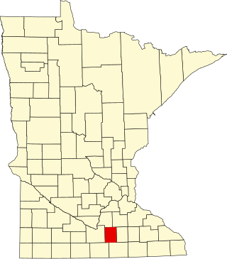
Waseca County is a county in the U.S. state of Minnesota. As of the 2020 census, the population was 18,968. Its county seat is Waseca.
Danville Township is a township in Blue Earth County, Minnesota, United States. The population was 262 as of the 2000 census.
McPherson Township is a township in Blue Earth County, Minnesota, United States. The population was 470 as of the 2000 census.
Medo Township is a township in Blue Earth County, Minnesota, United States. The population was 374 as of the 2000 census.

Waldorf is a city in Waseca County, Minnesota, United States. The population was 229 at the 2010 census.

Waseca is a city in Waseca County, Minnesota, United States. The population was 9,410 at the 2010 census. It is the county seat.

The Le Sueur River (lay-SEWER) is a tributary of the Blue Earth River, 111 miles (178 km) long, in southern Minnesota in the United States. Via the Blue Earth and Minnesota Rivers, it is part of the watershed of the Mississippi River, draining an area of 1,089 square miles (2,280 km2). It is the largest tributary of the Blue Earth River, draining 31% of its watershed.

The Straight River is a tributary of the Cannon River, 55.6 miles (89.5 km) long, in southeastern Minnesota, United States. Via the Cannon River, it is part of the watershed of the Mississippi River, draining an area of approximately 450 square miles (1,200 km2) in an agricultural region.

Palmers is an unincorporated community in Duluth Township, Saint Louis County, Minnesota, United States; located on the North Shore of Lake Superior.
Rodney Newell Searle Sr. was a Minnesota farmer, insurance agent, and public servant. Born and raised in urban New Jersey, Searle moved to rural Minnesota in 1947 with his wife Jane and their two young children. With no prior experience in agriculture, they moved to a farm, and soon were raising crops and livestock. He also became heavily involved in community activities.
Clover Valley is an unincorporated community in Duluth Township, Saint Louis County, Minnesota, United States.
This is a list of the National Register of Historic Places listings in Waseca County, Minnesota. It is intended to be a complete list of the properties and districts on the National Register of Historic Places in Waseca County, Minnesota, United States. The locations of National Register properties and districts for which the latitude and longitude coordinates are included below, may be seen in an online map.
Meriden is an unincorporated community in Meriden Township, Steele County, Minnesota, United States, near Owatonna and Waseca. The community is located along SW 92nd Avenue near SW 13th Street.
Wilton is an unincorporated community in Wilton Township, Waseca County, Minnesota, United States, near Waseca. The community is located near the junction of Waseca County Roads 4 and 23. The Le Sueur River flows through the community.
St. Mary is an unincorporated community in St. Mary Township, Waseca County, Minnesota, United States, near Waseca. The community is located near the junction of Waseca County Roads 9 and 29, and 320th Avenue. The Le Sueur River flows nearby.
Smiths Mill is an unincorporated community in Blue Earth and Waseca counties in the U.S. state of Minnesota. The community is located along 631st Avenue near 206th Street and U.S. Highway 14. Smiths Mill is located within Le Ray Township in Blue Earth County; and also located within Janesville Township in Waseca County. Nearby places include Janesville and Eagle Lake.
Otiscooh-TISS-koh) is an unincorporated community in Otisco Township, Waseca County, Minnesota, United States, near New Richland and Waseca. The community is located near the junction of Waseca County Road 15 and State Highway 13.
Matawan is an unincorporated community in Byron Township, Waseca County, Minnesota, United States, near New Richland. The community is located near the junction of Waseca County Roads 11 and 28. The Big Cobb River and the Little Cobb River both flow nearby.
Alma City is an unincorporated community in Waseca County, Minnesota, United States, south of Janesville.
Vista is an unincorporated community in Otisco Township, Waseca County, Minnesota, United States.


