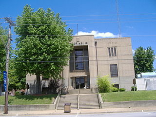
Ohio County is a county located in the U.S. state of Kentucky. As of the 2020 census, the population was 23,772. Its county seat is Hartford, and its largest city is Beaver Dam. The county is named after the Ohio River, which originally formed its northern boundary. It is a moist county, which means that the sale of alcohol is only legal within certain city limits.

McLean County is a county located in the U.S. state of Kentucky. As of the 2020 census, the population was 9,152. Its county seat is Calhoun and its largest city is Livermore. McLean is a prohibition or dry county. McLean County is part of the Owensboro, KY Metropolitan Statistical Area, which has a population of some 114,752.

Hancock County is a county located in the U.S. state of Kentucky. As of the 2020 census, the population was 9,095. Its county seat is in the city of Hawesville located in the Northern part of the county, and its largest city of Lewisport is located in the Northwestern part of the county.

Daviess County ( "Davis"), is a county in Kentucky. As of the 2020 census, the population was 103,312. Its county seat is Owensboro. The county was formed from part of Ohio County on January 14, 1815.

Daviess County is a county in the U.S. state of Indiana. As of the 2020 United States Census, the population was 33,381. The county seat is Washington. About 15% of the county's population is Amish of Swiss origin, as of 2017.

Jo Daviess County is the northwesternmost county in the U.S. state of Illinois. According to the 2020 census, it had a population of 22,035. Its county seat is Galena.

Owensboro is a home rule-class city in and the county seat of Daviess County, Kentucky, United States. It is the fourth-most populous city in the state. Owensboro is located on U.S. Route 60 and Interstate 165 about 107 miles (172 km) southwest of Louisville, and is the principal city of the Owensboro metropolitan area. The 2020 census had its population at 60,183. The metropolitan population was estimated at 116,506. The metropolitan area is the sixth largest in the state as of 2018, and the seventh largest population center in the state when including micropolitan areas.
Washington is a city in Daviess County, Indiana. The population was 12,017 at the time of the 2020 census. The city is the county seat of Daviess County. It is also the principal city of the Washington, Indiana Micropolitan Statistical Area, which comprises all of Daviess County and had an estimated 2017 population of 31,648.

Harrodsburg is a home rule-class city in Mercer County, Kentucky, United States. It is the seat of its county. The population was 9,064 at the 2020 census.
Utica is a small rural unincorporated community and census-designated place in Daviess County, Kentucky, in the United States. The population was 208 as of the 2020 census.

Elmore Township is one of ten townships in Daviess County, Indiana, United States. As of the 2010 census, its population was 1,113 and it contained 521 housing units.
Steele Township is one of ten townships in Daviess County, Indiana. As of the 2010 census, its population was 903 and it contained 399 housing units.
Philpot is an unincorporated community in Daviess County, in the U.S. state of Kentucky.
Yelvington is a small unincorporated community in the U.S. state of Kentucky, located approximately 12 miles east of Owensboro along U.S. Route 60 east and near the Daviess-Hancock county line.
Maceo is an unincorporated community and census-designated place (CDP) in Daviess County, Kentucky, United States. As of the 2020 census, the population was 404, down from the 2010 census population of 413.
Sorgho, Kentucky, originally named and known as Sorghotown, the boundaries of this unincorporated community were described in an order dated 12 May 1874, by Daviess County, Kentucky Judge Triplett, worded as follows: " Upon the application of ten voters to be effected by the change hereinafter specified; and it appearing to the Court right and proper that said change should be made; and further that the requirements of the law as to notice before application has been complied with, – it is therefore ordered that an additional voting precinct be and the same is hereby established in Daviess County (Kentucky), in District No. 1, to be called and known as 'Sorghotown Voting Place'...." The community was named for the Daviess County Sorgho Sugar Company which was formed there in 1868–'69 by Dr. J. Q. A. Stewart, J. Balee and E. Guthrie. that organized there in the winter of 1868–69 for the manufacturing of sorghum sugar. Once the factory was established the community began to develop.
Curdsville is an unincorporated community and census-designated place (CDP) located in Daviess County, Kentucky, United States. The population was 94 as of the 2020 census.
Saint Joseph is an unincorporated community located in Daviess County, Kentucky, United States. It is located around the intersection of Kentucky Route 56 and Kentucky Route 500.
Moseleyville is an census-designated place and unincorporated community located in Daviess County, Kentucky, United States. The population was 470 as of the 2020 census.
Pleasant Ridge is an unincorporated community and census-designated place (CDP) in Daviess and Ohio counties, Kentucky, United States. The population was 578 as of the 2020 census.


