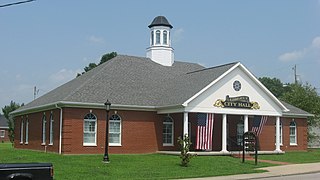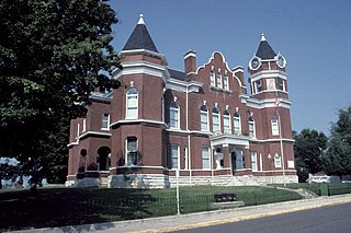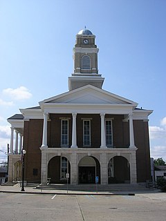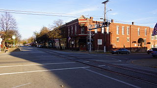
Liberty is a home rule-class city in Casey County, Kentucky, in the United States. It is the seat of its county. Its population was 2,168 at the 2010 U.S. census.

Flemingsburg is a home rule-class city in Fleming County, Kentucky, in the United States. The population was 2,658 at the 2010 census, down from 3,010 at the 2000 census. It is the seat of Fleming County.

Hickman is a city in and the county seat of Fulton County, Kentucky, United States. Located on the Mississippi River, the city had a population of 2,365 at the 2020 U.S. census and is classified as a home rule-class city. Hickman is part of the Union City micropolitan area.

Lancaster is a home rule-class city in Garrard County, Kentucky, in the United States. It is the seat of its county. As of the year 2010 U.S. census, the city population was 3,442.

Greensburg is a home rule-class city in and the county seat of Green County, Kentucky, United States. The population was 2,163 at the 2010 census, down from 2,396 at the 2000 census.

Audubon Park is a home rule-class city in central Jefferson County, Kentucky, United States. The population was 1,473 at the 2010 census. It is located about 5 miles (8 km) south of downtown Louisville and is surrounded on all sides by the city of Louisville.

Hodgenville is a home rule-class city in LaRue County, Kentucky, United States. It is the seat of its county. Hodgenville sits along the North Fork of the Nolin River. The population was 3,206 at the 2010 census. It is included in the Elizabethtown metropolitan area.

Hyden is a home rule-class city in and the county seat of Leslie County, Kentucky, United States. The population was 365 at the 2010 census. It is located at the junction of U.S. Route 421 and Kentucky Route 80, along the Middle Fork of the Kentucky River.

Kuttawa is a home rule-class city in Lyon County, Kentucky, in the United States. The population was 649 as of the 2010 census, up from 596 in 2000.

La Grange is a home rule-class city in Oldham County, Kentucky, in the United States. The population was 8,082 at the time of the 2010 U.S. census. It is the seat of its county. An unusual feature of La Grange is the CSX Transportation street-running mainline track on Main Street.

Livingston is a home rule-class city in Rockcastle County, Kentucky, in the United States. The population was 226 during the 2010 U.S. census. It is part of the Richmond-Berea micropolitan area.

Jamestown is a home rule-class city in Russell County, Kentucky, in the United States. It is the seat of its county. The population was 1,794 at the 2010 U.S. census.

Taylorsville is a home rule-class city in Spencer County, Kentucky, United States. It is the county seat of Spencer County. As of the 2010 census, the city had a total population of 763 and was estimated at 1,275 in 2018. It was incorporated in 1829.

Oneida is an unincorporated community and census-designated place (CDP) in Clay County, Kentucky, United States. Its population was 410 at the 2010 census. It is the home of Oneida Baptist Institute. Goose Creek, the Red Bird River, and Bullskin Creek confluence to form the South Fork of the Kentucky River a few hundred yards from the center of the town.
Summer Shade is a small unincorporated community and census-designated place (CDP) in Metcalfe County, Kentucky, United States. Originally the area was known as Sartain Precinct and later as Glover's Creek; W.M. Riggs, the postmaster, changed the name to Summer Shade in 1872. The rural-dominated area is home to the Kingsford Charcoal factory. State highway 90, connecting Glasgow to the Dale Hollow Lake area, runs through Summer Shade. There was one school in Summer Shade that is formerly known as Summer Shade Elementary School. It went from grades K-6. Now students go to Metcalfe County Elementary. One of the foremost doctors in south-central Kentucky and the state during the twentieth century was Dr. C.C. Howard, who was born in Summer Shade. He worked to establish tuberculosis hospitals throughout Kentucky and to improve medical care in the rural areas of the state.
Salvisa is a census-designated place in Mercer County, Kentucky, United States. Its population was 420 as of the 2010 census. Salvisa is located at the junction of U.S. Route 127 and Kentucky Route 1987, 10.7 miles (17.2 km) north of Harrodsburg. Salvisa has a post office with ZIP code 40372, which opened on April 4, 1825.
Lovelaceville is a census-designated place (CDP) in Ballard County, Kentucky, United States. The population was 972 at the 2010 census. The town is named after Elias and Andrew Lovelace who settled and raised their families there back around 1830. The Lovelace family came from North and South Carolina, after immigrating from England.
Keene is a home rule-class city located in Jessamine County, Kentucky, in the United States. It is home to the Keene Springs Hotel. The U.S. Census Bureau does not record Keene as a city and does not publish a population figure for the community.

Freeburn is a census-designated place, unincorporated community and coal town in Pike County, Kentucky, United States.
Dunmor is an unincorporated community and census-designated place (CDP) in Muhlenberg and Logan counties, Kentucky, United States. As of the 2010 census it had a population of 317.


