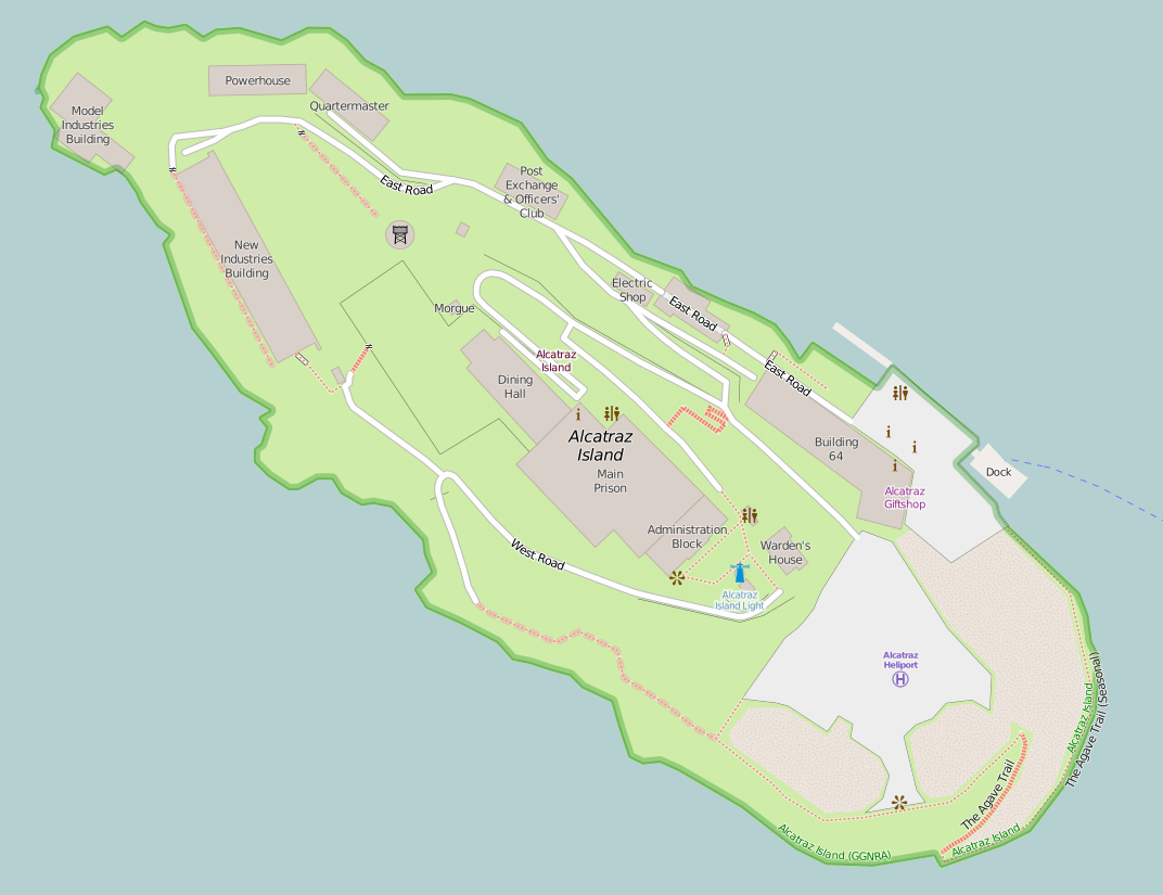
The Parade Grounds is a large concrete open area on the south end of Alcatraz Island, off the coast of San Francisco, USA. They lie beyond Building 64. They were originally built in the 1860s on a barren site by the U.S. military who used the site for military drills and parades. [1]

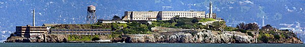
Alcatraz Island is located in San Francisco Bay, 1.25 miles (2.01 km) offshore from San Francisco, California, United States. The small island was developed with facilities for a lighthouse, a military fortification, a military prison, and a federal prison from 1934 until 1963. Beginning in November 1969, the island was occupied for more than 19 months by a group of Native Americans from San Francisco, who were part of a wave of Native activism across the nation, with public protests through the 1970s. In 1972, Alcatraz became part of a national recreation area and received designation as a National Historic Landmark in 1986.

San Francisco, officially the City and County of San Francisco, is a city in, and the cultural, commercial, and financial center of, Northern California. San Francisco is the 13th-most populous city in the United States, and the fourth-most populous in California, with 883,305 residents as of 2018. It covers an area of about 46.89 square miles (121.4 km2), mostly at the north end of the San Francisco Peninsula in the San Francisco Bay Area, making it the second-most densely populated large US city, and the fifth-most densely populated U.S. county, behind only four of the five New York City boroughs. San Francisco is also part of the fifth-most populous primary statistical area in the United States, the San Jose–San Francisco–Oakland, CA Combined Statistical Area.

Building 64, also known as the Building #64 or the Building 64 Residential Apartments, was the first building constructed on the island of Alcatraz off the coast of San Francisco, USA, entirely for the purpose of accommodating the military officers and their families living on the island. Located next to the dock on the southeastern side of the island below the Warden's House, the three-story apartment block was built in 1905 on the site of a U.S. Army barracks which had been there from the 1860s. It functioned as the Military Guard Barracks from 1906 until 1933. One of its largest apartments in the southwest corner was known as the "Cow Palace" and a nearby alleyway was known as "Chinatown".
After the island became a Federal Penitentiary in 1934, the Parade Grounds was used as a playground, especially on weekends and holidays, and was used host special events, often organized by the Officer's Club. [2] As the nearby Building 64 aged and fell into disrepair, the operators of the prison funded several new residential blocks on the square. [3] Gardens were developed around them, and handball and weightlifting facilities developed for the employees and their families. [4] The children living in the quarters on the Parade Ground were known to other children and their families on Alcatraz as "the topside kids" because they lived above those residing in Building 64 on the dock below. [5]

The Social Hall, also known as the Officers' Club, was a social club located on the northwestern side of the island of Alcatraz, off the coast of San Francisco, USA. Located in close proximity to the Power House, water tower and Former Military Chapel, it formerly housed the post exchange. The club was a social venue for the Federal Penitentiary workers and their families on the island to unwind after a hard week's work dealing with America's most hardened criminals after they'd been locked up at 17:30. It was burned down by a fire of disputed origins during the Occupation of Alcatraz in 1970; leaving a shell which still remains.
The island ceased use as a jail in 1963 and the residential buildings and gardens which were added were razed to the ground by the General Services Administration in the 1970s, but the foundation marks can still be seen. [4]

The General Services Administration (GSA), an independent agency of the United States government, was established in 1949 to help manage and support the basic functioning of federal agencies. GSA supplies products and communications for U.S. government offices, provides transportation and office space to federal employees, and develops government-wide cost-minimizing policies and other management tasks.