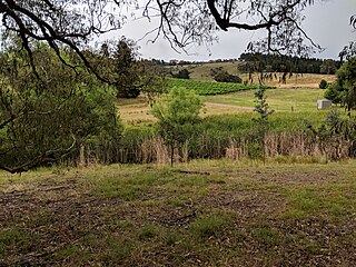
Lake George is an endorheic lake in south-eastern New South Wales, Australia. It is approximately 40 kilometres (25 mi) north-east of Canberra located adjacent to the Federal Highway en route to Goulburn and Sydney. Lake George is also the name of a locality on the western and southern edges of the lake, within the area of the Queanbeyan–Palerang Regional Council.

The Yass River, a perennial river that is part of the Murrumbidgee catchment within the Murray–Darling basin, is located in the Southern Tablelands and South Western Slopes districts of New South Wales, Australia.
Bannaby is a locality in the Southern Tablelands of New South Wales, Australia in Upper Lachlan Shire. It is located near the township of Taralga, on the Bannaby road. At the 2016 census, it had a population of 36.

Bulahdelah is a town and locality in the Hunter/Mid North Coast region of New South Wales, Australia in the Mid-Coast Council local government area. At the 2016 census, the locality had a population of 1,424. The main population centre, where 69% of the area's population lived in 2006, is the town of Bulahdelah.

Argyle County was one of the original Nineteen Counties in New South Wales and is now one of the 141 Cadastral divisions of New South Wales. It includes the area around Goulburn. It is bounded by Lake George in the south-west, the Shoalhaven River in the east, and the Wollondilly River in the north-east.

The Parish of Marulan is a parish of Argyle County located with the Goulburn Mulwaree local government area, which includes the towns of Marulan and Marulan South. The parish is bounded by Barbers Creek to the east, a small part of the Shoalhaven River to the south-east, and Jerrara Creek to the south. The Hume Highway and the Southern Highlands railway line run through the parish. Jerrara Road and Marulan South Road are other main roads in the area.

The Parish of Lake George is an Australian parish of the County of Murray which covers Lake George and part of the surrounding area. It is at the northern boundary of the county, with Argyle to the north-east. The Federal Highway runs through the parish where it runs to the west of the lake. Some parish maps of the area just record it as a lake and not as a parish, however it does have separate parish maps.

The Parish of Tarago is a parish of Argyle County. It does not actually contain the town of Tarago, which is located further to the south-east in the Parish of Mulwaree. The Parish was built by the Department of Lands in New South Wales.
The Parish of Wologorong is a parish of Argyle County, New South Wales, Australia.

The Parish of Towrang is a parish of Argyle County located to the south-east of Goulburn, and including some of its outer suburbs such as Goulburn North, and the area to the east of the Wollondilly River and Mulwaree Ponds. The Goulburn War Memorial is also located in this parish. The village of Towrang is located at the north-eastern edge of the parish, with Towrang creek part of the boundary in this area.
The Parish of Nattery is a parish of Argyle County located between Goulburn and Marulan in New South Wales. It is just east of the village of Towrang and includes the locality of Carrick. The Wollondilly River is the boundary in the north-west. Jerraba creek is part of the boundary in the south-east. The Southern Highlands railway line runs through the northern end of the parish, to the east of the Wollondilly river. The Hume Highway passes through the middle of the parish.
Big Hill is a bounded rural locality in Upper Lachlan Shire to the north of Marulan in the Southern Tablelands of New South Wales, Australia. At the 2016 census, it had a population of 44.
The parish of Algalah is an Australian cadastral parish in the NSW county of Narromine. It is located 367km west north west from Sydney approximately midway between Tottenham and Narromine and is in Narromine Shire, at 32°14′54″S147°49′04″E.

Currawang is a locality in the Queanbeyan–Palerang Regional Council, on the edges of Upper Lachlan Shire and Goulburn-Mulwaree Council, in New South Wales, Australia. It is located to the north of Lake George. It shares its name with the Currawang Parish of Argyle County, in which it is located. This was formerly known as the parish of Currowang. Both names derive from an Aboriginal word for the spearwood tree.

Nanima is a locality in the Yass Valley Council area, New South Wales, Australia. It lies on both sides of the Murrumbateman Road between Murrumbateman and Gundaroo, about 37 km north of Canberra. At the 2016 census, it had a population of 165.
Yarrangobilly, New South Wales is a rural locality in the Snowy Mountains, west of Canberra, Australia, and is also a civil Parish of Buccleuch County.
Nelanglo Parish is a civil parish of King County, New South Wales.
Ellenden Parish, is a civil parish of Murray County, New South Wales.


