The Hume Highway, inclusive of the sections now known as the Hume Freeway and Hume Motorway, is one of Australia's major inter-city national highways, running for 840 kilometres (520 mi) between Melbourne in the southwest and Sydney in the northeast. Upgrading of the route from Sydney's outskirts to Melbourne's outskirts to dual carriageway was completed on 7 August 2013.

The Wollondilly River, an Australian perennial river that is part of the Hawkesbury–Nepean catchment, is located in the Southern Tablelands and Southern Highlands regions of New South Wales. The river meanders from its western slopes near Crookwell, flowing south-east through Goulburn, turning north-east to near Bullio, flowing north-west to Barrallier, before finally heading north-easterly into its mouth at Lake Burragorang.

Towrang is a village in the Southern Tablelands of New South Wales, Australia, in Goulburn Mulwaree Council. It is approximately 13 kilometres (8.1 mi) before Goulburn on the Hume Highway 180 kilometres (110 mi) south from Sydney. At the 2016 census, Towrang had a population of 171.

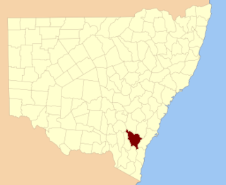
Murray County was one of the original Nineteen Counties in New South Wales and is now one of the 141 Lands administrative divisions of New South Wales. It included the area which is now part of Canberra and as far north as Lake George and Yass. It was originally bounded on the west by the Murrumbidgee River, on the east by the Shoalhaven River and on the north by the Yass River. A large area of the county was transferred to the Commonwealth government in 1909 in the Seat of Government Acceptance Act to make part of the Australian Capital Territory, along with land in Cowley County. Since then, the ACT border is now part of the western boundary. Part of the ACT border is determined by property boundaries in the Parish of Keewong, in the County of Murray; specifically the southern end of portions 177, 218, 211, 36, and 38. This is mentioned in the Seat of Government Acceptance Act of 1909.

Argyle County was one of the original Nineteen Counties in New South Wales and is now one of the 141 Cadastral divisions of New South Wales. It includes the area around Goulburn. It is bounded by Lake George in the south-west, the Shoalhaven River in the east, and the Wollondilly River in the north-east.

Amungula Parish is a parish of Murray County, New South Wales, a cadastral unit for use on land titles. It is located in two non-contiguous sections, divided by the Australian Capital Territory, as most of the parish was transferred to the ACT in 1909 and now makes up much of the Kowen district. The northern section, the larger of the two, is located just to the south of Wamboin around 35°15′50″S149°17′29″E; the southern, a section of land between the Goulburn-Queanbeyan railway and the Molonglo River around 35°20′48″S149°19′49″E. Before 1909, the Molonglo River was the southern boundary of the parish. The Kings Highway passes through a small part of the southern remaining portion. It was formerly located in Yarrowlumla Shire, but is now located in Queanbeyan-Palerang Regional Council.

Carwoola Parish is a parish of Murray County, a cadastral unit for use on land titles. It is located to the south of the Australian Capital Territory and to the south-east of Queanbeyan. The original northern and eastern boundary was the Molonglo River; this is still the boundary for most of the parish, except in the north, where the relatively small area north of the Queanbeyan-Goulburn railway line was transferred to the ACT in 1909. The south-western boundary is the Queanbeyan River. Captain's Flat Road is the major road running through the parish. The area also roughly aligns with the locality of Carwoola.

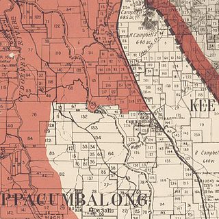
Keewong Parish is a parish of Murray County, New South Wales, a cadastral unit for use on land titles. A small part of the north-western end of the parish around 35°34′40″S149°07′28″E between the Murrumbidgee River and the Queanbeyan-Cooma railway line was transferred to the Australian Capital Territory in 1909. The southern ends of portions 177, 218, 211, 36, and 38 in the Parish of Keewong form part of the border of the ACT with New South Wales, which is mentioned in the Seat of Government Acceptance Act of 1909.

The Parish of Marulan is a parish of Argyle County located with the Goulburn Mulwaree local government area, which includes the towns of Marulan and Marulan South. The parish is bounded by Barbers Creek to the east, a small part of the Shoalhaven River to the south-east, and Jerrara Creek to the south. The Hume Highway and the Southern Highlands railway line run through the parish. Jerrara Road and Marulan South Road are other main roads in the area.
The Parish of Wamboin is a parish of the County of Murray, a cadastral unit for use on land titles. It is located just to the north-east of the Australian Capital Territory and includes part of the town of Bungendore on the eastern edge and the rural community of Wamboin near the south-western edge.

The Parish of Tarago is a parish of Argyle County. It does not actually contain the town of Tarago, which is located further to the south-east in the Parish of Mulwaree. The Parish was built by the Department of Lands in New South Wales.
The Parish of Wologorong is a parish of Argyle County, New South Wales, Australia.

The Parish of Goulburn is a parish of Argyle County which includes most of the city of Goulburn, New South Wales.
The Parish of Nattery is a parish of Argyle County located between Goulburn and Marulan in New South Wales. It is just east of the village of Towrang and includes the locality of Carrick. The Wollondilly River is the boundary in the north-west. Jerraba creek is part of the boundary in the south-east. The Southern Highlands railway line runs through the northern end of the parish, to the east of the Wollondilly river. The Hume Highway passes through the middle of the parish.

Manangle Parish, Cumberland is one of the 57 parishes of Cumberland County, New South Wales, a cadastral unit for use on land titles. Its eastern boundary is the Georges River, and western boundary the Nepean River. It includes the southern Sydney suburbs of Menangle Park, Gilead, Rosemeadow and part of Glen Alpine. Major roads in the area include the South Western Freeway, Menangle Road and Appin Road.
The Mulwaree River, a perennial river that is part of the Hawkesbury-Nepean catchment, is located in the Southern Tablelands region of New South Wales, Australia.
Toongabbie Creek, an urban watercourse that is part of the Parramatta River catchment, is located in Greater Western Sydney, New South Wales, Australia.

The Parish of Baw Baw is a parish of Argyle County, New South Wales, Australia. It is located in to the west of Goulburn, in Goulburn Mulwaree Council at 34°42′54″S, 149°38′04″E.

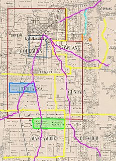
Tirrannaville is a locality in the Goulburn Mulwaree Council, New South Wales, Australia. It is located about 11 km south of Goulburn on the road to Braidwood. It was formerly called Terranna, which is the name of the parish covering most of the locality. The northern part of the defined locality, including the small settlement of Tirrannaville and cemetery, is in the parish of Goulburn. At the 2016 census, it had a population of 237. The locality mostly consists of grazing land.

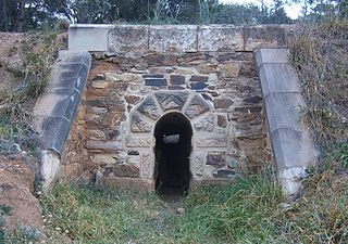
Towrang Convict Stockade is a heritage-listed former convict stockade on the Old Hume Highway at Towrang, Goulburn Mulwaree Council, New South Wales, Australia. It was built from 1838 to 1843 by convict gangs. It was added to the New South Wales State Heritage Register on 1 February 2013.


