History
Park Gate was developed around Swanwick railway station and was a distribution hub for local strawberries that were grown in the area. In 1913, at the peak of strawberry production, more than 3,000 tons of strawberries were sent from local fields every week to be distributed from the station. Strawberry distribution stopped in 1966, however, the railway station remains, and even though fruit and vegetables are still grown in the area, the present landscape is dominated by housing. The Station Master's House adjacent to the railway station has since become a restaurant.
In 1944, Park Gate played host to convoys of Canadian soldiers and tanks who were stationed along Botley Road adjacent to Fair View Terrace, waiting for their orders for the Normandy D-Day landings. During this time, there was an account of a V1 rocket landing in the Duncan Road area, causing some of the Canadian ammunition trucks to catch fire and explode.
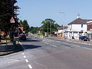
In the late 1980s, Park Gate along with neighbouring Locks Heath, became a growth sector for southern Hampshire with modern businesses moving to nearby Segensworth. With Junction 9 of the M27 within easy reach, Park Gate has become a base for commuting East to Portsmouth, West to Southampton and North to Winchester, Andover and Basingstoke.

Twickenham is a suburban district in London, England. It is situated on the River Thames 9.9 miles (15.9 km) southwest of Charing Cross. Historically part of Middlesex, it has formed part of the London Borough of Richmond upon Thames since 1965, and the borough council's administrative headquarters are located in the area.
Fareham is a market town at the north-west tip of Portsmouth Harbour, between the cities of Portsmouth and Southampton in south east Hampshire, England. It gives its name to the Borough of Fareham. It was historically an important manufacturer of bricks, used to build the Royal Albert Hall, and grower of strawberries and other seasonal fruits. In 2011 it had a population of 42,210.
Portchester is a village in the borough of Fareham in Hampshire, England. It is 4 miles (6.4 km) northwest of Portsmouth and around 18 miles east of Southampton on the A27 road. Its population according to the 2011 United Kingdom census was 17,789.

Chadwell Heath is an area of Dagenham in East London, England. It is split between the London Borough of Barking and Dagenham and the London Borough of Redbridge, around 2 miles (3.2 km) west of Romford and 4 miles (6.4 km) east of Ilford, and 12 miles (19 km) north-east of Charing Cross.
Whiteley is a planned community of 6,500 homes in the county of Hampshire, England, United Kingdom near Fareham. The development straddles the boundary between two council districts: the Borough of Fareham to the south and east, and the city of Winchester to the north and west.
Hedge End is a town and civil parish in Hampshire, England. Situated to the east of the City of Southampton, it adjoins the districts of West End and Botley. Hedge End lies within the Borough of Eastleigh and is part of the Southampton Urban Area. The original hamlet developed on Botley Common after 1250 when it was granted to the men of Botley as common pasture. In 1267, royal charters allowed Botley to hold an annual fair and a weekly market on the common which eventually became a market town.

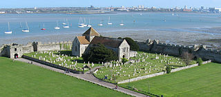
Netley, officially Netley Abbey, is a village on the south coast of Hampshire, England. It is situated to the south-east of the city of Southampton, and flanked on one side by the ruins of Netley Abbey and on the other by the Royal Victoria Country Park.

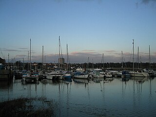
Warsash is a village in southern Hampshire, England, situated at the mouth of the River Hamble, west of the area known as Locks Heath and south of Sarisbury. Boating plays an important part in the village's economy, and the village has a sailing club. It is also home to the Warsash Maritime Academy, part of Southampton Solent University, which provides training for Merchant Navy Officers from around the world.
Hampshire's total economy is the largest economy in England outside London, providing almost 3% of total GDP for the UK as a whole.

Funtley – from the Anglo-Saxon, "Funtaleg", "spring field (clearing)", is a hamlet or exurb north of Fareham, Hampshire, England. It forms a projection towards the South Downs National Park and is generally included within Fareham's population as it is within its built-up area. At present the village is unparished, as the creation of a parish council was rejected by Fareham Borough Council, despite having the support of the majority of residents.
Buriton is a village and civil parish in the East Hampshire district of Hampshire, England. It is located 2 miles (3.3 km) south of Petersfield.

Locks Heath Football Club is a football club based in Fareham suburb of Locks Heath, Hampshire, England. The club is affiliated to the Hampshire Football Association. The club is an FA Charter Standard club. They won the Hampshire League title in 1991. They are currently members of the Hampshire Premier League Senior Division and play their home games at Locks Heath Recreation Ground, Warsash Road, Fareham.
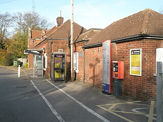
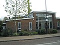
Swanwick railway station is a railway station in Fareham, Hampshire, England. Despite its name, it is actually located in Park Gate, one mile south of Swanwick.

Sholing, previously Scholing, is a district on the eastern side of the city of Southampton in Southern England. It is located between the districts of Bitterne, Thornhill and Woolston.

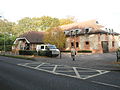
Locks Heath is a residential suburb of Fareham, in the south of Hampshire, England. Locks Heath is immediately surrounded by a collection of villages including Sarisbury to the west, Swanwick, Park Gate and Whiteley to the north, Warsash to the southwest and Titchfield to the southeast. Within the heart of the area its shopping village is located with a community centre. The population of the village itself in 2011 was 7,104 whilst the wider Locks Heath residential area equaled 43,359 as of 2011.

Sarisbury is a village to the west of Park Gate within the borough of Fareham, Hampshire, in the south of England. Its focal point is Sarisbury Green and the parish church of St Paul, formerly part of Titchfield parish. In previous times it was a rural locality dependent on fruit growing. At the 2011 Census the population of the ward was 7,385. Nearby villages include Bursledon, Hamble-le-Rice and Swanwick.
Segensworth is a business park near Whiteley and Fareham in Hampshire in England. At the 2011 Census the business park was included in the Park Gate Ward of Fareham Council.