
Madhepura district is one of the thirty-eight districts of Bihar state, India, and Madhepura town is the administrative headquarters of this district. Madhepura district is a part of Kosi division.

Katihar district is one of the thirty-eight districts of Bihar state in India, and Katihar city is the administrative headquarters of this district. The district is a part of Purnia Division. It is prominently known for its Katihar Junction Railway Station, which is a Category A station on the Barauni–Guwahati line. It has been included in the Aspirational Districts Program of the Government of India since 2018, to improve its socio-economic indicators.

Bhagalpur district is one of the thirty-eight districts of Bihar state, India. Bhagalpur is the oldest district of Bihar. Bhagalpur city is the administrative headquarters of this district.

Saharsa is one of the thirty-eight districts of Bihar, India. Saharsa city is the administrative headquarters of this district. Saharsa district is a part of the Kosi Division and it became a district on 1 April 1954 and has subsequently become smaller with other districts being carved from it, most notably Madhepura in 1981.

Bhagalpur division is one of the nine administrative units of Bihar, a state in the east of India. Bhagalpur city is the headquarters of the division. Established in 1765, it is oldest division of the state
Banka is one of the thirty-eight districts of the state of Bihar in India. The district headquarters of Banka is situated in Banka town. The district was established on 21 February 1991.

Bhagalpur, historically known as Champa Nagri, is a city in the Indian state of Bihar, situated on the southern bank of the Ganges river. It is the third largest city of Bihar by population and also serves the headquarters of Bhagalpur district, Bhagalpur division & Eastern Range. It is known as the Silk City & also listed for development under the Smart Cities Mission by Government of India. It is the only district in Bihar after capital city Patna where three major higher educational institutions IIIT, TMBU & Agriculture University(BAU) are located and also Vikramshila Central University is under construction next to the ruins of ancient Vikramshila University. Bhagalpur Railway Station serves the city. The river around city is home to the Gangetic dolphin, the National Aquatic Animal of India, and the Vikramshila Gangetic Dolphin Sanctuary is established near the town. The city holds the largest Manasa Puja and one of the largest processions in Kali Puja, an intangible cultural heritage of the region.
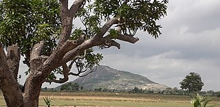
Dharhara is a village in the Gopalpur sub division of Bhagalpur district of Bihar, India. There is a tradition of plantation when a girl is born in any family of this village. The occupation of this village is agriculture.
Pirpainti is a town and a notified area in Bhagalpur district in the Indian state of Bihar. It is a block of the Bhagalpur district and also a vidhansabha.
Saraiyahat is a community development blocks that forms an administrative division in the Dumka Sadar subdivision of the Dumka district, Jharkhand state.
Hansdiha is a village in the Saraiyahat community development block which is an administrative division in the Dumka Sadar subdivision of the Dumka district, Jharkhand state of India.
Khajuria is a village in the Sonhaula Block of the Colgong Tehsil of the Bhagalpur District of the Indian state of Bihar State. It is located approximately 42 kilometres (26 mi) west of Bhagalpur, the district headquarters and approximately 265 kilometres (165 mi) from the state capital Patna.
Maura, or Moura Jharkaha, is a village in Shankarpur Block, Madhepura District, Bihar, India. It is located on the north of the district, approximately 19 kilometres northeast of the district capital Madhepura, and 5 kilometres north of the block capital Shankarpur. As of 2011, it has a population of 42,528.
Kharik is a village and the administrative center of Kharik Block, Bhagalpur District, Bihar, India. It is located on the northern part of the district, approximately 14 kilometres north of the district capital Bhagalpur. In 2011, It has 42,354 inhabitants.
Shankarpur Khawas is a village in Colgong Block, Bhagalpur District, Bihar, India. It is situated near the state border with Jharkhand, about 16 kilometres east of the district seat of Bhagalpur, and 12 kilometres southwest of the block seat of Kahalgaon. In 2011, it had a population of 38,852.
Saidpur Dabra is a village in Gopalpur Block, Bhagalpur District, Bihar, India. It is located near the state boundary with Jharkhand, about 21 kilometres northeast of the district seat Bhagalpur, and 19 kilometres northeast of the block seat Gopalpur. In the year 2011, it has a total population of 37,101.
Rarhi is a village in Jale Block, Darbhanga District, Bihar, India. It is located near the northern border of the country, about 27 kilometres northwest of the district capital Darbhanga, and 5 kilometres south of the block capital Jale, Bihar. In the year 2011, it has a population of 36,569.
Cheraut, or Charaut, is a town and the administrative center of Choraut Block, Sitamarhi District, Bihar, India. It is near India's northern border with Nepal, approximately 30 kilometres east of the district capital Sitamarhi. With a population of 35,976 in 2011, it is the most populous settlement within Choraut Block.
Partapnagar is a village in Chhatapur Block, Supaul District, Bihar, India. It is situated near India's northern border with Nepal, about 49 kilometres northeast of the district seat Supaul, and 9 kilometres northeast of the block seat Chhatapur. The village had a total population of 2,504 as of the 2011 census.
Kita Chauhattar is a village in Maner Block, Patna District, Bihar, India. It is situated by the district boundary with Bhojpur District, about 27 kilometres west of the district seat Patna, and 2 kilometres north of the block seat Maner. The population of the village was 35,608 in 2011.

