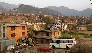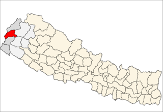
Budhanilkantha is a municipality in Kathmandu District in the Province No. 3 of Nepal that was established on 2 December 2014 by merging the former Village development committees Chapali Bhadrakali, Mahankal, Bishnu, Chunikhel and Kapan. The city is situated at the foot of Shivapuri hill. At the time of the 2011 Nepal census, it had a population of 15,421.

Dakshinkali is a municipality in Kathmandu District in the Province No. 3 of Nepal that was established on 2 December 2014 by merging the former Village development committees Chalnakhel, Chhaimale, Sheshnarayan, Sokhek, Talku Dudechaur and Old-Dakshinkali. The municipality's name means 'Southern Kali' and refers to a several centuries old temple complex that lies in the vicinity.
Rupakot is a village development committee in Tanahu District in the Gandaki Zone of central Nepal. At the time of the 1991 Nepal census it had a population of 4765 people living in 937 individual households. The VDC has been merged with existing Bhanu village development committees(VDCs), Barbhanjyang village development committees (VDCs) Tanahunsur Village Development Committee, Purkot VDC, Mirlung VDC, Satiswara VDC, Risti VDC, Basantapur VDC and Chok Chisapani VDC on 19 September 2015 to form Bhanu Municipality.

Phidim Municipality is the headquarters of the Panchthar District in the Mechi Zone of eastern Nepal. Phidim was upgraded into 'municipality' from 'village' when a development committee merged with other vdcs - including Phidim, Chokmagu and Siwa villages - on 18 May 2014. It serves as a route for trekkers and locals who travel to and from the Taplejung district bordering with the Tibetan Autonomous Region of China. It is also a commercial hub for the rural people of the district.

Gardi was a village development committee in Chitwan District in the Narayani Zone of mid-southern Nepal before merging into Madi Municipality. At the time of the 1991 Nepal census it had a population of 9544 people living in 1620 individual households. Sitalpur (सितलपुर) is the largest village inside Gardi.

Shivasatakshi is a municipality in the southeastern part of Jhapa District in the Mechi Zone of eastern Nepal. The new municipality was formed by merging two existing villages—Shivaganj and Satasidham—on 2 Dec 2014. The office of the municipality is that of the former Satasidham village development committee (VDC).

Mahakali, formerly Dodhara-Chandani, is a municipality in Nepal.

Mithila is a municipality in Danusha District in the Janakpur Zone of south-eastern Nepal. After the government announcement the municipality was established on 2 December 2014 by merging the existing Begadawar, Nakatajhijh and Dhalkebar village development committees (VDCs). At the time of the 2011 Nepal census after merging the three VDCs population it had a total population of 31,575 persons. After the government decision the number of municipalities has reached 191 in Nepal.

Deumai is a municipality in the eastern development region of Ilam District in the Mechi Zone of Nepal. The new municipality was formed by merging two existing villages Mangalbare and Dhuseni on 02 Dec 2014. The office of the municipality is that of the former Mangalbare village development committee.

Gokarneshwar is a municipality in Kathmandu District in the Province No. 3 of Nepal that was established on 2 December 2014 by merging the former Village development committees Sundarijal, Nayapati, Baluwa, Jorpati and Gokarna. The office of the municipality is that of the former Jorpati village development committee.

Chandragiri is a municipality in Kathmandu District in the Province No. 3 of Nepal that was established on 2 December 2014 by merging the former Village development committees Baad Bhanjyang, Balambu, Dahachok, Mahadevsthan, Machhegaun, Matatirtha, Naikap Naya Bhanjyang, Naikap Purano Bhanjyang, Satungal, Thankot and Tinthana. The urban administration is located in Old-Balambu. The city's main attractions include Chandragiri Hill, Nepal with its Cable Car.

Kageshwari-Manohara is a municipality in Kathmandu District in the Province No. 3 of Nepal that was established on 2 December 2014 by merging the former Village development committees Aalapot, Bhadrabas, Daanchhi, Gagalphedi, Gothatar and Mulpani. The office of the municipality is that of the former Daanchhi village development committee. Krsihnahari Thapa of CPN-UML is Mayor and Bindu Simkhada also of CPN-UML is Deputy mayor of this municipality. They both were elected on Nepalese local elections, 2017.

Tokha is a municipality in Kathmandu District in the Province No. 3 of Nepal that was established on 2 December 2014 by merging the former Village development committees Dhapasi, Jhor Mahankal, Gongabu, Tokha Chandeshwari and Tokha Saraswati on 2 December 2014. The municipality derives its name from the historical town of Tokha.

Nagarjun is a municipality in Kathmandu District in the Province No. 3 of Nepal that was established on 2 December 2014 by merging the former Village development committees Bhimdhunga, Ichangu Narayan, Ramkot, Syuchatar and Sitapaila. The office of the municipality is located at Harisiddhi Sitapaila. Previously there were 14 wards in the municipality. After implementation of federalism, it has been now decreased to 10 wards.

Shankharapur is a municipality in Kathmandu District in the Province No. 3 of Nepal that was established on 2 December 2014 by merging the former Village development committees Bajrayogini, Indrayani, Lapsiphedi, Naglebhare, Pukhulachhi and Suntol. The office of the municipality is that of the former Pukhulachhi village development committee in the old Newari town of Sankhu. In the Local Level Election 2074, Suwarna Shrestha of Communist Party of Nepal was elected as mayor securing 4,833 votes and Sukralaxmi Shrestha of Communist Party of Nepal was elected as Deputy Mayor securing 4,501 votes.

Tarakeshwar " तारकेश्वर " is a municipality in Kathmandu District in the Province No. 3 of Nepal that was established on 2 December 2014 by merging the former Village development committees Dharmasthali, Futung, Goldhunga, Jitpurphedi, Kabhresthali, Manmaiju and Sangla. The office of the municipality is that of the former Dharmasthali village development committee.

Laligurans is a municipality located in Terhathum District in the Province No. 1 of eastern Nepal. After the government announcement, the municipality was established on 19 September 2015 by merging the existing Basantapur, Phulek, Dangpa, Sungnam and Solma village development committees (VDCs). The center of the municipality is established in Basantpur. At the time of the 2011 Nepal census after merging the five VDCs population it had a total population of 16,934 persons. After the government decision the number of municipalities has reached 217 in Nepal.

Bhanu is a municipality of Tanahun District in Gandaki Zone of western Nepal. The municipality was established on 19 September 2015 by merging the existing Bhanu village development committees(VDCs), Barbhanjyang village development committees (VDCs), Rupakot village development committees (VDCs), Tanahunsur Village Development Committee, Purkot VDC, Mirlung VDC, Satiswara VDC, Risti VDC, Basantapur VDC and Chok Chisapani VDC. The center of the municipality is establish in former VDC Office of Bhanu. After merging the population of all of the VDCs, it had a total population of 46,179 according to 2011 Nepal census. After the government decision the number of municipalities has reached 217 in Nepal. Famous Nepali poet Bhanubhakta Acharya was born in Bhanu Municipality .The place is named after him as Bhanu Municipality.


