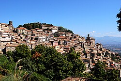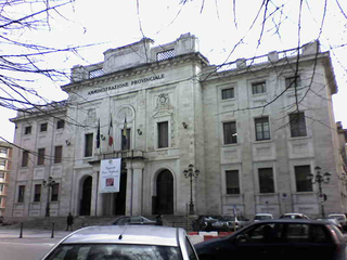
The province of Frosinone is a province in the Lazio region of Italy. Its capital is the city of Frosinone. It has an area of 3,247 square kilometres (1,254 sq mi) and a total population of 493,605 (2016). The province contains 91 comuni, listed in the comuni of the province of Frosinone.
Arnara is a comune (municipality) in the Province of Frosinone in the Italian region Lazio, located about 80 kilometres (50 mi) southeast of Rome and about 6 kilometres (4 mi) southeast of Frosinone.
Casalattico is a comune (municipality) in the Province of Frosinone in the Italian region of Lazio. The village is located about 110 kilometres (68 mi) southeast of Rome and about 30 kilometres (19 mi) east of Frosinone.
Castelliri is a comune (municipality) of c. 3,500 inhabitants in the province of Frosinone in the Italian region Lazio, located in the valley of the Liri, about 90 kilometres (56 mi) southeast of Rome and about 20 kilometres (12 mi) northeast of Frosinone.
Cervaro is a town and comune (municipality) in the Province of Frosinone in the Italian region Lazio. It is located in the Liri valley, about 130 kilometres (81 mi) southeast of Rome and about 50 kilometres (31 mi) southeast of Frosinone.
Colfelice is a comune (municipality) in the Province of Frosinone in the Italian region Lazio, located about 100 kilometres (62 mi) southeast of Rome and about 25 kilometres (16 mi) southeast of Frosinone.
Colle San Magno is a comune (municipality) in the Province of Frosinone in the Italian region Lazio, located about 110 kilometres (68 mi) southeast of Rome and about 30 kilometres (19 mi) southeast of Frosinone.
Falvaterra is a comune (municipality) in the Province of Frosinone in the Italian region Lazio, located about 100 kilometres (62 mi) southeast of Rome and about 20 kilometres (12 mi) southeast of Frosinone.
Giuliano di Roma is a comune (municipality) in the province of Frosinone in the Italian region Lazio, located about 80 kilometres (50 mi) southeast of Rome and about 12 kilometres (7 mi) southwest of Frosinone.
Pescosolido is a comune (municipality) in the Province of Frosinone in the Italian region Lazio, located about 100 kilometres (62 mi) east of Rome and about 30 kilometres (19 mi) northeast of Frosinone.

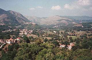
Picinisco is a comune (municipality) in the Province of Frosinone in the Italian region Lazio, located about 120 kilometres (75 mi) east of Rome and about 45 kilometres (28 mi) east of Frosinone. It is included in the Valle di Comino and National Park of Abruzzo, Lazio e Molise.

Piglio is a comune (municipality) in the Province of Frosinone in the Italian region Lazio, located about 50 kilometres (31 mi) east of Rome and about 30 kilometres (19 mi) northwest of Frosinone, offering a panoramic view on the valleys of the Sacco and Aniene rivers.

San Biagio Saracinisco is a comune (municipality) in the Province of Frosinone in the Italian region of Lazio, located about 120 kilometres (75 mi) east of Rome and about 50 kilometres (31 mi) east of Frosinone.

San Donato Val di Comino is a comune (municipality) in the Province of Frosinone in the Italian region Lazio, located in the Comino Valley about 110 kilometres (68 mi) east of Rome and about 40 kilometres (25 mi) east of Frosinone.
San Giorgio a Liri is a comune (municipality) in the Province of Frosinone in the Italian region Lazio, located about 120 kilometres (75 mi) southeast of Rome and about 45 kilometres (28 mi) southeast of Frosinone.

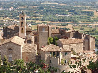
Strangolagalli is a comune (municipality) in the province of Frosinone in the Italian region Lazio, located about 90 kilometres (56 mi) southeast of Rome and about 12 kilometres (7 mi) southeast of Frosinone. It is located on the slopes of Ernici Mountains, towards the Liri River. Economy is based mainly on agriculture, numerous inhabitants commuting to nearby industries for work.
Supino is a comune (municipality) in the Province of Frosinone in the Italian region Lazio, located about 70 kilometres (43 mi) southeast of Rome and about 10 kilometres (6 mi) west of Frosinone.
Terelle is a comune (municipality) in the Province of Frosinone in the Italian region Lazio, located about 110 kilometres (68 mi) southeast of Rome and about 35 kilometres (22 mi) east of Frosinone.
Villa Santa Lucia is a comune (municipality) in the province of Frosinone in the Italian region Lazio, located about 110 kilometres (68 mi) southeast of Rome and about 35 kilometres (22 mi) southeast of Frosinone.

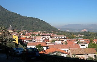
Molteno is a comune (municipality) and a hill-top town in the Province of Lecco in the Italian region Lombardy, located about 35 kilometres (22 mi) northeast of Milan and about 11 kilometres (7 mi) southwest of Lecco. As of 31 December 2004, it had a population of 3,206 and an area of 3.2 square kilometres (1.2 sq mi).